
Snow-vember: Yet more Aussie snow coming just three weeks before summer
Yet another late spring cold front is set to coat the highest parts of the Australian high country and elevated parts of Tasmania with snow this Tuesday.
The loop below shows the speckled cloud pattern typically associated with a cold airmass with polar origins moving towards Tasmania and the coast of Victoria and southeast SA this Monday.
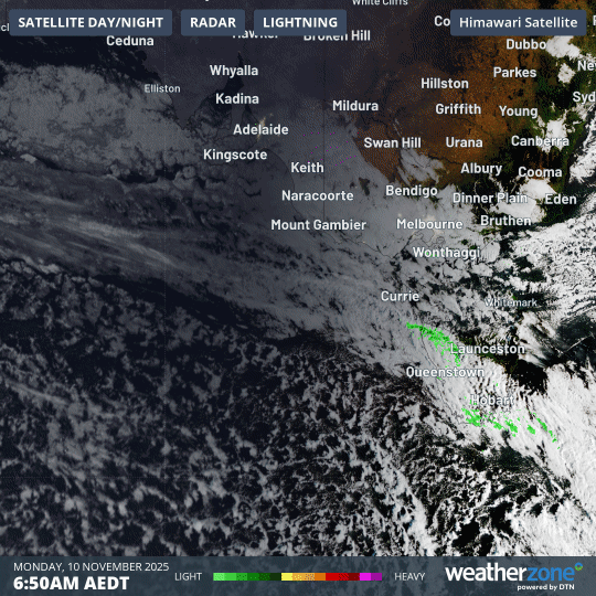
Image: Four-hour combined satellite and radar loop for Tasmania, the tip of SE Australia and nearby waters on the morning of Monday, November 10, 2025.
The cold, moist airmass will deliver Melbourne another frigid showery day on Tuesday with a high of just 14°C expected with apparent or "feels like" temperatures hovering around just 6 to 8 degrees for much of the day.
The unseasonably cold day Tuesday will arrive a week after the bleak Melbourne Cup Day public holiday, and just three days after Saturday's maximum of 12.7°C – which was Melbourne’s coldest November day in 80 years, as snow coated the ski resorts of Victoria and southern NSW for the second time in a week.
Adelaide won’t feel the worst of the chill this week but will still be cool for this time of year with maximums around 19°C on both Monday and Tuesday (the November average maximum is 24.5°C).
Hobart can expect a miserable Tuesday. While the official maximum could reach 14°C, strong southwesterly winds and persistent showers will ensure a "feels like" temperature close to 5 degrees for most of the day, with snow falling on kunanyi/Mt Wellington to levels as low as 400 metres above sea level.
In other words, the uppermost streets in Hobart’s highest suburbs could see snowflakes this Tuesday.
Why so many cold outbreaks just a few weeks before summer?
Cold fronts that bring snow to elevated terrain are part of the typical spring weather mix in southeastern Australia and Tasmania. That said, it’s unusual to see back-to-back cold systems surging so far north this late in the season.
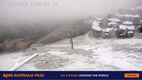
Image: Mt Hotham on Sunday, November 9, after the cold air that chilled Melbourne hit the Victorian High Country.
Two main factors are at play. The first is the recent negative phase of the Southern Annular Mode (SAM), which tends to push Southern Ocean cold fronts further north than usual.
The recent negative SAM is linked to the sudden stratospheric warming event that occurred over Antarctica in September, which you can read about here.
There’s also another factor fuelling the repeated bursts of wintry weather in Tasmania and the southeastern mainland. In short, it’s nodes of cold air.
While a negative phase of the SAM tends to push the large-scale atmospheric circulation in the Southern Ocean closer to Australia, that circulation contains a wavy pattern of relatively warm and cold nodes.
In recent weeks, the cold nodes have been peaking in the perfect longitudinal neighbourhood to bring a chill to the southeast.
As another of those cold nodes arrives this Tuesday, we’ll bring you the latest on how low the snowflakes fall in Tasmania and the mainland here on the Weatherzone news feed.
It’s also worth noting that there will be no significant heat rebound this week, as there was in Victoria last week, when many locations topped 30°C in the period between the Melbourne Cup Day cold snap and the weekend chill.
Instead, this week will see only a very gradual warming across Tasmania and the southeastern mainland, with chilly minimums (Canberra could see frost on Wednesday morning with a minimum of 0°C expected) and no significant outbreak of heat on the immediate horizon.