
A climate driver called SAM
SAM is a climate driver of Australia which influences the weather of southern and eastern Australia. In fact, SAM influences the weather for many countries in the Southern Hemisphere, contributing to floods and droughts.
SAM stands for the Southern Annular Mode. It is also referred to as the Antarctic Oscillation (AAO). It is a secondary climate driver for Australia, whereas the El Nino Southern Oscillation and the Indian Ocean Dipole are primary climate drivers.
What does the SAM measure? Around the subtropics, there is a belt of high-pressure systems called the subtropical ridge. SAM measures the relative position of these high-pressure systems. A positive SAM occurs when the highs are shifted southward toward Antarctica, while a negative SAM occurs when the highs are shifted northward over Australia. The SAM plays a role in the rainfall and temperatures because high-pressure systems direct cold fronts and moisture.
SAM tends to be in its positive phase during La Nina, which was the case for much of the year. This has contributed to above average rainfall for southeast QLD, eastern NSW and eastern VIC and below average rainfall for western TAS, southern VIC, and southeast SA.
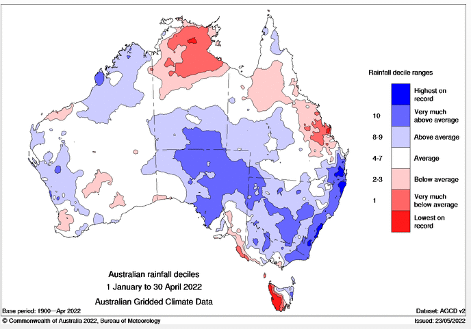
Image: Australian rainfall deciles, January-April 2022, courtesy BOM
The following pressure chart from February 26th, 2022, shows an example of a positive SAM with the highs south of Australia. This setup contributed to the extensive flooding across QLD and NSW by driving moisture onto the east coast into troughs. Notice the cold front being kept south of Australia by the high, leading to reduced rainfall for the southeast.
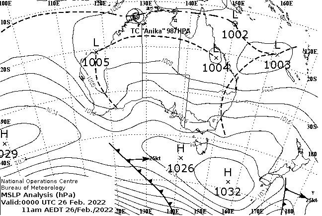
Image. MSLP analysis 11am EST 26th February 2022, courtesy BOM
However, the pattern recently shifted, and SAM entered its negative phase. The pressure chart from today (May 28, 2022), shows high pressure over southern WA and SA. The highs being further northward allows cold fronts to reach southern WA and the southeastern states, with several fronts and troughs expected within the next week. The strongest cold front is expected to impact SA, VIC, NSW and TAS from Monday 30th, which will cause widespread damaging winds, extreme cold temperatures, rain, storms, and snow for the Alps.
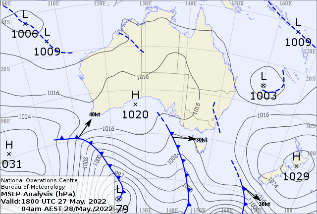
Image: MSLP analysis 4am EST 28th May 2022, courtesy BOM
The following shows the accumulating rainfall to 10pm EST Wednesday 1st June as a result of these fronts and troughs, with totals reaching 20-40mm for southeast SA, southern VIC and western TAS, and only about 5-15mm for the east coast.
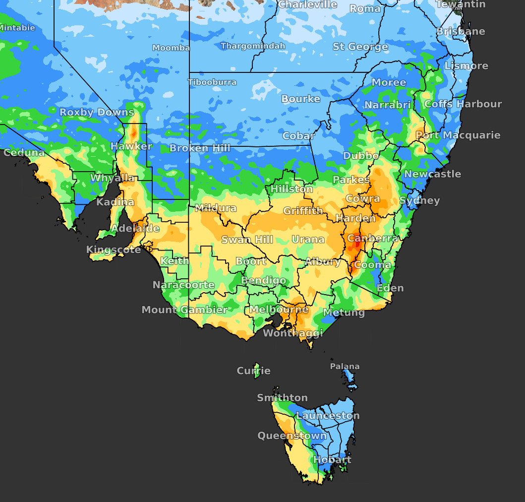
Image: Accumulating precipitation to 10pm Wednesday, June 1 (ECMWF model).
The impacts of the different phases of SAM are quite different. It also depends on whether it is summer or winter since the subtropical ridge shifts with seasons.
SAM is expected to become neutral at the beginning of next month. However, it is not possible to forecast this climate driver beyond about two weeks.
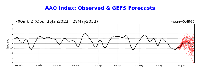
Image: SAM (AAO) observation and forecast, courtesy NOAA.
For more information, please refer to the BOM’s information page: http://www.bom.gov.au/climate/sam/#tabs=What-is-SAM%3F