
Big snow on the horizon after soggy alpine week
After a week which featured a mix of rain and snow in Australia’s ski resorts, heavy snow is likely in the second week of July, just in time for school holidays in the southern states.
Let’s start with a brief recap of the past few days, when the East Coast Low which brought heavy rain and strong winds to coastal NSW and eastern Victoria also dragged warm air from the Coral Sea all the way southwards to the alpine region.
There’s an old saying in the Australian snowfields that nothing good ever comes from the east – a reference to easterly systems often being too warm for reliable snow. And while East Coast Lows can occasionally deliver heavy snowfalls under the right conditions, that was not the case this week.
While at times it snowed at higher elevations, there was also plenty of rain, especially lower down.
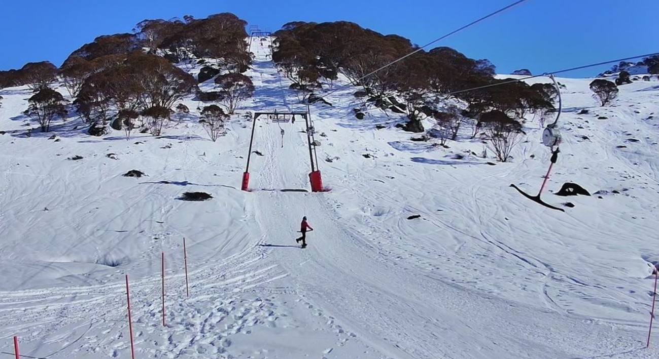
Image: Even at Charlotte Pass, the Australian ski resort with the highest base, there were a few extra rocks poking through by Friday, July 4, due to the week's often damp conditions. Most of them should be covered by this time next week. Source: ski.com.au.
For example, mainland Australia’s lowest ski resort – Victoria’s Mt Baw Baw – saw 127.2mm of precipitation between July 1 and July 3, but the mercury only dipped to 0°C or lower for about six hours of that entire period. Rain, brief heavy snow, then more rain was the result.
Next week, the majority of precipitation at all elevations promises to be of the frozen variety, as the broad-scale weather outlook shifts to the classic winter pattern of westerly winds across southern Australia with outbreaks of polar air from the southwest.
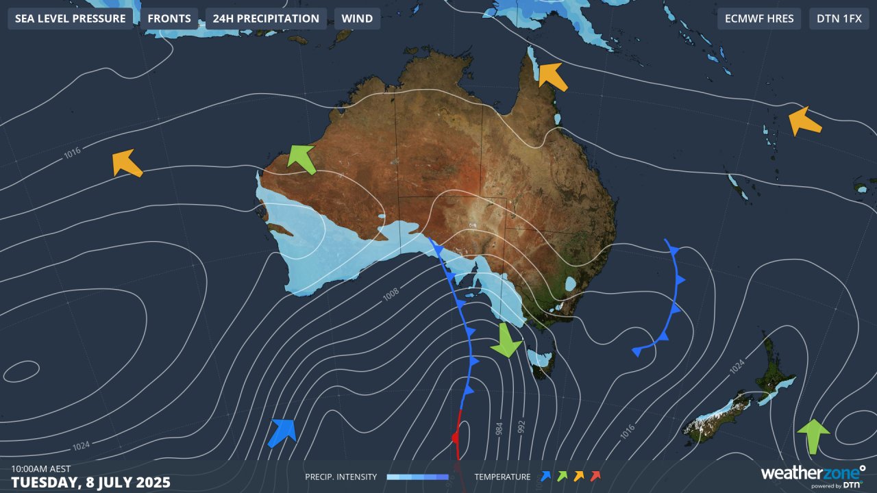
Image: Predicted synoptic chart for next Tuesday, July 8, showing a strong cold front approaching SE Australia.
Winds will begin to pick up across the alpine region on Sunday as a relatively weak cold front crosses the area, with a few flakes likely on that day and Monday at higher elevations.
By late Tuesday, blizzard conditions should set in, with a total of 35-70cm of fluffy white goodness possible across the mountains in the three-day period through to Thursday.
While it's difficult to predict weather conditions with confidence beyond the middle of next week, there's definite potential for further cold fronts to push through to the southeast of the continent, allowing for additional snowfalls.
The 2025 snow season to date
The season started well, with heavy falls on the traditional June long weekend season opening.
READ MORE: Before and after images of the June long weekend snowfall
A second major June snowfall event occurred about 10 days ago. Both of June’s big snowy systems delivered about 50cm, but with natural snowpack compaction plus a couple of bouts of rain, the current natural snow depth is closer to 50cm than a metre at the higher elevations of most resorts.
The latest Snowy Hydro reading at Spencers Creek – at an elevation of 1830m approximately halfway between the NSW ski resorts of Perisher and Thredbo – showed a depth of 74.9cm on June 26. The depth is likely quite similar (or slightly lower) this Friday, July 4, after the week’s mix of rain and snow.
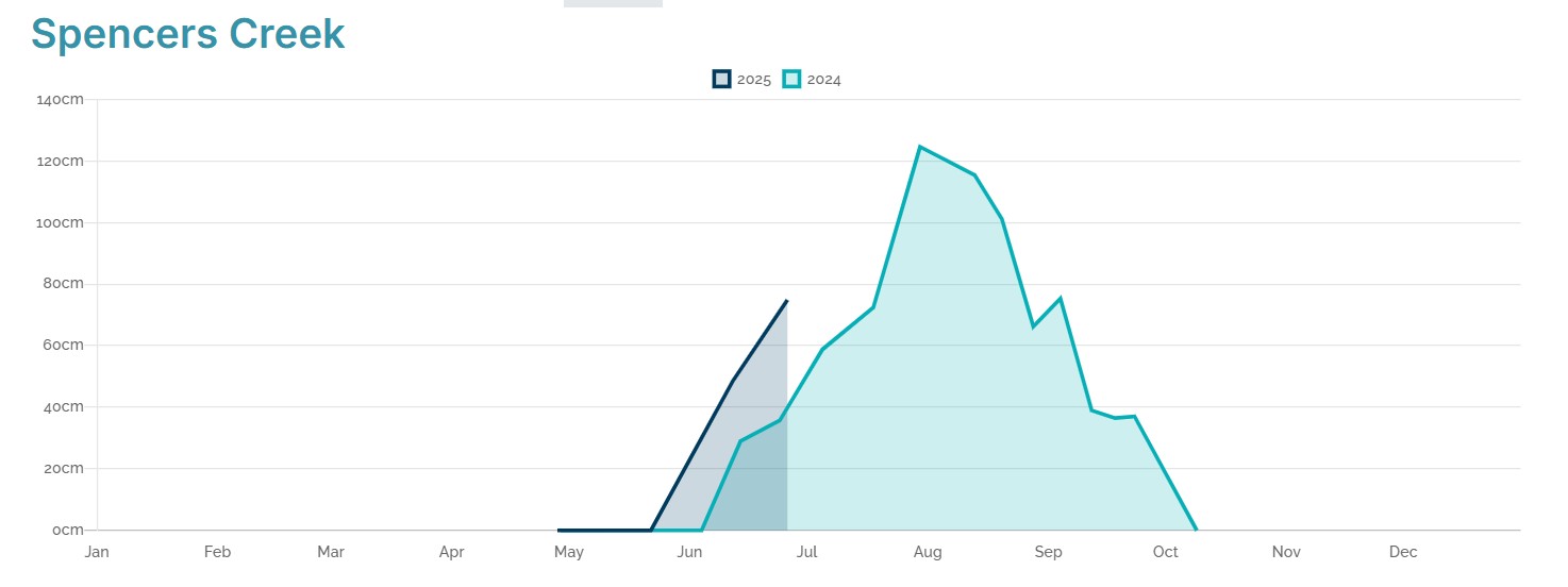
Image: The dark blue line shows depths for the 2025 season so far compared to 2024 (aqua line). Source: Snowy Hydro.
It's interesting to note that the trend on the current Spencers Creek graph is quite similar to last year at this stage, albeit that the 2025 season kicked off a little earlier.
It’s possible that by the end of next week, last year’s peak snow depth of 124.6cm of could have been exceeded.
If that happens, snow lovers will then be hoping that the 2025 graph doesn’t continue to imitate both 2024 and 2023, two seasons in which the snow depth declined rapidly in August after relatively early season peaks.
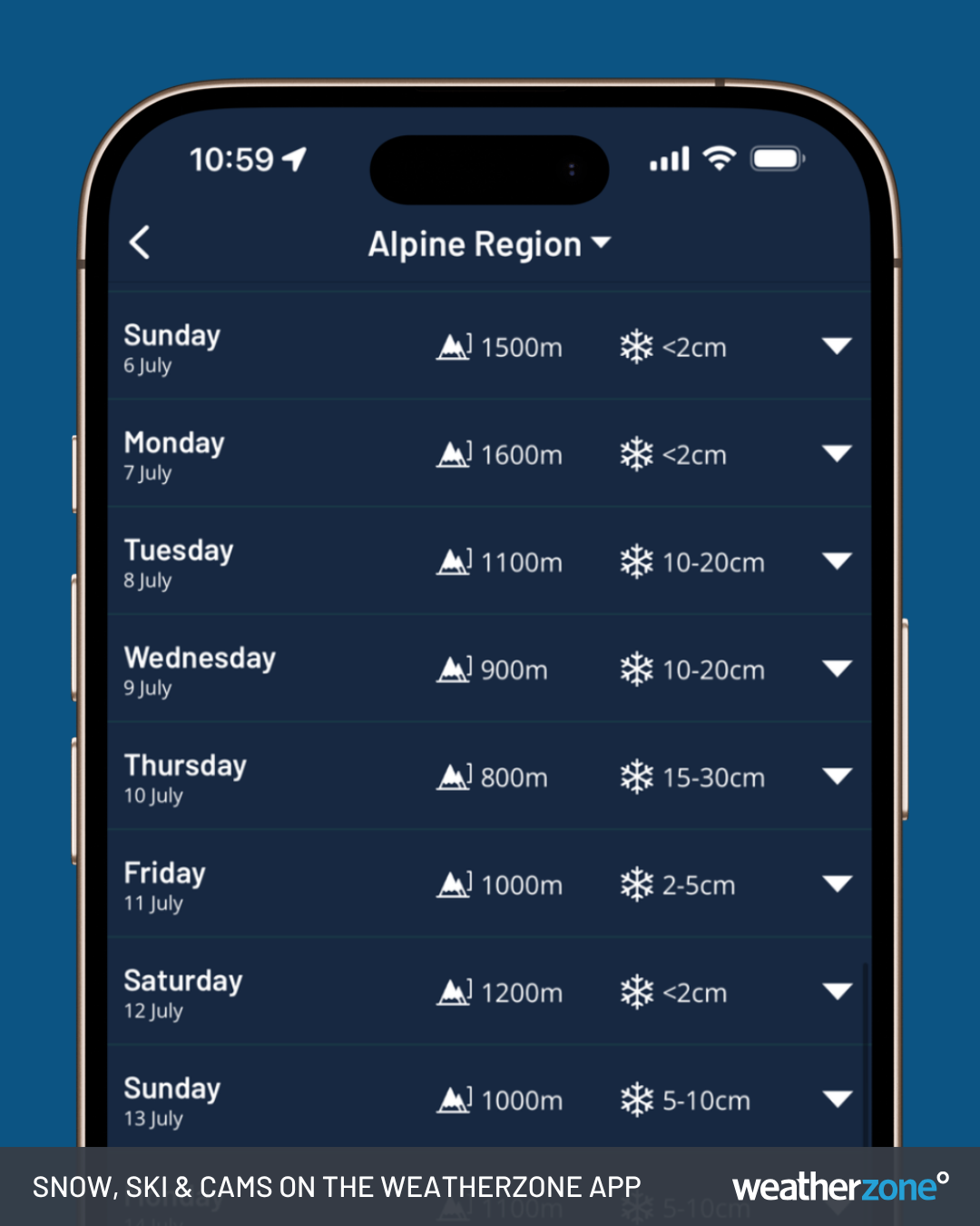
Image: 14-Day Snow Forecast on the Weatherzone app for the mainland Australian alpine region.
Don’t forget to check the Weatherzone snow page throughout the 2025 season for the latest forecasts, live cams and much more.