
Three-day blizzard at ski resorts with snowfalls in nearby towns
The predicted half metre of snow has accumulated at Australia’s higher ski resorts over the King’s Birthday long weekend, with Mt Hotham in Victoria reporting a storm total of 62cm and nearby Falls Creek 63cm to Monday morning, while snow has also settled at lower elevations below the mountains.
This was the scene in Thredbo village on Sunday morning with around 15cm of snow on the ground at an elevation of around 1400m. Nearly triple that amount was reported on the resort’s higher slopes, which rise above 2000m.
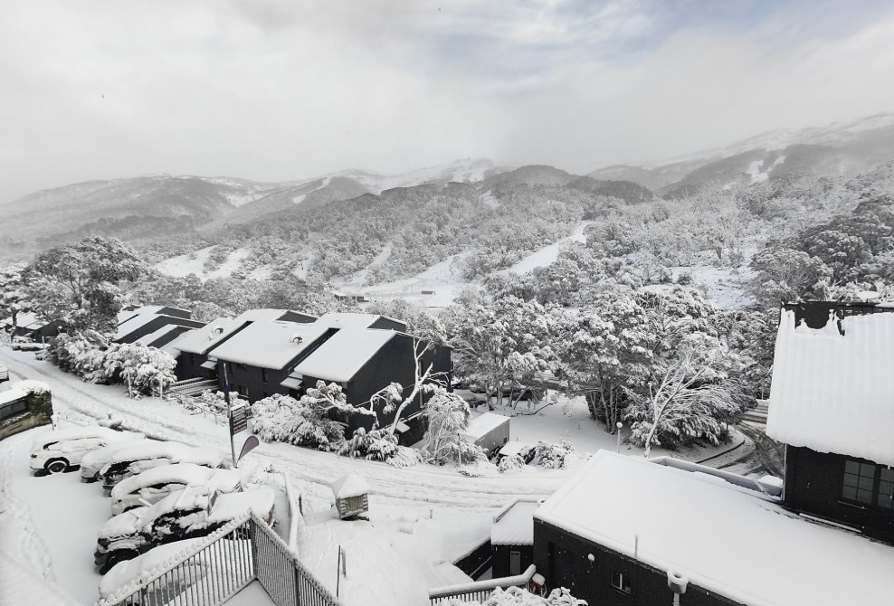
Image: Thredbo village on Sunday morning, June 8, 2025. Source: RustyJ via ski.com.au.
Snow also fell below the mountains, with lawns and roofs turning white in the town of Adaminaby, on the eastern fringe of Kosciuszko National Park at an elevation of 1020m.
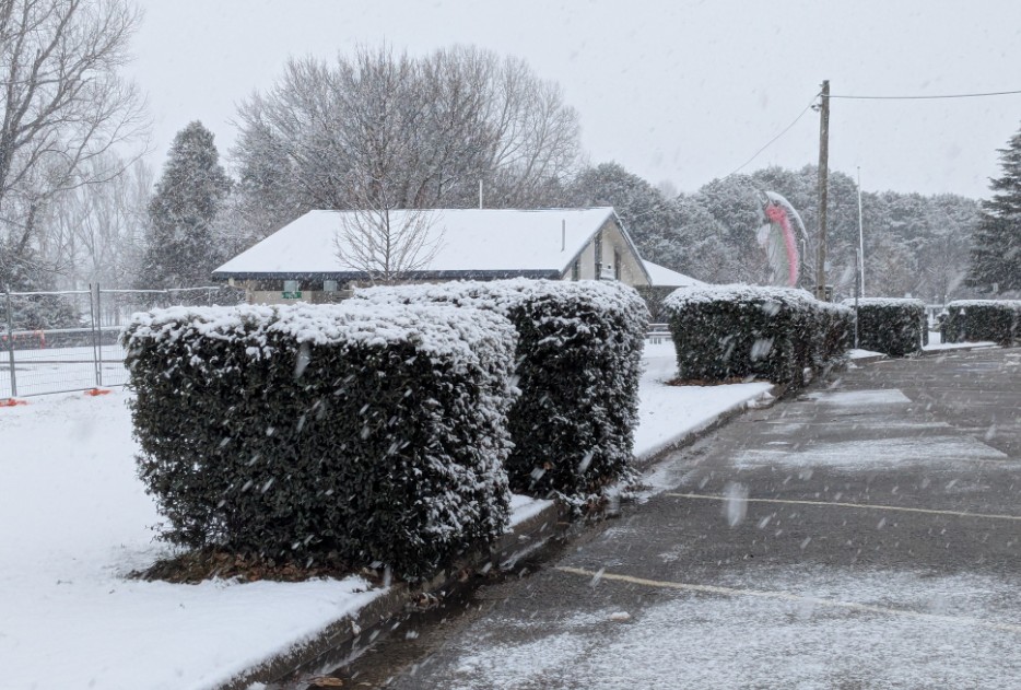
Image: It wasn’t great weather for catching trout, but Adaminaby’s famous big trout probably caught a cold on Monday morning. Source: MattyHoll via ski.com.au.
A few flakes were even recorded on Mt Ainslie, the renowned Canberra lookout spot at an elevation of 846m which overlooks the War Memorial, Parliament House and the Canberra CBD.
A very cold start to the morning as snow falls over the hills of Canberra.
— Timothy Dean Photographer (@TimothyDeanAU) June 8, 2025
Monday 9th June 2025 8.00am#canberra #snow #ACT #Australia #winter pic.twitter.com/2xOpHfxdav
Snow was also reported on the NSW Central Tablelands, with parts of the town of Orange (elevation 863m) turning white. The NSW Northern Tablelands caught a few flakes too, with snow just north of Armidale at Black Mountain and Guyra.
The snow came in two waves over the long weekend. A cold front that passed through southeastern Australia on Saturday delivered the first batch from the west, with a low pressure system (currently centred off the coastline near the NSW/Vic border) then feeding more moisture onshore.
Snowfalls will start to clear later this Monday as the low moves across the Tasman Sea, and a slight warming trend will set in, with snow flurries turning to rain showers below about 1300m.
But with snow still falling heavily at lunchtime on Monday all the way to the bottom of the lifts at most of Australia’s mainland ski resorts, this will go down as a memorable start to the ski season.
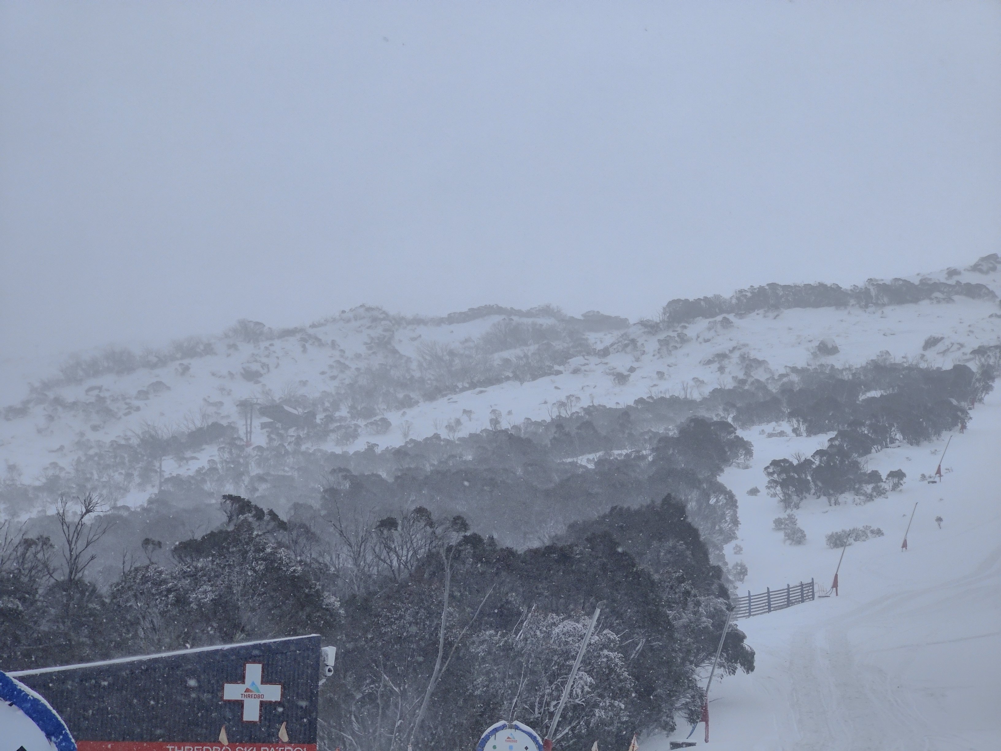
Image: Looking towards Thredbo's upper slopes from the Merritts area on Monday, June 9, 2025. Source: RustyJ via ski.com.au.
When the clouds clear and the freshly fallen snow compacts, expect a natural snow base of around 50cm on the higher slopes, with numerous lift openings imminent.
Don’t forget to bookmark the Weatherzone snow page for the latest forecasts, live cams and much more throughout the 2025 Australian ski season.