
Before-and-after images of the big weekend snowfall
Approximately 50 to 70 cm of snow accumulated on the highest parts of Australia’s mainland ski resorts between Friday night and Monday evening, which was very much in line with last week’s predictions.
The result of the best opening long weekend blizzard in years? Lifts spinning at most resorts, with more terrain set to open soon.
With the weather having rapidly cleared this Tuesday, and with several days of fine weather ahead for the alpine region – as for most parts of the country – we thought we’d put together a few before-and-after images from Australian snow cams.
First up here’s Mt Perisher, where Australia’s newest chairlift was installed over summer – a six-seater replacing the slow old double and triple chairs. Perisher is hoping to open the so-called "Mt Perisher 6" by June 21.
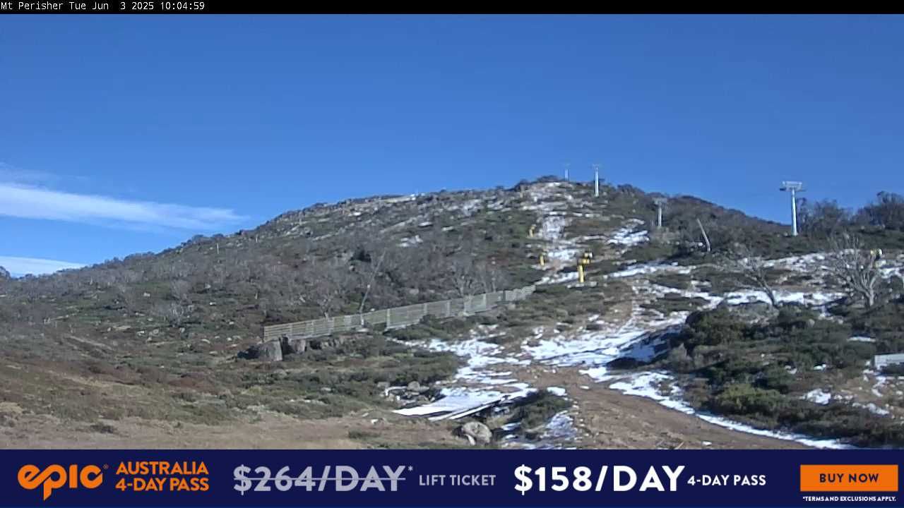
Image: Mt Perisher before the storm on June 3. Source: Perisher.
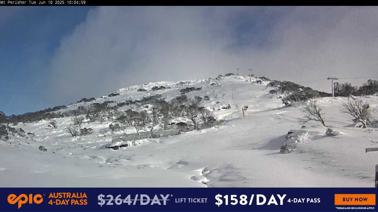
Image: Mt Perisher after the storm on June 10. Source: Perisher.
Now here's a look at Selwyn Snow Resort in New South Wales, which plans to open soon.
The resort is the smallest in NSW with by far the lowest summit and sometimes misses out on the big dumps received by higher resorts. But it generally does well in a cold northwesterly wind flow, which is exactly what prevailed for much of the weekend.
Some snowmaking patches were evident at Selwyin’s toboggan park before the storm, with a total absence of natural snow. The area appears to have gained at least 30cm in the weekend blizzard.
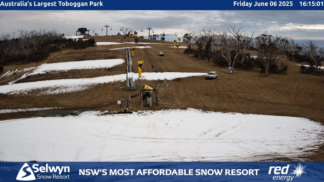
Image: Selwyn before the storm on June 6. Source: Selwyn Snow Resort.
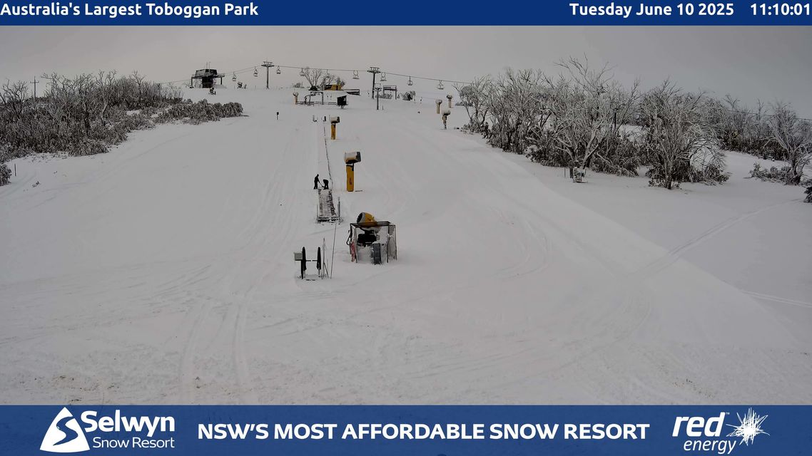
Image: Selwyn after the storm on June 10. Source: Selwyn Snow Resort.
Lastly, here’s the view from near the summit of Mt Blue Cow, which is part of Perisher. Note that the second view is from June 9 (the other images above are from today, Tuesday June 10) because the Mt Blue Cow snow cam screen was iced over on Tuesday. But the contrast still tells a story.
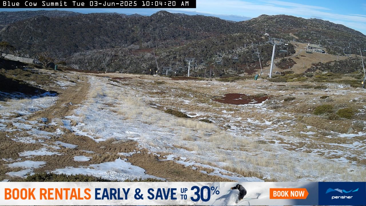
Image: Mt Blue Cow on June 3 with light snow remaining from a late May snowfall, looking across to the building which houses the top station of the Skitube. Source: Perisher.
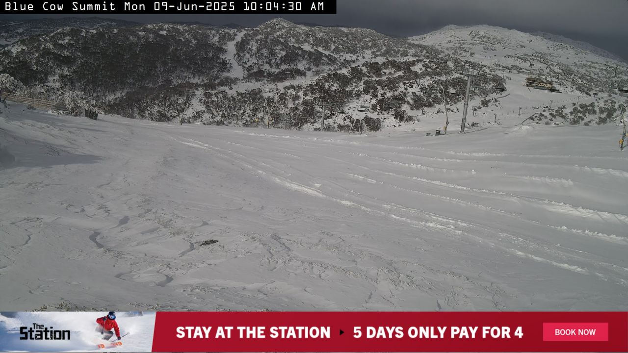
Image: Mt Blue Cow on June 9, looking across to the building which houses the top station of the Skitube. Source: Perisher.
And not to forget Victoria, here are two images of Mt Hotham. Unfortunately, we are using two different images due to fog this Tuesday enshrouding the area pictured in the first image. But the amount of snow between last Friday and this Tuesday still says plenty, even if it's a slightly different section of the resort.
Image: Looking over towards Hotham's extreme area on June 6. Source: Mt Hotham.
Image: Looking down into Hotham's Heavenly Valley area on June 10. Source: Mt Hotham.
A little snow is likely again over the mainland alpine region for a stretch of a few days from next Sunday, however nothing in the magnitude of last weekend’s falls is expected.
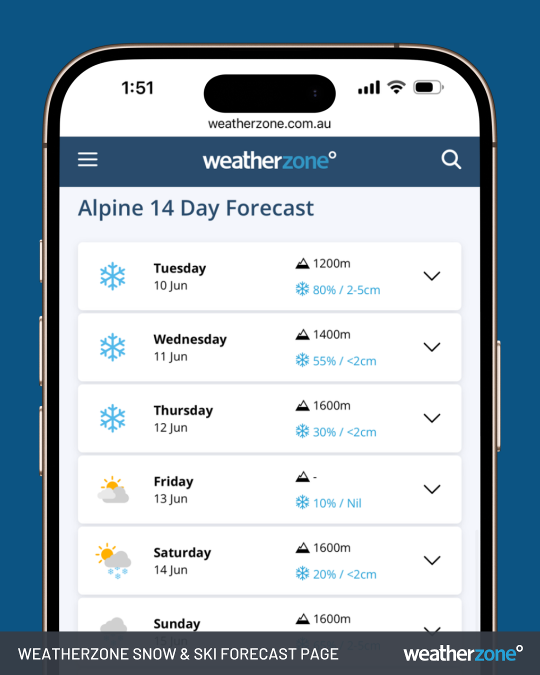
Image: Snow and Ski Forecast Page on Weatherzone.
And don’t forget to bookmark the Weatherzone snow page for the duration of the 2025 ski season for the latest forecasts, live cams, and much more.