
Weather chucks a Tuesday sickie
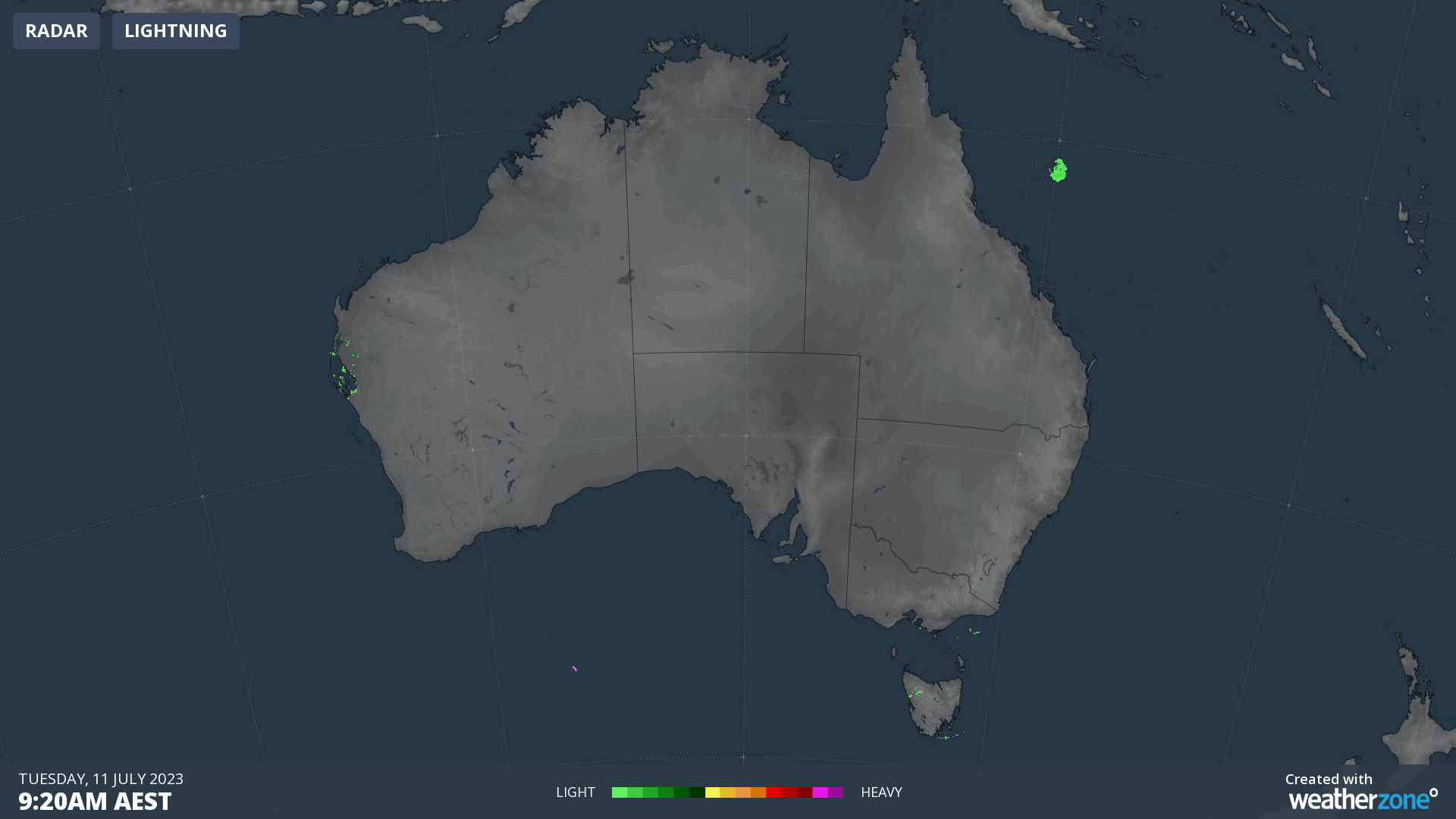
Take a look below at the action on the rain radar on Tuesday morning. Not much happening across Australia, is there? It's almost as if the weather has taken the day off.
There's a tiny speck of green here and there, but for the most part, our vast continent is precipitation-free. There's just not much happening, which makes a change from the last few weeks when we've seen everything from heavy outback rain, to extremely warm Queensland temperatures, to snow and wild winds down south.
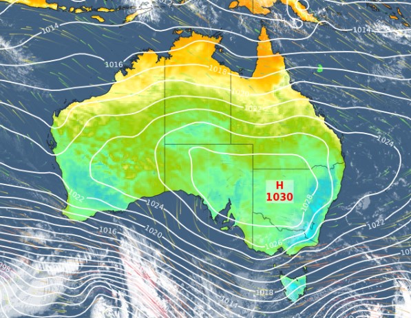
When you get a day like this in winter, it's usually because a large high pressure system is parked over the continent and that's exactly the case this Tuesday.
As you can see, the only part of the country exposed to the unstable westerly flow is the western half of Tasmania which should see showers today and throughout the week.
The far southwestern tip of WA could also see light showers this Tuesday, as could the alpine areas of NSW and Victoria, with some light snow showers above about 1600 metres.
Otherwise it's one of those days when the weather should be pretty pleasant in most places. There's not a lot of cold air around the continent at the moment either, so enjoy the relatively mild winter conditions which should stick around for at least another day over the vast majority of the country.