
Waterfalls on Uluru after outback soaking, more rain to come
Parts of the Kimberley and Red Centre have received several months' rain in the last couple of days as a northwest cloudband continues to deliver unseasonably heavy rain in the Australian outback.
The animation below uses enhanced water vapour satellite imagery to show a large northwest cloudband developing over Australia during the last 48 hours.
Development of the northwest cloud band ⬜ï¸ðŸŸ© currently over Australia. A new upper low 🟨 emerging south of WA is expected to produce a second cloud band on the weekend, with the rainfall focus likely to be NT and QLD. pic.twitter.com/pzEWAHnUHb
— Andrew Miskelly (@andrewmiskelly) June 27, 2023
The rain from this cloudband has been heavy and widespread over central and northwestern Australia during the last couple of days. Here are some of the standout observations up to 9am local time on Tuesday:
- Gibb River in the Kimberley received 72 mm of rain during the 24 hours to 9am Tuesday. This is more than seven times its June monthly average, more than five times its winter average, and its second wettest winter day in records dating back to 1922.
- Yulara Airport, near Uluru, received 64.6 mm of rain in the 48 hours ending 9am Tuesday. This is nearly four times its June monthly average, and its wettest pair of June days since 2004.
- Curtin Springs, NT and Ernabella/Pukatja, SA picked up 55.2 mm and 48.6 mm, respectively, during the 48 hours ending at 9am on Tuesday. This was the wettest pair of June days since 2001 at both sites.
- Broome’s 30 mm in the 24 hours ending at 9am on Tuesday was more than a month’s rain for this time of year and its wettest June day in a decade.

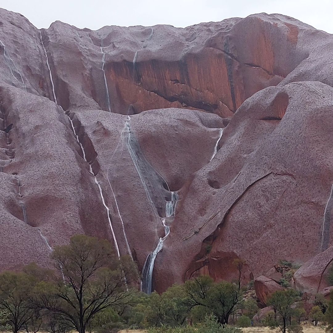
Images: Waterfalls on Uluru after heavy rain on Monday, June 26, 2023. Source: @geigbe_the_van / Instagram
Despite the substantial rain that has already fallen in the past 48 hours, more widespread and heavy rain is still on the way through the remainder of this week.
The slow-moving northwest cloudband will cause rain to spread across a broad area of northern, central and eastern Australia during the rest of this week and likely into the start of next week.
The map below shows how much rain one computer model is predicting between today (Tuesday, June 27) and Monday next week.
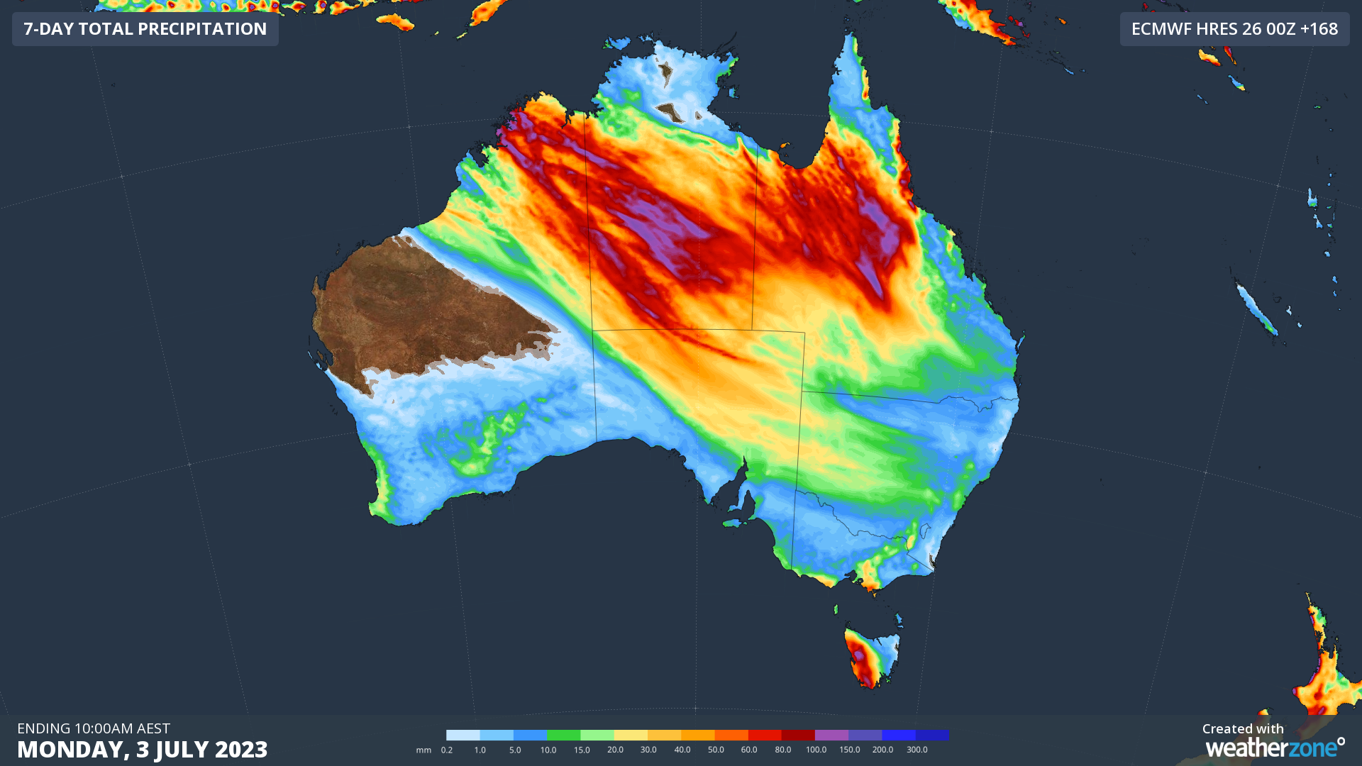
Image: Forecast accumulated rain during the 7 days ending at 10pm AEST on Monday, July 3.
Flood watches are already in place for parts of WA, the NT and SA and more flood watches and warnings are likely to be issued over the coming week. Be sure to check the latest warnings and road closures for the most up-to-date information.