
Severe weather warnings in four states, Adelaide’s wettest July day in 10 years
Severe weather warnings have been issued for parts of South Australia, Victoria, New South Wales and the Australian Capital Territory, as a cold front roars across southeastern Australia, ushering in the strongest spell of wild, wintry weather to date in winter 2026.
Let’s take a closer look at the current conditions, overnight rainfall observations, and forecasts for the states and territories which will be impacted by this dynamic weather system this Thursday.
South Australia
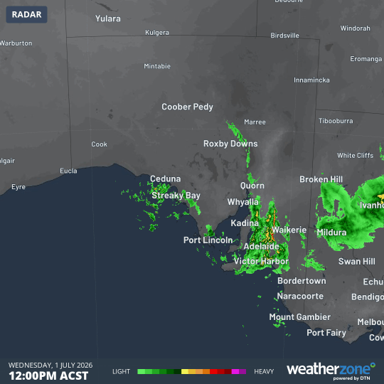
Image: Several bands of moisture can be seen crossing the Adelaide area in the 12 hours to midnight (ACST) as Wednesday turned to Thursday. Source: Weatherzone.
Adelaide had its wettest day July day in 10 years with 33 mm in the city’s main West Terrace/ngayiradpira gauge in the 24 hours to 9am Thursday.
It was also the city’s wettest day in any month since January 26, 2024, and followed 19 mm the previous day. The SA capital now has 340 mm for the year to date – a healthy running total considering January was completely dry.
Rain was even heavier in the Adelaide Hills, with at least 15 weather stations recording 50 mm or more – including a high reading of 77.8 mm at Scott Creek, just 24 km SE of the Adelaide CBD.
Further showers can be expected across southern and southeastern parts of SA today in the cold airmass which arrived in Adelaide just before 9am. The arrival of the cold front created an unusual situation where the city’s overnight minimum occurred not around dawn, but at 8:58am.
A severe weather warning is in place for damaging winds in coastal parts of the Lower South East forecast district as the cold front surges east.
Victoria
For the third day in a row, parts of northern and central Victoria saw heavy rainfall, with totals over 50mm recorded at four weather stations, while at least a few millimetres fell at locations in all nine official Victorian BoM forecast districts.
The wildest weather today is in the alpine region, where wind gusts of 100 km/h or stronger have been recorded in the ski resorts of Falls Creek and Mt Hotham. Snow is also falling at high elevations of the Victorian Alps, with heavy snowfalls dropping to much lower levels from tonight.
A severe weather warning for damaging winds is in place for parts of the East Gippsland, North East, and West and South Gippsland forecast districts.
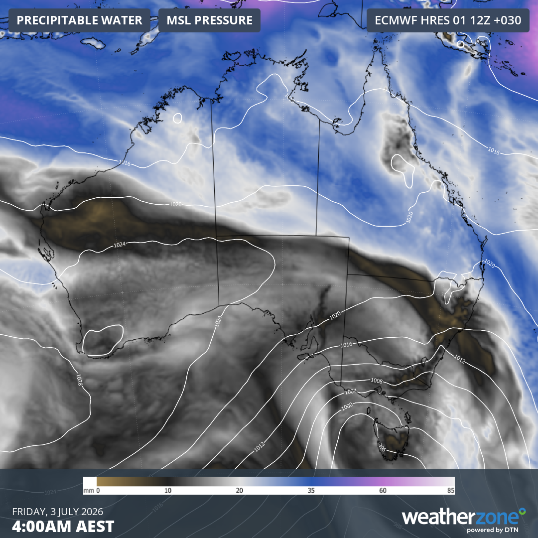
Image: Forecast mean sea level pressure and precipitable water for Australia at 4 am (AEST) on Friday, July 3, 2026, showing the southwesterly flow crossing the southeast corner of the country. Source: Weatherzone.
New South Wales/ACT
It was another wet night in the state’s west and central west, with heavy rainfall also recorded in some southern parts of NSW, as well as in the ACT.
The heaviest rainfall reading statewide was 51.4 mm at the tiny western NSW map speck of Mount Hope.
Tuggeranong (Isabella Plains), in Canberra’s south, received a very healthy 35.8 mm, its heaviest July daily total in 21 years, while Canberra Airport received 22.8mm, the heaviest July fall in 16 years.
As with Victoria, the most extreme weather is heading for elevated parts of NSW this Thursday, with a severe weather warning issued for damaging winds for the South West Slopes, Snowy Mountains and Australian Capital Territory.
The BoM warns that blizzard conditions are possible during the day in the Snowy Mountains, becoming likely on Thursday evening before starting to ease on Friday morning.
Overnight, a gust of 113 km/h was recorded at Thredbo Top Station, Australia’s highest weather station.
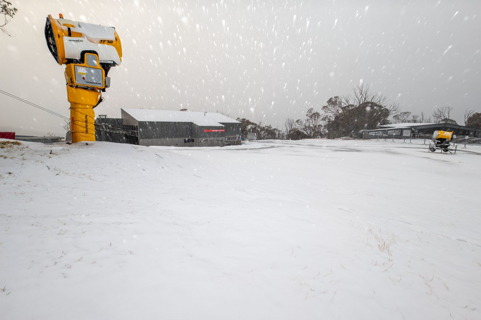
Image: Early flakes in what should be the first significant snowfall of the 2026 season at Thredbo on Thursday, July 2, 2026. Source: Thredbo Resort.
Tasmania
While no severe weather warnings are currently in place for Tasmania, much of the state again saw rain overnight.
The coldest air from the current vigorous weather system will impact Tasmania on Friday and Saturday, with snowfalls expected to elevations as low as 600 metres by Saturday.
Please check the Weatherzone warnings page for the latest information for your area, and the Weatherzone snow page for the latest forecast, live cam images and more.