
Polar airmass surging towards Australia – where will the chill hit?
A strong, dynamic cold front is lurking over waters south of the Great Australian Bight, and will surge northwards towards Tasmania and the southeastern mainland on Friday and Saturday.
Frigid polar air is associated with this system, with the coldest air to move across Tasmania on Saturday, while the airmass will be cold enough for snowfalls on the Australian Alps from Friday into the weekend.
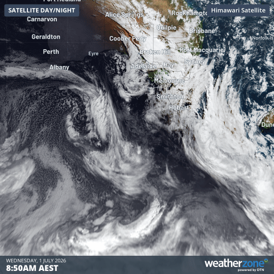
Image: Three-hour satellite loop on the morning of Wednesday, July 1, 2026, showing a frigid polar airmass (the speckled cloud) over waters south of Western Australia. It will track towards SE Australia. Source: Weatherzone.
Overdue burst of winter after a very mild June
The imminent cold snap comes after a mild start to July across the southeast, on the back of an unseasonably warm June. For example, in June:
- Sydney’s average maximum was 3.0°C above the long-term average and its average minimum was 2.9°C above the long-term average.
- Melbourne’s average maximum was 2.3°C above the long-term average and its average minimum was 2.4°C above the long-term average.
- Canberra’s average maximum was 1.4°C above the long-term average and its average minimum was 2.4°C above the long-term average.
Biggest snowfall of 2026 winter to date for Australia’s snow resorts
After a snowfall of around 10 to 20 centimetres just before the traditional King’s Birthday long weekend snow season opening in early June, mild days, rain, and humid nights have left Australia’s ski resorts with no natural snow cover, and extremely limited terrain covered by snowmaking.
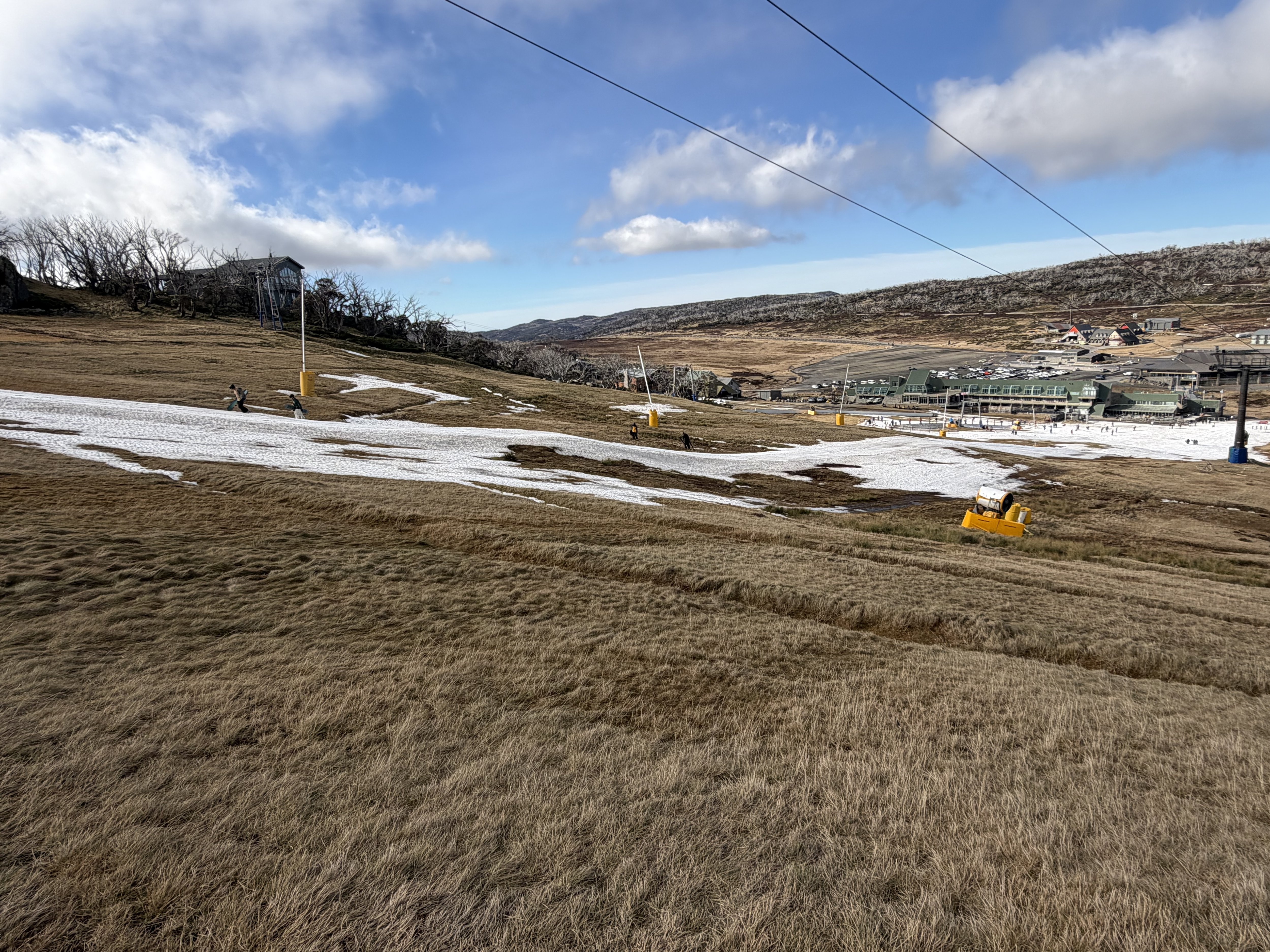
Image: Perisher's Front Valley slopes devoid of anything but tiny patches of snowmaking snow in the last week of June, 2026. Source: Steve Smith.
For only the second time in 72 years of records, the ski resorts enter July with an official snow depth of zero centimetres at Spencers Creek, the highest of three sites in the Snowy Mountains of New South Wales where hydro-electric operator Snowy Hydro has taken regular readings since 1954.
But around 20 centimetres is likely to fall from Friday into the weekend, with the heaviest snow falling on Friday. The snow level should drop to around 1000 metres above sea level on the mainland, meaning the mountains will at last look white, even if the snowpack is still low for early July after this event.
Check the Weatherzone snow page for the latest forecasts, live cams and more.
Low level snow in Tasmania
The coldest air from this system will impact Tasmania, with snow to fall as low as 400 metres above sea level by Saturday in the state’s south, which mean’s Hobart’s highest suburbs could potentially see a few flakes.
Kunanyi/Mt Wellington above Hobart rises to 1271 metres, so it’s highly likely that the mountain will be coated in a significant mantle of white by Sunday.
Road closures and hazardous driving conditions will be an issue in Tasmania this weekend, so please check the TasAlert site for the latest information. The Weatherzone warnings page also has the latest weather and flood warnings.
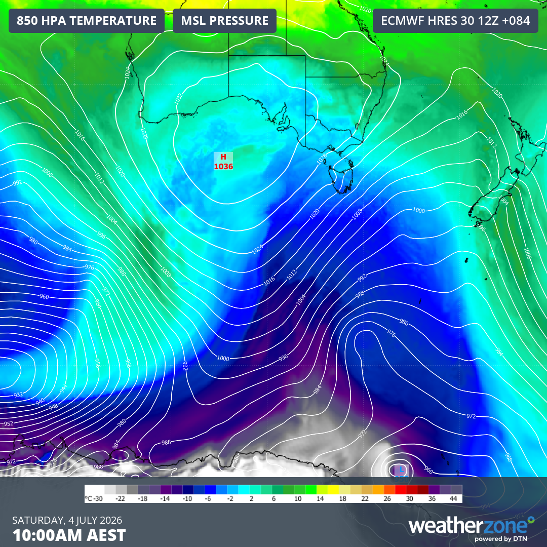
Image: Forecast 850 hPa temperatures and mean sea level pressure for Tasmania and southern mainland Australia at 10 am (AEST) on Saturday, July 4, 2026, according to the ECMWF model. Source: Weatherzone.
Colder in the southeastern capitals
As you’d expect on a day when low level snow is forecast for Tasmania, Hobart will be bitterly cold on Saturday, with a forecast maximum of just 9°C. But with the frigid southwesterly winds, the apparent or "feels like" temperature will barely rise above 0°C all day.
Melbourne’s average July maximum is 13.5°C, and daytime temperatures should peak close to that level over the weekend and into Monday, with no day expected to reach higher than 15°C from Thursday through to next Tuesday.
Canberra’s chilliest day in the coming cold snap should be Friday, when the forecast maximum of 10°C will likely be the national capital’s coldest day of the year to date.
Even Sydney will get a taste of winter. After the mercury in the harbour city topped 20°C 16 times in June – including a 15-day streak – Saturday will be the start of a prolonged spell of maximums closer to 17 or 18°C, with "feels like" temperatures closer to 10°C.