
Snow coming after equal-worst start to Australian season in 72 years
Snow is looming on the forecasts for the alpine region of mainland Australia and large parts of Tasmania later this week – and not before time.
As the calendar flips over from June to July, you’d normally expect to see at least some snow coverage at the highest elevations of Australia’s ski resorts by the end of the first month of winter. But not this year.
Officially no natural snow to start July
Last week, hydro-electricity operator Snowy Hydro released a reading of precisely zero centimetres at Spencers Creek – the highest of three snow measuring sites where it has conducted regular readings throughout the cooler months since 1954.
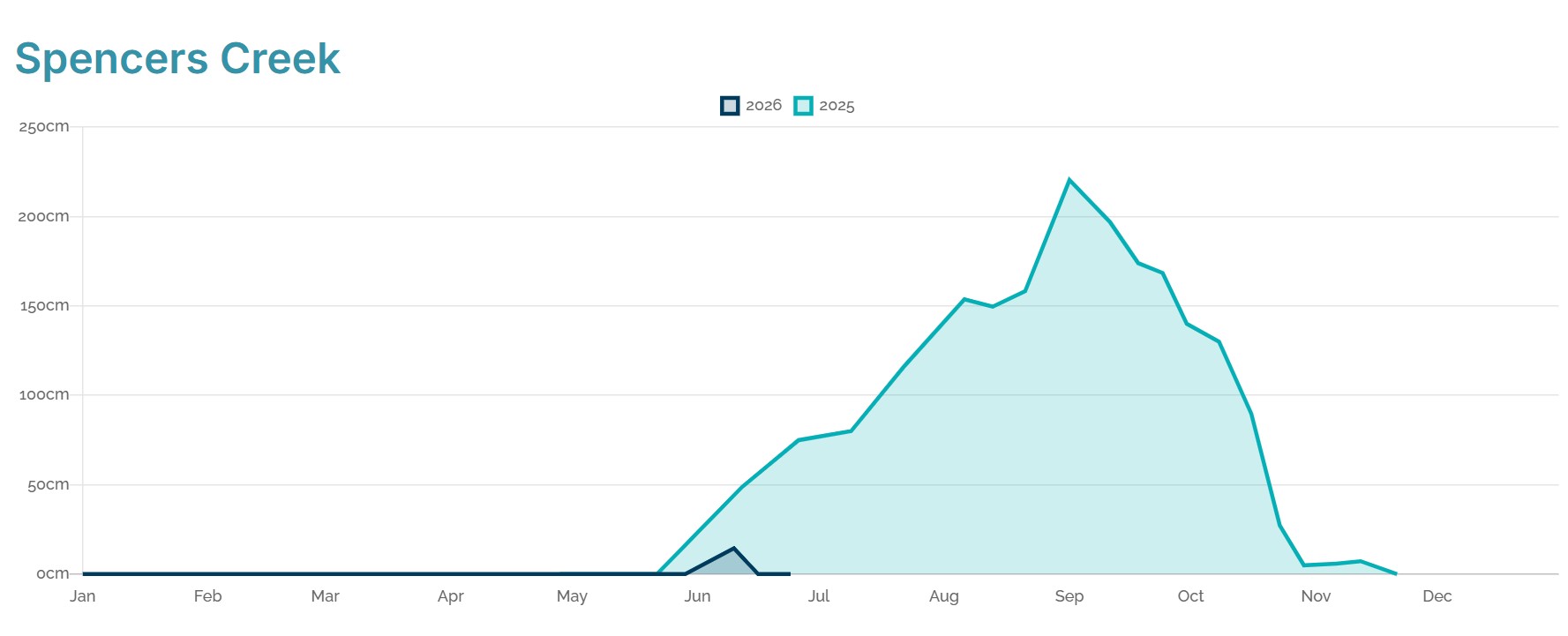
Image: Snow depth comparison of 2025 and 2026 (up until June 24) at Spencers Creek, NSW. Source: Snowy Hydro.
Only once previously has Spencers Creek registered no snow at the start of July in 72 years of data.
But with almost zero chance of snow accumulation before Wednesday, July 1 (and the likelihood of heavy rain on Tuesday), the Australian Alps look set to start July snowless for just the second time on record.
Consistent warm temperatures and frequent rain events are the cause of the bare slopes. After a promising snowfall of up to 20 cm just before the traditional King’s Birthday long weekend, the snow soon washed away or melted, and virtually no snow has fallen since.
As an example of the recent mild temperatures, Perisher’s average minimum and maximum for June 2026 are currently running at 2.3°C and 1.7°C above their respective long-term averages.
Bad weather for snowmaking too
Compounding the bleak picture for snow enthusiasts and the resort staff and business that rely on their trade, minimal snowmaking has been conducted by Australia’s ski resorts throughout June, due to a relentless string of nights which have been too warm or too humid for snowmaking.
That’s why even slopes like Perisher’s normally reliable Front Valley are currently just a string of disconnected patches this Monday, with only some very basic sliding terrain for people experiencing their first day on snow (bottom right of image below).
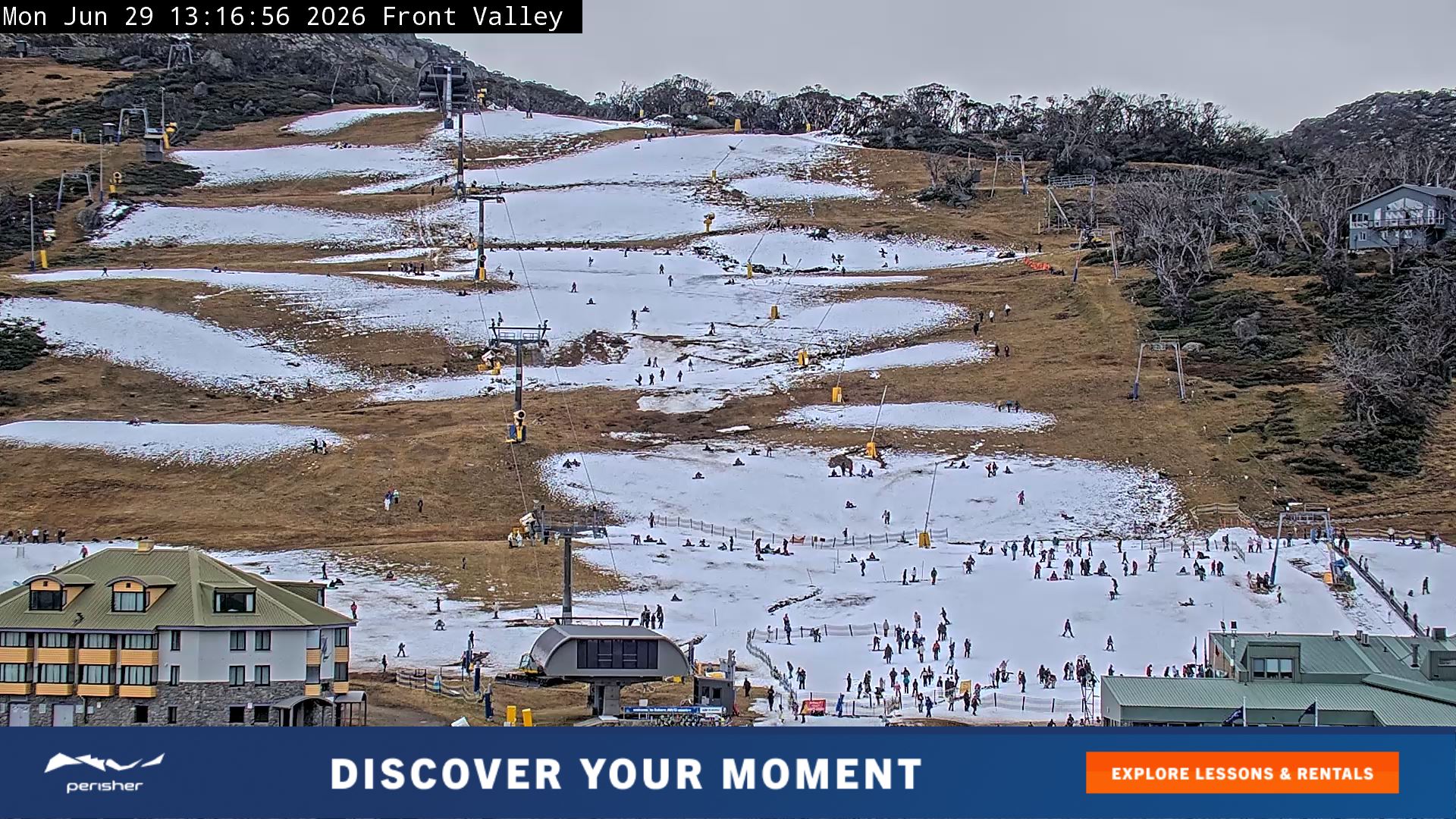
Image: Expect full coverage on Front Valley by this weekend, if forecasts hold. Source: Perisher.com.au.
Heavy rain, then snow moves late Thursday night
As Weatherzone meteorologist Ben Domensino wrote on Monday morning, three distinct bands of rain are expected move across Australia this week, potentially causing flooding in some parts of the southeast.
The first two rainbands will be accompanied by airmasses with tropical origins that are too warm for snow at the elevation of the ski resorts.
The third system is a different story. It pushes in from the Southern Ocean and reaches the mountains late on Thursday, and has the potential to deliver a much-needed dump of around 30 centimetres of snow at higher elevations.
In Tasmania, snow could be even heavier, and looks likely to fall to very low elevations due to a burst of especially frigid air at more southerly latitudes than the mainland.
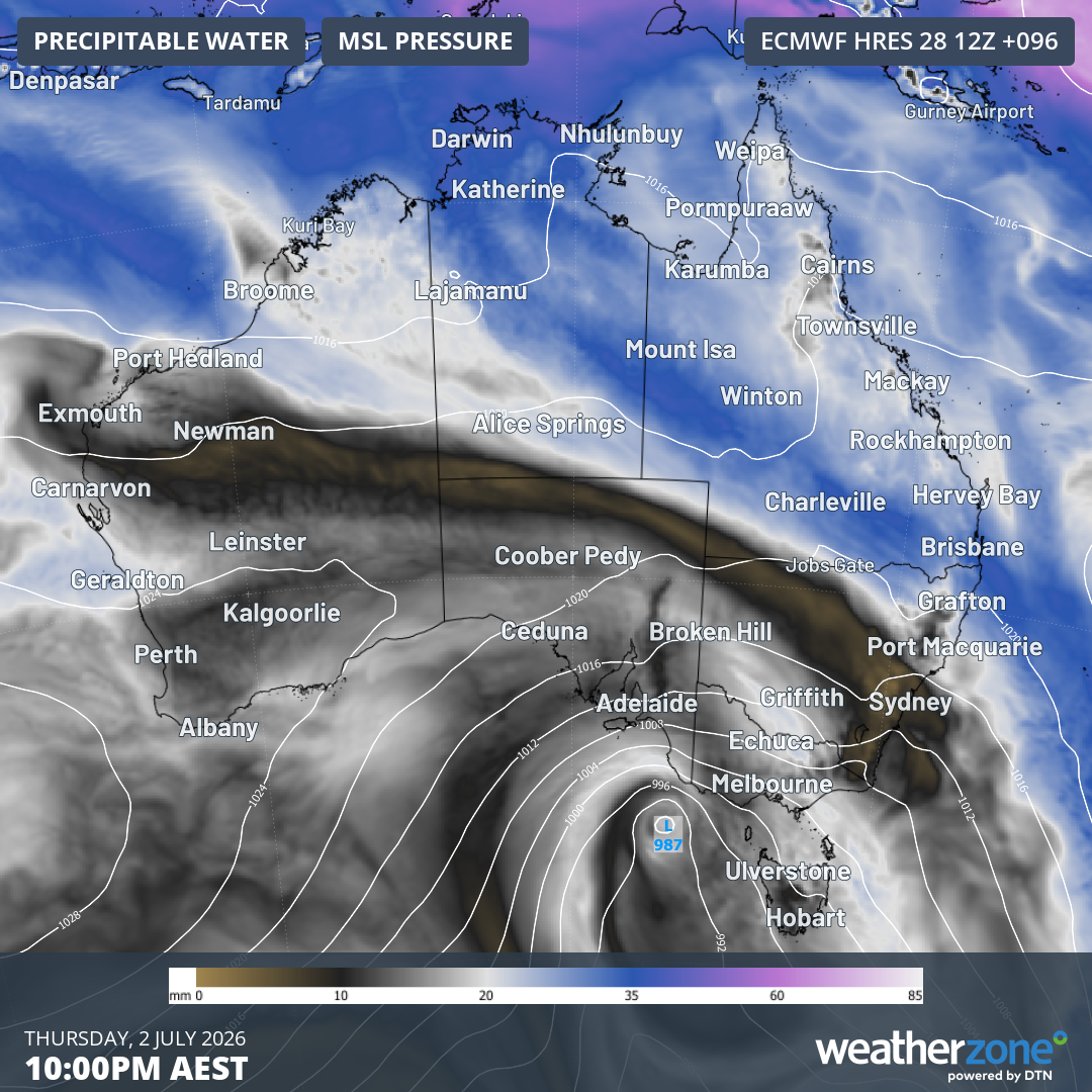
Image: Precipitable water and mean sea level pressure for 10pm (AEST) on Thursday, July 2, 2026. Source: Weatherzone.
As the graphic above shows, the heaviest quantities of atmospheric water vapour will stream across the country ahead of the cooler air associated with the low centred over western Bass Strait.
But there should still be significant moisture crossing the mountains in tandem with the cool air for a period of 36-hours or so from late on Thursday into the early hours of Sunday. This should generate the heaviest Australian snowfalls since the early June snow which washed away.
Perhaps the most positive news for Australia’s ski resorts as the school holidays get into full swing (Vic and Qld kicked off this week, NSW and SA schoolkids are off from next Monday) is that the cold, mostly dry air in the wake of Friday’s cold front should produce ideal snowmaking conditions well into next week.
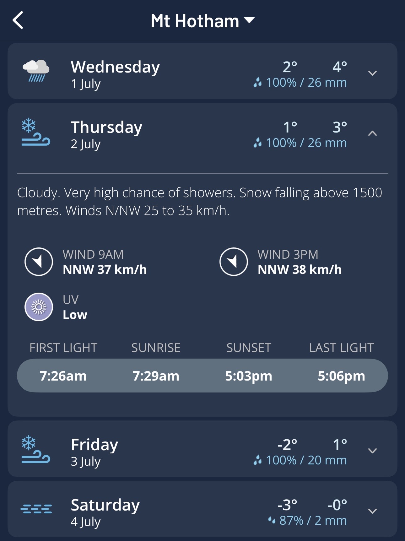
Image: Daily forecasts for Mt Hotham (Vic) on the Weatherzone app.
As ever, check the latest forecasts, live cams and more on the Weatherzone snow page.