
Sydney heading for 2 weeks over 20°C – a new June record
Winter has failed to show up in Sydney so far this month, with the city registering its longest run of June days over 20°C in close to 170 years of records.
A string of high pressure systems and a lack of strong cold fronts have kept daytime temperatures unusually high in Sydney and other areas of NSW so far this month.
The long-term average maximum temperature at Sydney’s Observatory Hill weather station, located next to the Harbour Bridge, is around 17°C. This month, it has been running at around 21°C and the coldest day managed to reach 18.2°C.
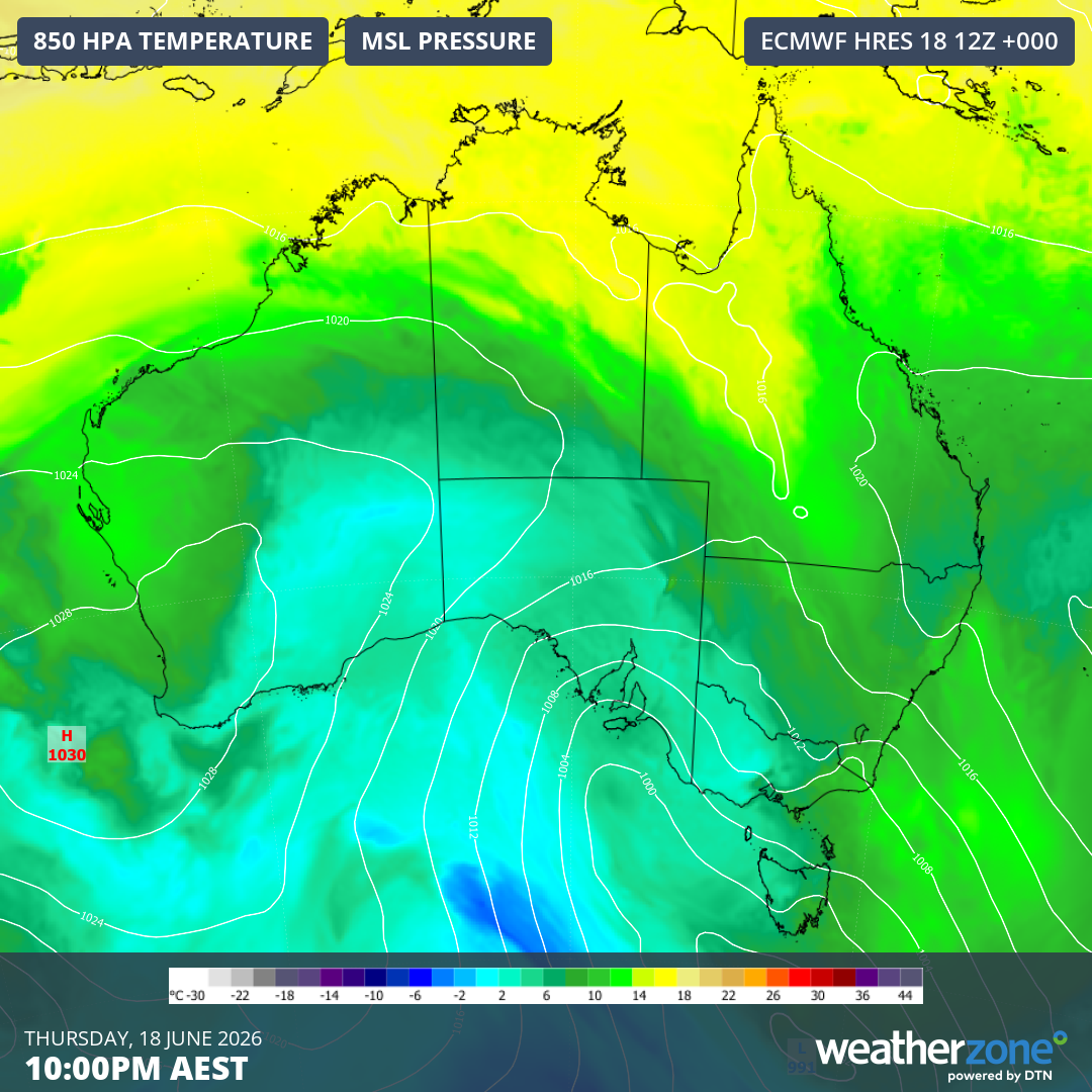
Image: Modelled 850 hPa temperature and mean sea level pressure over Australia on Thursday night, showing a high pressure system directing warm air across NSW. Source: Weatherzone.
Longest run of June days over 20°C
Today, Friday June 19, marks the 13th consecutive day above 20°C at the Observatory Hill weather station. This easily beats Sydney’s previous June record of nine days in a row above 20°C from 1919, with data available back to 1859.
Sydney is expected to extend this record-breaking run to 14 days on Saturday, before slightly cooler conditions develop from Sunday, possibly ending the streak.
Looking ahead, southerly winds should keep temperatures below 20°C throughout most of next week, with maximums forecast to sit around more typical June highs of 17 to 19°C.
Another record possible by month’s end
There are early signs that some warmer weather will return towards the end of next week, possibly bringing a few more days over 20°C in the final days of the month.
The record for the most 20°C days in a single June was 18 in 1957. This month has already had 14 days over 20°C (which includes the current 13-day streak) and should have its 15th on Saturday. With more days over 20°C possible from late next week, there is a chance this month will challenge the record from 1957.