
Bitterly cold across the southeast with fresh snow and wild winds up high
The cold front that crossed Tasmania and the southeast mainland overnight has left up to 15 centimetres of fresh snow at higher elevations, with strong winds and low temperatures creating bitter conditions in the alpine region.
This Wednesday also promises to be one of the coldest days of the year to date in many lower elevation locations across South Australia, Victoria, Tasmania, the ACT and southern New South Wales – especially when you factor in the apparent or "feels like" temperature.
At 10 am, it was still just -5.2°C at Australia’s highest weather station, Thredbo Top Station at 1957 metres, with a “feels like” temperature of -17.3°C as winds gusted above 60 km/h. The strongest gust overnight was 120 km/h just before 2 am.
Hobart was just 7.2°C at 10 am, with a “feels like” temperature of 2.5°C.
Melbourne was 10.6°C at 10 am with a “feels like” temperature of 7.0°C. The mercury is expected to reach just 13°C, which would make it just the third day this month to fall below the long-term average July maximum of 13.5°C.
Spectacular speckled cloud mass reveals air with polar origins
The loop below shows the cold front moving overnight.
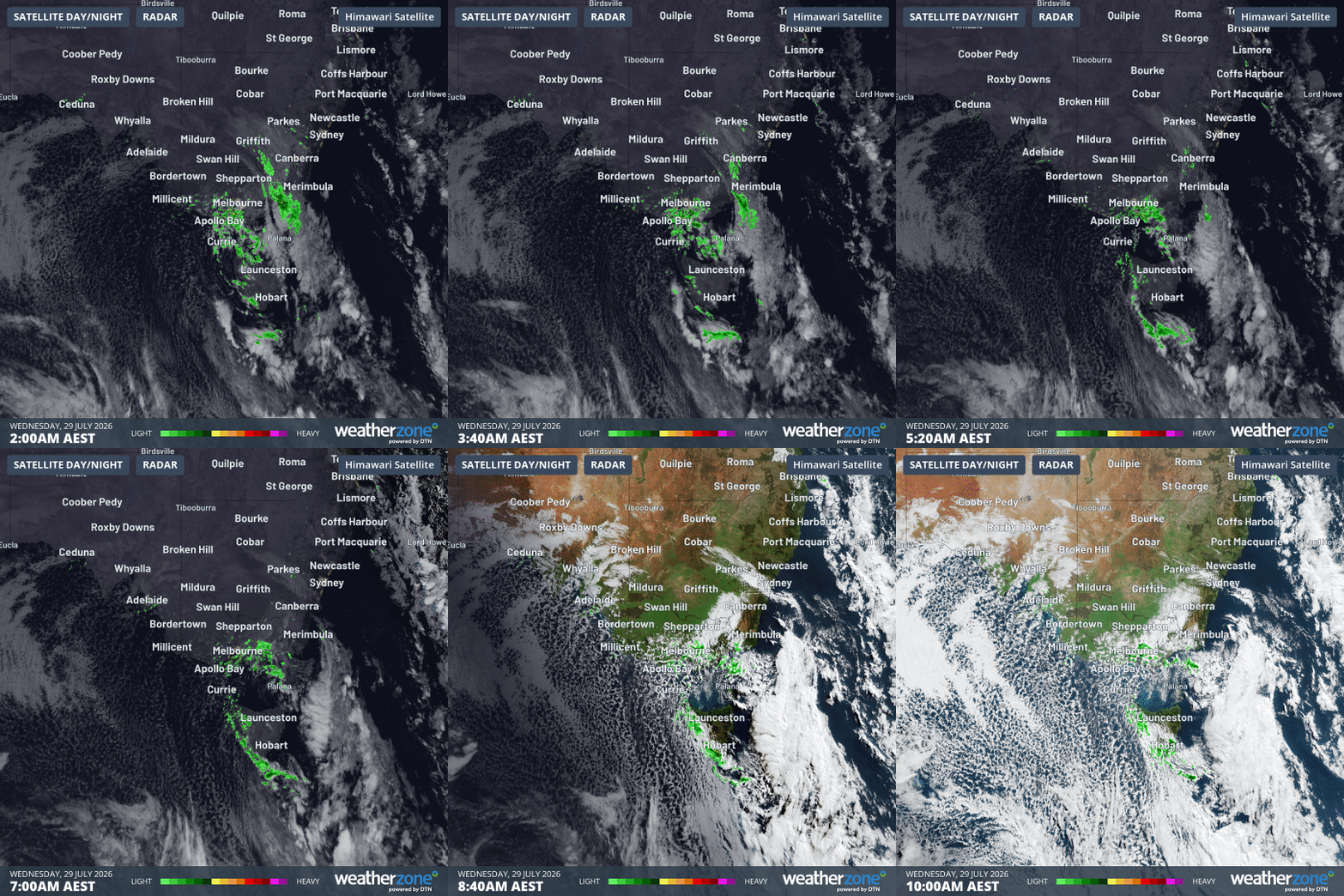
Image: Combined satellite and radar loop for SE Australia for the eight hours to 10 am (AEST) on Tuesday, July 29, 2026. Source: Weatherzone.
The heaviest band of moisture that produced rain and snow on the southeastern corner of the mainland moved through in the small hours of the morning, while Tasmania saw some of the heaviest precipitation from this system during the daylight hours of Wednesday morning.
The speckled cloud pattern which is clearly visible over waters south of SA and Vic after sunrise is caused by frigid air moving over the comparatively warm ocean, creating cumulus cloud cells with clear patches of sky in between.
Rapid clearing pattern with frosty nights to follow
As stated earlier this week, this always appeared likely to be a cold but relatively short-lived system. While frequent rain or snow showers will persist until Wednesday evening in Tasmania, southern Victoria and SA, and the high country of Vic, NSW and the ACT, the atmosphere will dry rapidly by Thursday.
While the Victorian coastline and parts of Tasmania will see showers through the midweek period, a spell of clear, chilly weather will set in for several days across much of the southeast, with minimums set to plummet to potentially the coldest levels many locations have seen this year.
For example, the mercury at Thredbo Top Station is expected to dip to -9°C on Thursday morning. The coldest thus far in the 2026 winter was -7.1°C on June 27.
Due to a shower or two persisting along the Victorian coastline, Melbourne won’t see its coldest mornings this week until Friday or Saturday, with frost possible in inland suburbs on both mornings.
Day of the season at the snow resorts
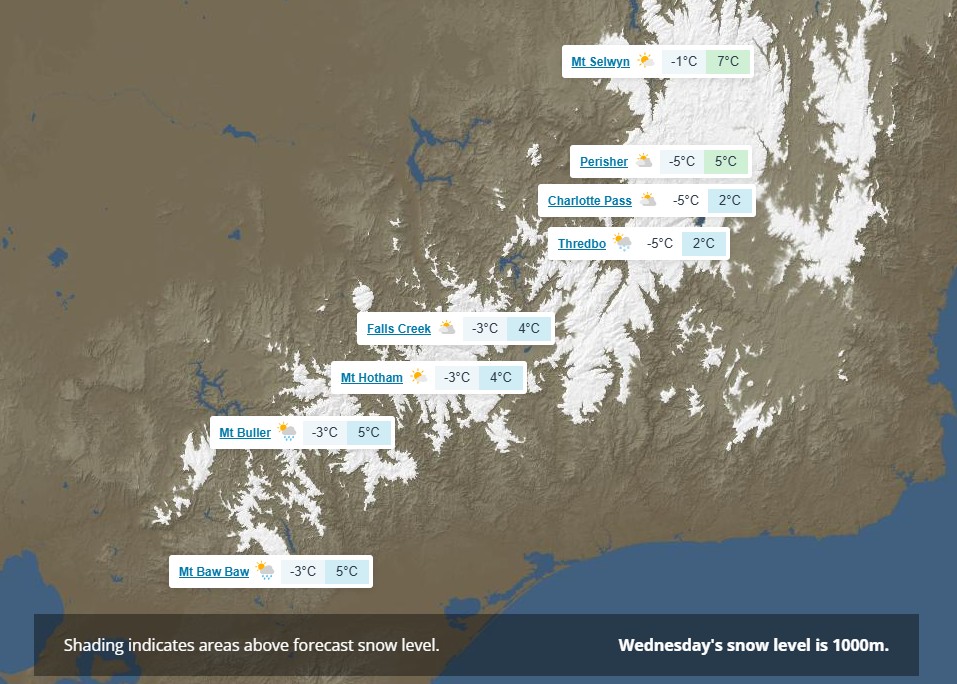
Image: The elevation and locations where at least some snowfalls are possible across the SE Australia alpine region on Wednesday, July 29, 2026. Source: Weatherzone.
With snowfalls likely to continue into Wednesday afternoon, Thursday should be a cracker at the mainland ski resorts.
The combination of sunshine with a coating of soft, dry snow should make for perfect surface conditions even though the overall snowpack is still relatively thin for this time of year.
This is not the major snowfall event that snow enthusiasts and ski industry businesses were hoping for, but it has definitely made a difference. And the further good news is that the coming clear, cold nights should be perfect for snowmaking to augment the natural cover.
READ MORE: Snowmaking begins in Australia: but how does it work?
There are also early signs of a system of similar or slightly lesser intensity which could arrive around the same time next week.
Please check the Weatherzone snow page for the latest forecasts, live cam images and more.