
Midweek cold front to bring rain, snow, strong winds to the southeast
A classic midwinter cold front will surge across southeastern Australia on Tuesday and Wednesday, bringing rain, strong winds, and snow to higher elevations of Tasmania and the mainland alpine region.
While this will not be a particularly powerful or long-lived system, it will still bring a burst of cold, wintry conditions that will punctuate a period of relatively stable weather either side of it.
You can see the system brewing over the waters of the Great Australian Bight, southwest of the WA/SA border, in the satellite loop below. The system will track rapidly eastwards over the next 24 to 48 hours.
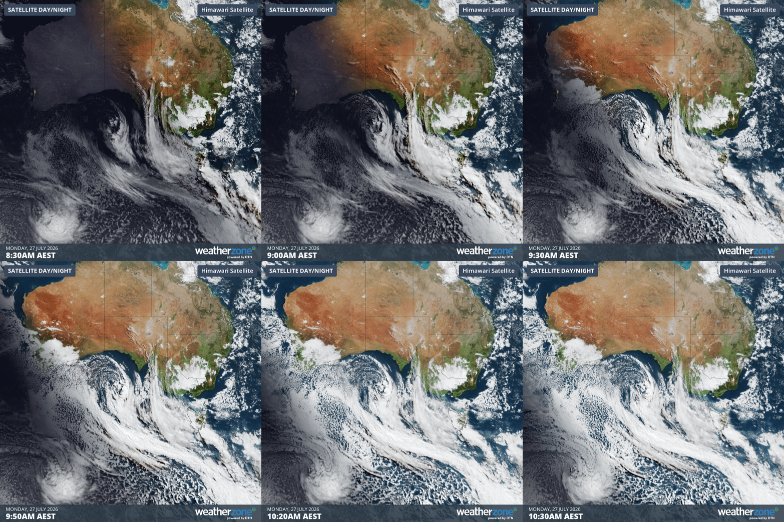
Image: Satellite loop for the two hours to 10:30 am (AEST) on Monday, July 27, 2026. Source: Weatherzone.
As Weatherzone meteorologist Ben Domensino explains, “the low pressure system passing over Tasmania on Tuesday night and Wednesday morning will drive cold air and moisture over southeastern Australia during the middle of this week.”
How much rain and snow can be expected?
As the chart below shows, the heaviest precipitation is likely in western and central parts of Tasmania, while parts of the South Australian and Victorian coastlines and mountainous areas of the southeast can also expect a good drop of rain or snow.
Of the southeastern capitals, Melbourne could do best, with an event total of around 10 mm likely, which would take Melbourne up from its running monthly total for July 2026 of 40.0 mm to around the July average of 47.1 mm.
For the mainland ski areas, snowfall totals of 10 to 20 centimetres are likely. This would be a handy top-up, but would definitely not qualify as a season-defining snowfall event.
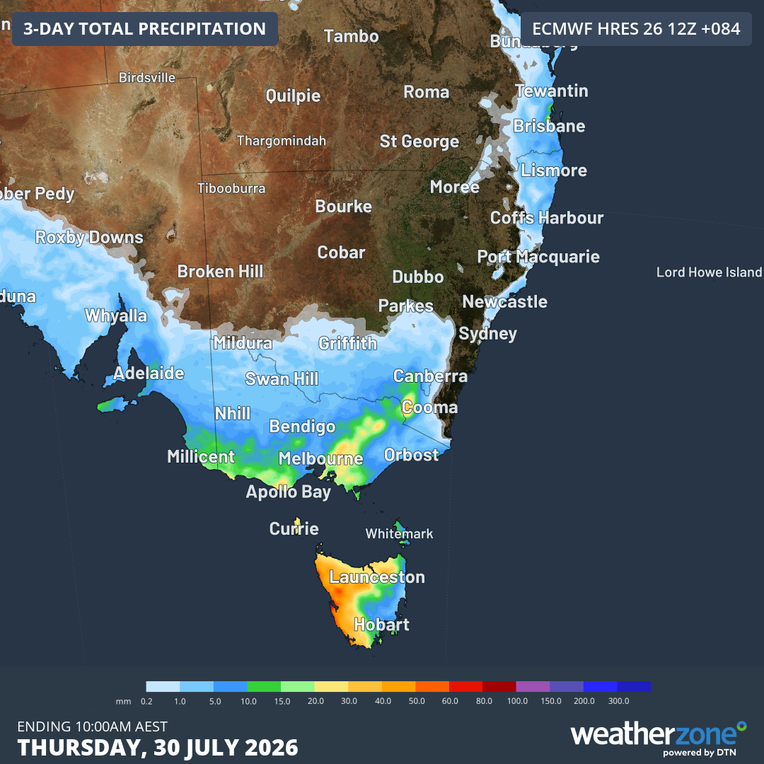
Image: Accumulated rainfall forecast for SE Australia up until 10 am on Thursday, July 20, 2027, according to the ECMWF model. Source: Weatherzone.
The most recent reading at Spencers Creek – the highest of three sites in the Snowy Mountains of NSW where hydro-electric operator Snowy Hydro has regularly measured snow depths in the cooler months since 1954 – was 68 cm on July 21.
- The average depth at Spencers Creek for the end of July over 72 years of data is around 120 cm.
- The season with the lowest peak depth on record was 2006, with 85.1 cm in late August.
Due to snow compaction, it’s possible that we still won’t have exceeded the 2006 high mark after the coming event.
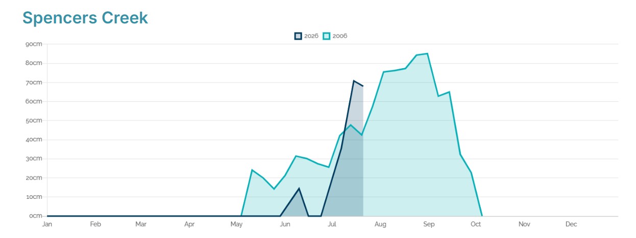
Image: A comparison of the lightest snow season on record, 2006 (light blue), and the 2026 season to date (dark blue). Source: Snowy Hydro.
Fortunately for snow enthusiasts and snow industry businesses, we still have the whole of August to come – and the recent trend towards a negative Southern Annular Mode (SAM) is historically a good pointer towards the prospects of snowfalls, although it is no guarantee.
Please check the Weatherzone snow page for the latest forecasts, live cam images and more.