
The Southern Annular Mode (SAM) has gone negative – what this means for Australia
Plenty of Sydney sunshine and heavy rain and snow in Tasmania will be some of the impacts caused this week by a negative Southern Annular Mode (SAM) that has just developed in the Southern Hemisphere.
What is the Southern Annular Mode?
The SAM is an index that reflects changes in the strength and position of a westerly wind belt encircling Antarctica. These westerly winds flow between Australia and Antarctica throughout the year, carrying cold fronts and low pressure systems from west to east.
The SAM fluctuates between neutral, positive and negative phases throughout the year:
- A neutral SAM occurs when the westerly winds are in a normal position for that time of year.
- When the westerly wind belt strengthens and contracts southward towards Antarctica, the SAM is in a positive phase.
- When the westerlies slacken and expand further north towards Australia, the SAM is in a negative phase.
Unlike El Niño and La Niña, which take months to develop, the SAM can switch between positive and negative phases in a matter of days.
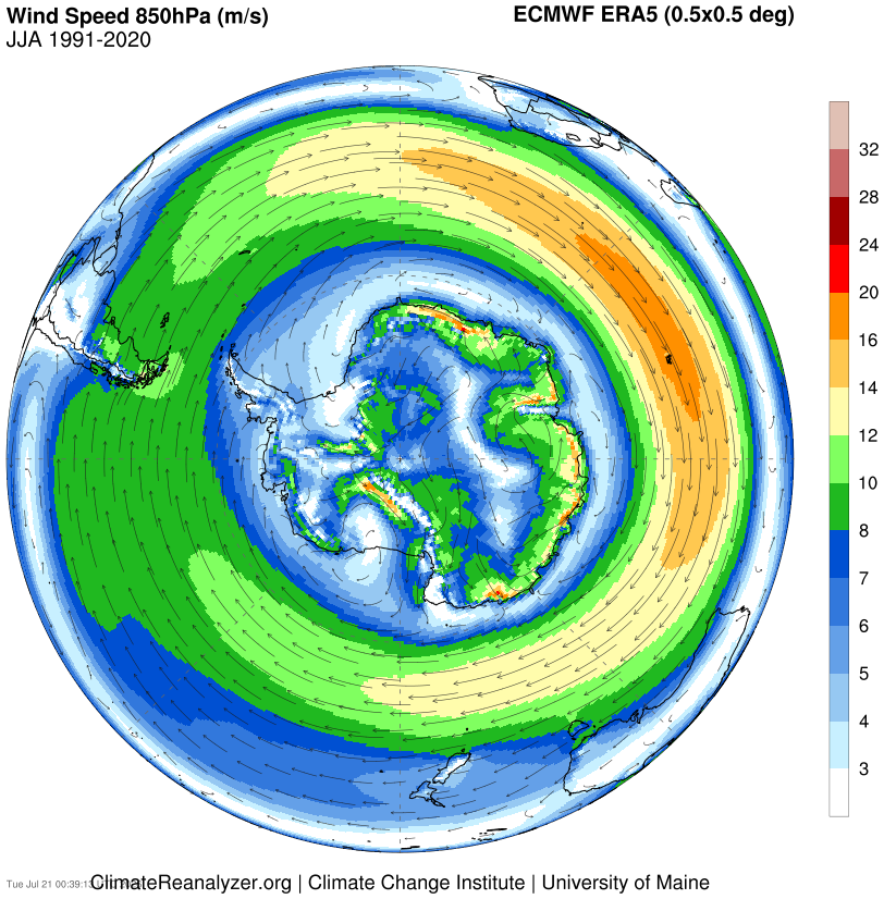
Image: Mean 850 hPa wind speed during the Southern Hemisphere’s winter (June to August). Source: ClimateReanalyzer.org
What is the SAM doing now?
The SAM was recently in a prolonged positive phase between late May and early July, with the index becoming extremely positive in June. This strong positive SAM phase contributed to a lacklustre start to the 2026 snow season in the Australian Alps.
The recent positive SAM phase ended around July 9, and the index has continued to drop since then. Over the weekend, the SAM index dropped to -1.83 on Saturday, which is the lowest value since December last year. Forecast models suggest this negative SAM phase should persist for the rest of this week and possibly until the end of July.
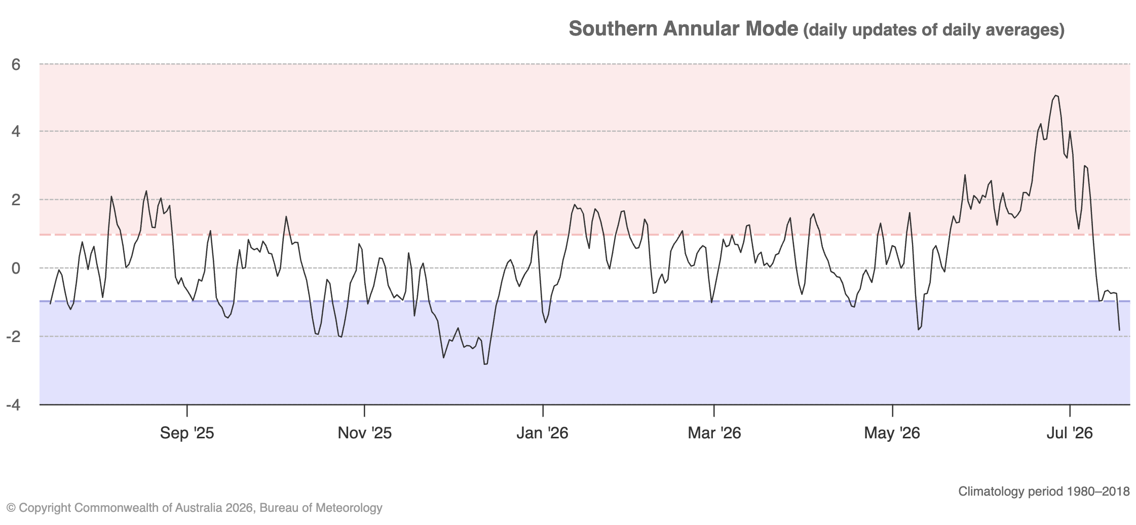
Image: Southern Annular Mode (SAM) index between November 1, 2025, and July 18, 2026. Source: Bureau of Meteorology.
At this time of year, a negative SAM usually causes more winter storm systems over southern Australia and often enhances drier westerly winds over eastern Australia.
Tasmania will feel the influence of the negative SAM this week when a powerful low pressure system blasts the state with wind, rain, hail and snow between Wednesday and Friday. This is likely to include low-level snow on Thursday as frigid polar air causes temperatures to plummet across the state. The temperature in Hobart will feel lower than 1°C for most of Thursday.
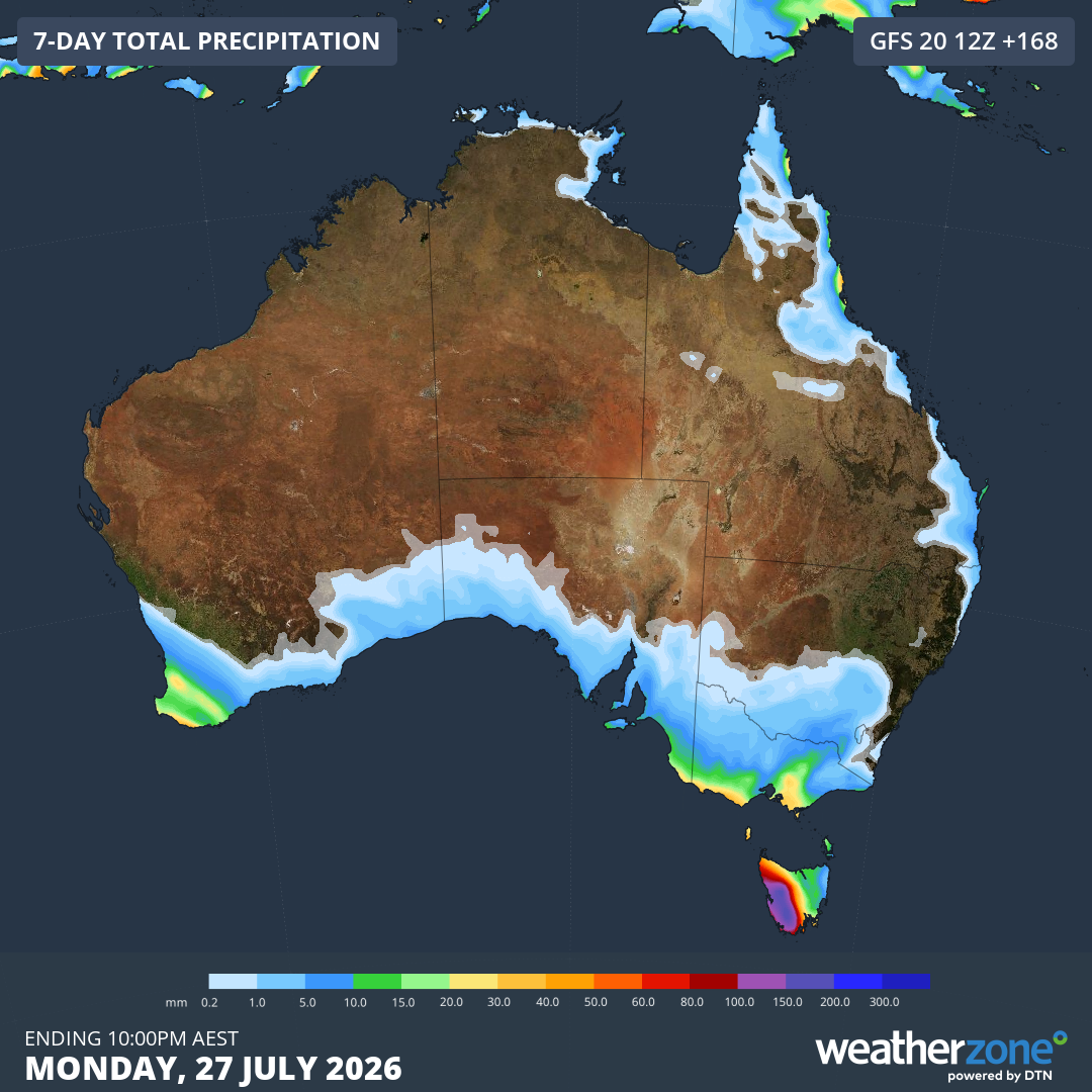
Image: Forecast accumulated precipitation over Australia during the next seven days, showing heave falls in western Tasmania. Source: Weatherzone.
Showers will also affect other areas of southern Australia this week, including Victoria, South Australia and southern parts of Western Australia and New South Wales.
By contrast, eastern NSW will see a run of dry weather under the influence of westerly winds. Sydney could remain completely dry all week with maximum temperatures reaching 19 to 21°C on most days. This is several degrees above the July monthly average of 16.5°C.