
Biggest snowfall of the season likely to develop this weekend
The strongest snowy weather system of the 2026 winter appears likely to arrive towards the end of this coming weekend in the mainland alpine region.
The cold front is expected to hit late on Sunday and has the potential to deliver up to half a metre of snow at higher elevations. Long-range models are also currently predicting a significant follow-up system due midweek.
Cold, windy conditions are likely to accompany both systems as they surge across southeastern Australia, with persistent showers and even small hail at elevations well below the mountains.
Let’s take a quick look at the 2026 Australian snow season to date before moving to the forecasts.
2026: a below-average snow season through June and July
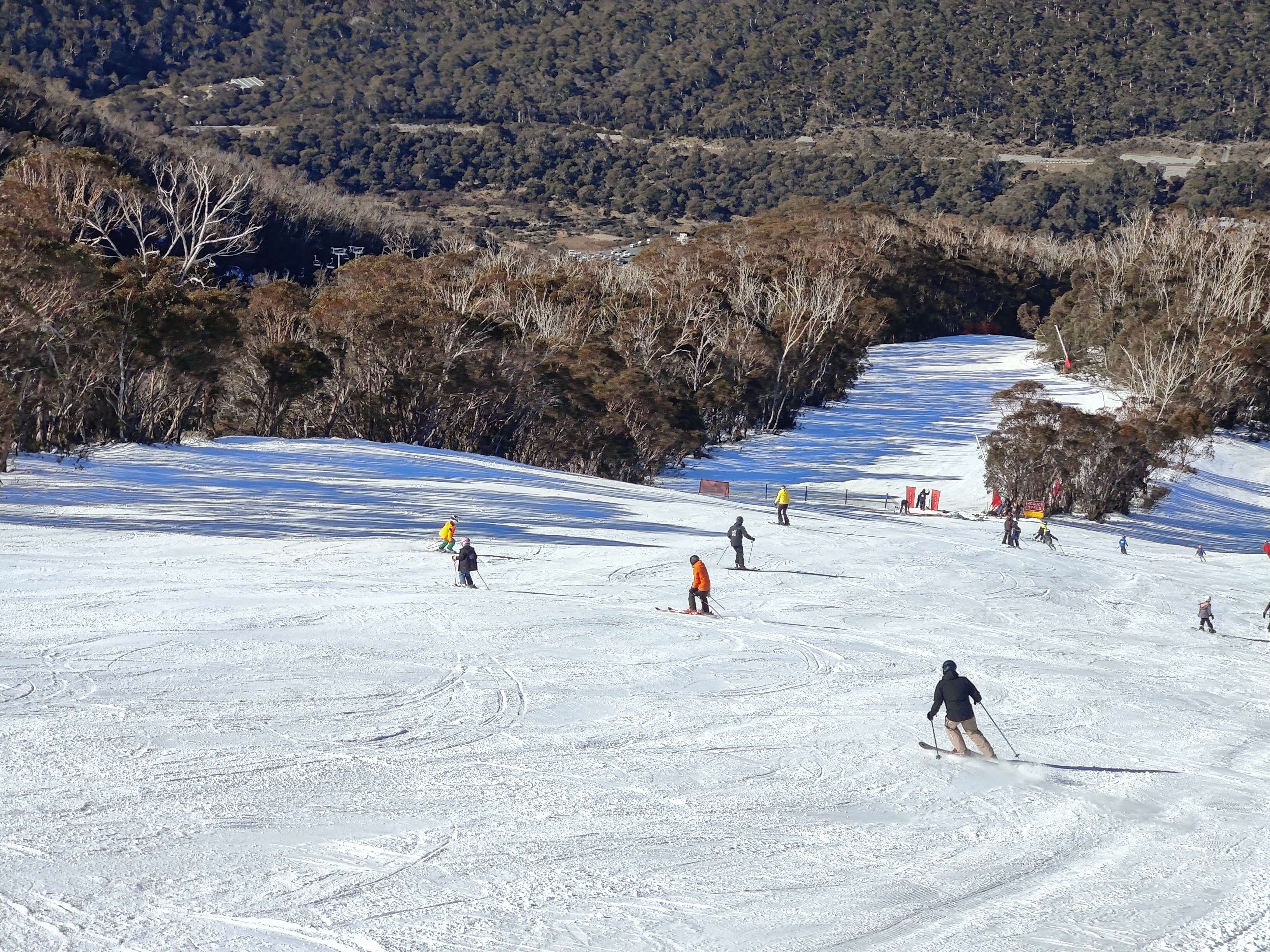
Image: Skiers on the High Noon run at Thredbo in mid-July with a snow base heavily augmented by snowmaking and the valley bare of snow. Source: Rusty J.
The 2026 season started on a positive note, with a snowfall just before the traditional King’s Birthday long weekend opening in early June. But the month thereafter was largely wet and warm.
For just the second time since 1954, when hydro-electric operator Snowy Hydro commenced regular measurements of the winter snowpack at three locations in New South Wales, there was no measurable snow at the start of July at the highest site, Spencers Creek (1830 m), roughly halfway between Perisher and Thredbo.
July was colder but also drier, and while at least three snowfalls brought the season to life, none of them were particularly heavy, with the Spencers Creek depth around 70 cm as July turned to August. That was well below the average of around 120 centimetres for that point of the season.
But the coming snowfalls have the potential to turn a mediocre season into at least an average one, and possibly even quite a good one by historical standards in terms of peak season depth.
First cold front arrives Sunday, August 9
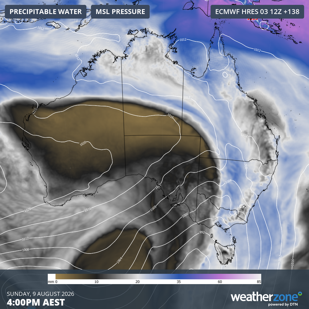
Image: Predicted mean sea level pressure and precipitable water over Australia for 4 pm (AEST) on Sunday, August 9, 2026, according to the ECMWF model. Source: Weatherzone.
The image above shows the mean sea level pressure over Australia with precipitable water in the atmosphere predicted for Sunday afternoon. It paints both a good and bad picture for snow.
The unstable southwesterly flow arriving over the Australian Alps is the good news, but the concerning part for snow enthusiasts is that the moisture-laden atmosphere will be too warm for snow initially.
In other words, expect rain to erode the existing meagre snowpack to a degree before it starts snowing heavily all the way through to at least the middle of Monday.
Second cold front arrives around Tuesday 11 August
It’s too early to state with confidence how much snow will arrive with this system, or if the season will even materialise over the Australian Alps, however most models currently suggest it could deliver another significant fall. There are even early signs of a third system behind it later next week.
As Weatherzone meteorologist Brett Dutschke wrote on the Weatherzone snow page, "All up, the next 10 or so days could bring as much fresh snow as we've received in the previous two months combined."
Why have snowy systems finally started to arrive in the last month of winter?
While there is always natural variability with weather systems, much of winter 2026 has been marked by a strongly positive Southern Annular Mode (SAM). This means that the band of westerlies, with its snow-producing cold fronts, was further south towards Antarctica than is usual for this time of year.
READ MORE: What is the Southern Annular Mode (SAM) and how does it affect Australia?
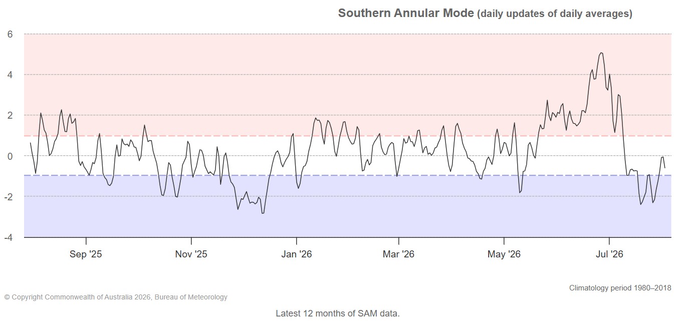
Image: last 12 months of SAM data. Source: BoM.
But as the graph above shows, the SAM has recently return to a neutral phase after briefly dipping into negative territory last week, which means an increased likelihood of snow-bearing systems like the ones that are likely to arrive from Sunday onwards.