
Snowfalls breathe life into 2026 Australian ski season
The weather gods left it pretty late, but the 2026 Australian ski season will kick off this Saturday, June 6, with at least 10 cm of natural snow on the ground at most resorts, plus whatever they can pump out over the next 48 hours through snowmaking.
After a mix of rain and snow from Monday through to Wednesday morning, snowfalls began in earnest across the high country of New South Wales and Victoria on Wednesday evening, with the snow level dropping as low as 800 metres above sea level in Victoria on Thursday morning.
This was the scene at Mt Buller in Victoria on Thursday morning.
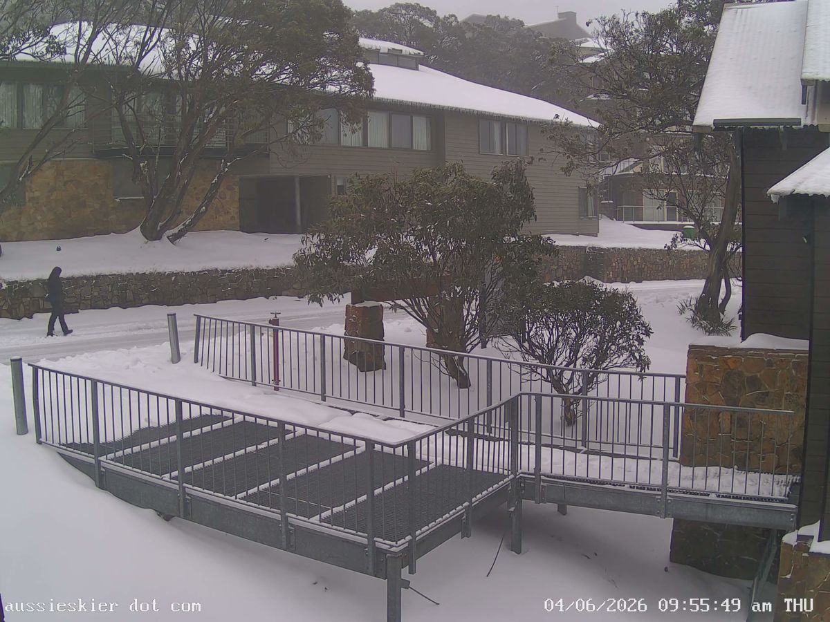
Image: Fresh snow at Mt Buller on June 4, 2026. Source: ski.com.au.
Snowfalls have continued on-and-off throughout Thursday morning, and this event is not done yet.
There's a decent chance of a further accumulation of 10 centimetres or so, as the large blob of moisture situated just northwest of Melbourne at 10am (in the loop below) hooks around towards the Australian Alps on Thursday afternoon.
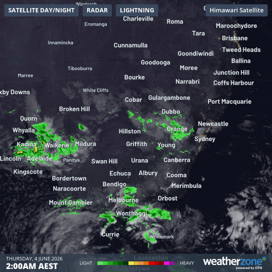
Image: Combined satellite and radar loop for southeastern Australia for the eight hours to 10am (AEST) on Thursday, June 4, 2026. Source: Weatherzone.
Even if more snow arrives on Thursday, the most meaningful weather conditions between now and Saturday from the point of view of Australian ski resort operators will be the coming cold nights.
Perisher in New South Wales can expect a string of subzero nights, including three consecutive mornings when a minimum around -5°C is likely. Similar overnight conditions can be expected at Victorian resorts like Falls Creek.
These temperatures will allow perfect conditions for snowmaking, especially as the atmosphere begins to dry out in the wake of the cold front from Friday onwards.
As for how many ski lifts will open this coming long weekend, we can't confirm that yet, however it seems highly likely that all major resorts will open some beginner terrain. In other words, the 2026 ski season opening will actually be a proper opening, albeit with limited skiing (and snowboarding).
READ MORE: Snowmaking begins in Australia: but how does it work?
What is the short-to-medium term outlook for further snowfalls?
Beyond the current system, a pattern of blocking high pressure systems looks likely to dominate southern Australia's weather until at least mid-June.
This will likely prevent significant outbreaks of moist, snowfall-producing polar airmasses from reaching the Australian mainland.
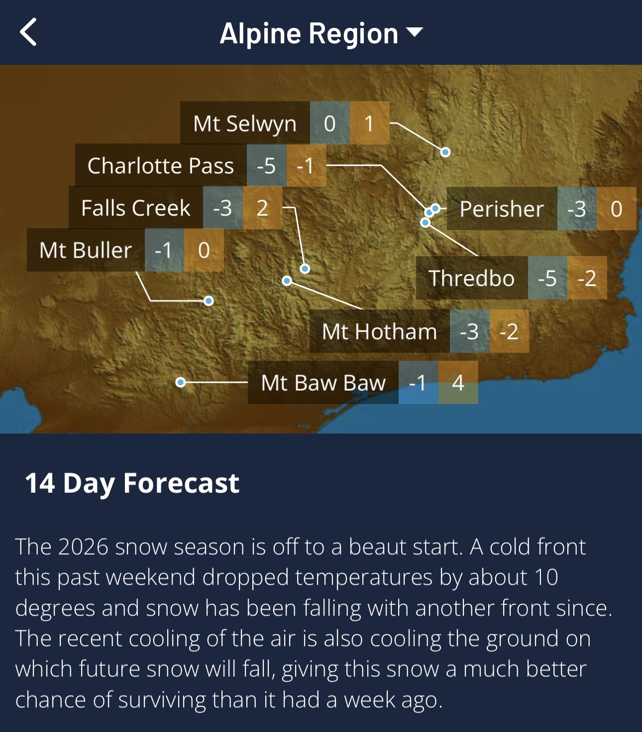
Image: Explore Snow & Ski forecasts on the Weatherzone app.