
Wild, wet and windy weather slamming southeast Australia
To twist the old Qld tourism slogan, spring is the season when the weather is beautiful one day, absolutely horrible the next, and that's exactly what we're seeing over a large part of southeast Australia this Friday.
A frontal system marched easterwards overnight across the greast Australian Bight and is currently crossing Victoria, bringing with it some pretty wild conditions.
Here's a breakdown of some of the effects of this current system.
Rain
A rain band is currently crossing Victoria with the front. Heavy rain was on the forecast all week for Melbourne today, and while the city has managed to stay mostly dry till about 11 am Friday, that's changing as we write this story.
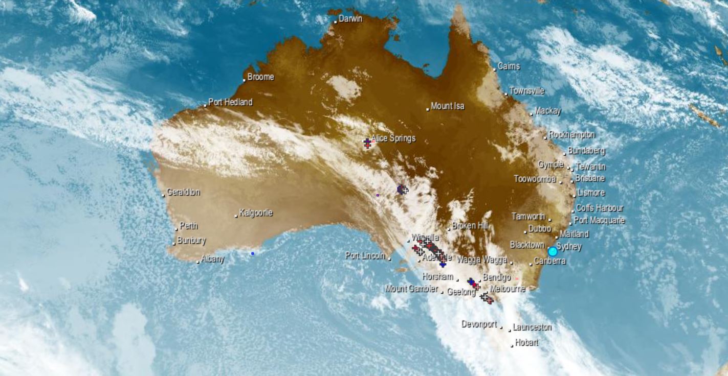
The Melbourne radar is pretty intense right now, and the sat pic of the whole of Australia (below) illustrates the picture well too, showing a northwest cloudband extending all the way to the Indian Ocean.
Rainfall totals have already topped 5 mm in SW Victoria since 9 am, but more is coming, especially in mountain districts and into the weekend (when it will fall as snow in higher areas).
Temperature drops
- Adelaide had a maximum temp of 31.2°C yesterday, its earliest day on record with temps so high. Today it's struggling to reach the predicted top of 16°C.
- Melbourne, too, had unusual early spring heat yesterday, with a top of 26.6°C and its 2nd-hottest September morning in 166 years of records (min 20.1°C). Temperatures reached 23°C on Friday morning, but should drop quite dramatically later today, with maximums of just 15°C and 14°C expected for Saturday and Sunday respectively in the cold air behind the front.
- As we publish this story, it's still unseasonably warm to say the least in many parts of Victoria. Mt Buller had a minimum of 6.7°C last night, which is pretty tropical by its standards! (the average September min is -0.7°C)
That howling wind
Ahead of the front, strong, unseasonably warm northwesterly winds are buffeting parts of four states.
- Wind gusts exceeded 100 km/h in Thredbo this morning, and reached a cyclonic 118 km/h at kunanyi/Mt Wellington above Hobart yesterday.
- Winds of at least 50 km/h are also being experienced in lowland districts of Victoria.
Warnings
Loads of them are in place, including severe weather warnings for parts of Victoria, NSW and the ACT. We'd encourage you to click on our main warnings page here, and navigate your way around to see specific warnigns for your area.
The (dwindling) snow
As you'd expect, this system is none too good for the snow pack in the mountains, although some snow should fall in NSW and VIC this weekend to repair the damage a little at the resorts, some of which still hope to open from their Covid lockdowns before the traditional season's end on the first weekend of October.
We'll have an update on snow conditions on Weatherzone this afternoon with a surprising (and slightly disturbing) statistic regarding peak season depth, so stick around.