
Warmest October on record for Sydney, Brisbane
Sydney and Brisbane just had their warmest October on record, despite a relatively cool end to the month.
A surge of cold air caused temperatures to plummet in eastern Australia earlier this week. In Brisbane, the temperature only reached 22.2°C on Tuesday, while Sydney’s maximums remained below 18°C on both Tuesday and Wednesday. These chilly days, which were about 4 to 5°C below average for this time of year, were a cold drop in an ocean of warmth this month.
Sydney and Brisbane, and many areas in between, just experienced their warmest October on record based on maximum temperatures.
Sydney’s average maximum temperature for the month will come in at around 26.6°C. This is more than 4°C above the monthly average and warmer than the previous October record of 26.2°C from 1988.
Brisbane’s average maximum temperature in October will come in at around 29.4°C, more than 2°C above average and comfortably higher than the previous October record of 28.7°C from 1918.
Many other areas in Queensland and New South Wales also broke their maximum temperature records this month. This included new state records when Birdsville, Qld reached 46.1°C and Wanaaring, NSW reached 44.9°C on October 21.
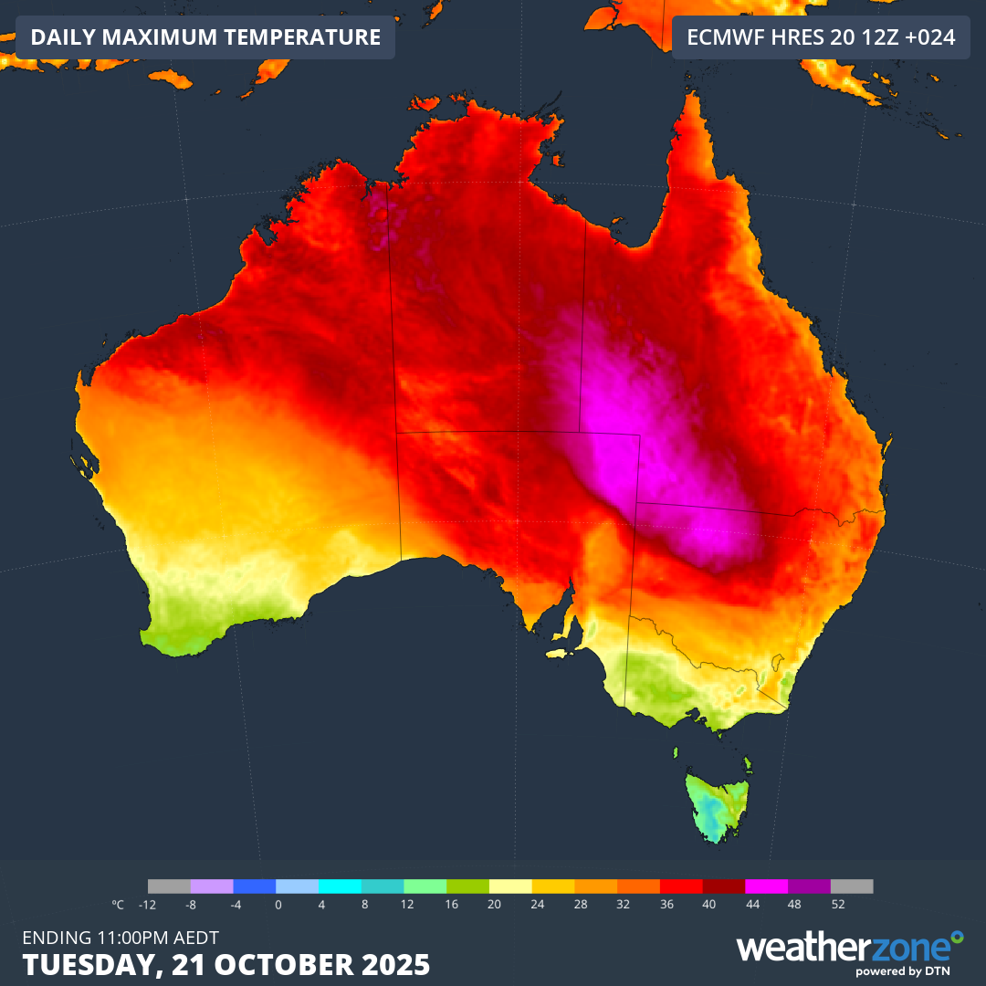
Image: Modelled daily maximum temperature over Australia on October 21, 2025, showing a pool of very hot air over the eastern inland.
Why was October so warm in eastern Australia?
A rare sequence of stratospheric warming episodes occurred high above Antarctica in September and October. These abrupt changes in temperature disrupted the Southern Hemisphere's polar vortex, which affected weather patterns over Australia during October.
One of the big effects from this stratospheric phenomenon was a relentless flow of warm and dry westerly winds over eastern Australia throughout most of October. These westerly winds carried hot air from central Australia across Qld and NSW, causing weeks of unseasonably warm and dry weather.
The map below shows that air temperature around 1.5 km above the surface was, on average, about 3 to 4°C warmer than usual over a large area of central and eastern Australia.
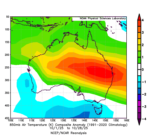
Image: Average 850 hPa temperature anomaly for the first 28 days of October 2025. Source: NOAA
Another factor that helped cause this month’s record-breaking heat was a lack of cloud and rain over large areas of the country. Despite the presence of a strong negative Indian Ocean Dipole – a climate driver than typically boosts cloud and rain over Australia in spring – northern, central and eastern Australia only saw limited rain during October. This was because of the strong influence of the stratospheric warming event, which counteracted the IOD.
Climate change is also likely to have played a role in this month’s record heat. The average maximum temperature over eastern Australia has increased by around 1.84°C since 1910.