
Three maps which explain this week's severe thunderstorms over NSW and QLD
Eastern Australia has been hit by several days of severe weather this week, including multiple supercell thunderstorms.
We've seen all of the phenomena which demarcate severe thunderstorms during this outbreak - tornadoes, damaging straight-line winds, large hail and torrential rain rates.
One of the most notable impacts of this week's thunderstorms were hailstones with a whopping 16 centimetre diameter which fell over Yalboroo, QLD on Tuesday, setting a new Australian record.
So, what made this week's thunderstorms so severe?
The primary cause of the severe weather in the past few days was a kink in the jet stream, which developed early this week. This transported cool, dry air in the middle levels of the atmosphere from the mid-latitudes well into the tropics.
In the lower levels, meanwhile, humid Coral and Tasman Sea air provided abundant moisture over eastern parts of QLD and northern NSW.
The vertical temperature profile produced when cool, dry air sits above warm moist air not only allows the humid, surface air to surge upward through the troposphere - producing thunderstorms - but is also perfect for the development of large hail.
Here are three charts that help to explain what happened this week.
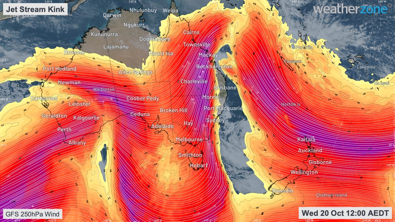
Image: Upper-level winds developed a strong southerly component over eastern Australia, thanks to a kink in the jet stream. This is called meridional flow, meaning the air flows in a north-south orientation.
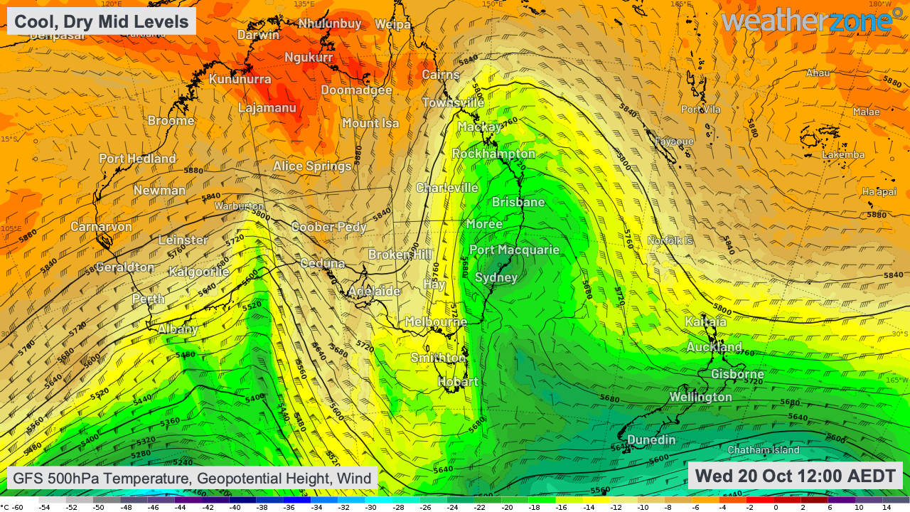
Image: The meridional jet stream transported cool, dry air in the middle levels of the atmosphere a long way north (well into the tropics).
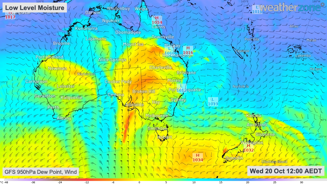
Image: Humid Coral/Tasman Sea air provided abundant moisture in the low levels.
While thunderstorms are still occurring over parts of eastern Australia, the worst is likely to have passed with the cool upper air now moving away to the east.