
The Red Centre just got a whole lot more colourful after midweek deluge
In a week when we could all use a little bright news, this rainbow poking out behind Uluru ought to do the trick.
The rainbow was captured by Meegan Irene, who was visiting Uluru-Kata Tjuta National Park.
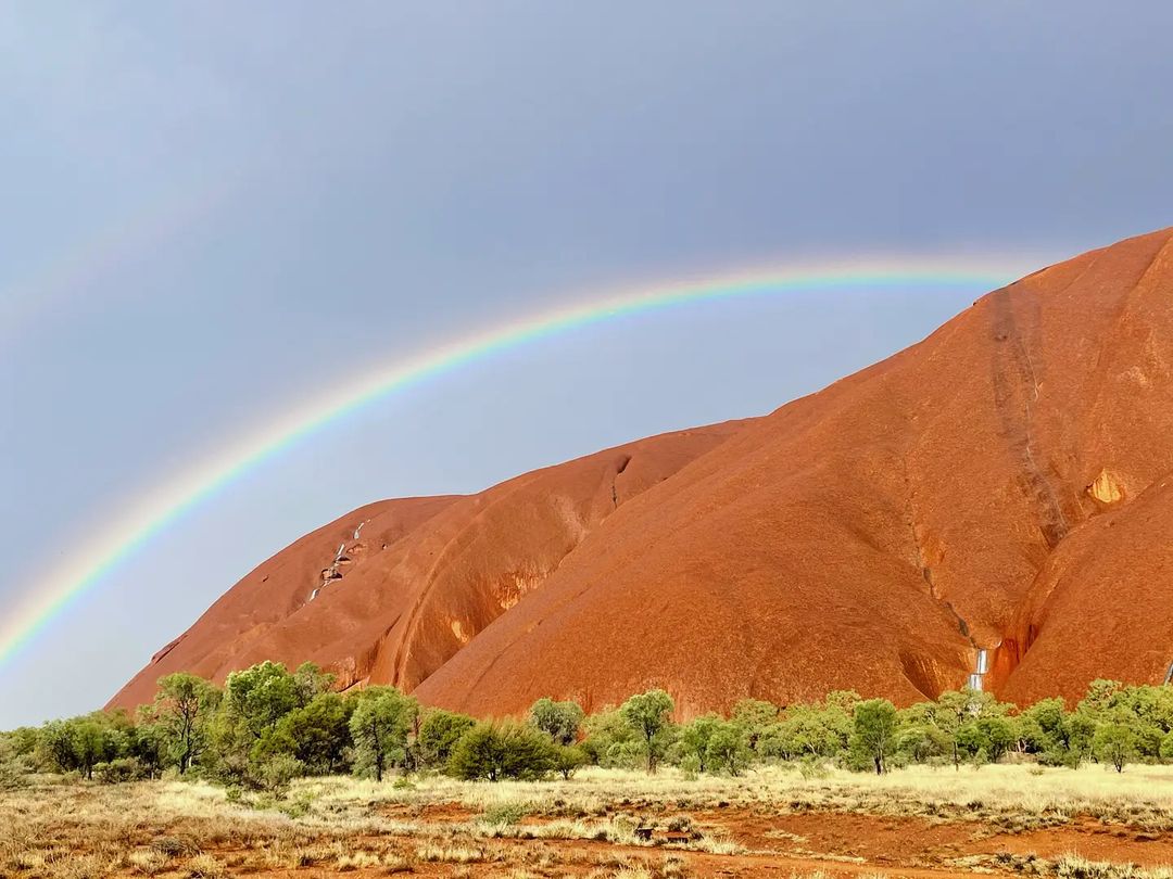
Image: The red, orange, yellow, green, blue, indigo and violet centre. Source: @miss_meegan_ via Instagram.
WANT MORE RAINBOW NEWS? WHY THIS NSW CENTRAL COAST RAINBOW WAS PREDOMINANTLY PINK
Now sadly, we here at Weatherzone were stuck at work and weren't out in the Red Centre to witness the rain in person, but it very much appears that this was a good, soaking rain rather than a momentary deluge.
The graph below illustrates that, showing steady accumulation across Tuesday and Wednesday.
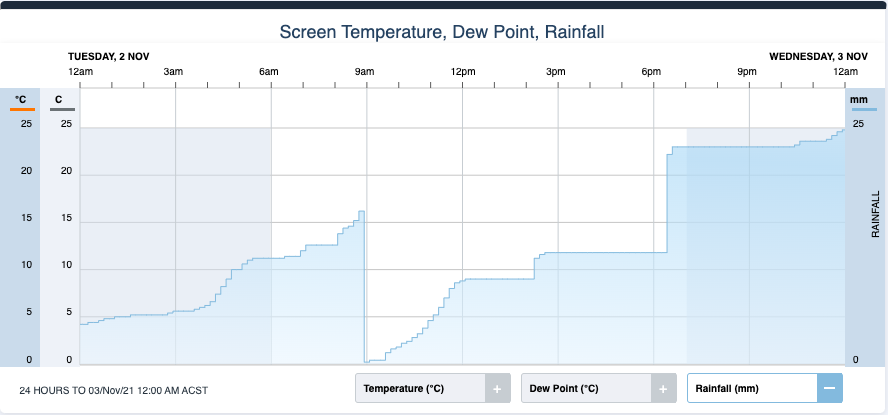
- A total of 46 mm of rain fell over the two days, exceeding the November average for Yulara Airport (the closest current weather station to Uluru) of 30.8 mm.
- This was not the heaviest single-day or 48-hour rainfall for 2021, but it was the second-highest on both counts, secondly only to the 12.4 mm and 40.4 mm (total 52.8 mm) that fell in March.
Contrary to the popular imagination, the Uluru area is far from the driest part of Australia, with an annual average rainfall at Yulara Airport of 268.4 mm.
The majority of that tends to fall in the warmer months, with winter and early spring the driest time of year. Even so, winter and early spring in 2021 were dry in the Red Centre by local standards.
- Just 8.2 mm fell in October (average 21.4 mm) and 5.4 mm in September (average 8.2 mm).
- August was bone dry, and indeed there was a total of just four days in the whole of winter 2021 when the ground was dampened, with a seasonal total of 12.2 mm of rain (average 37.8 mm).
So what caused this week's Red Centre rain?
A low pressure trough interacting with tropical moisture caused the rain and thunderstorms over central Australia on Tuesday and Wednesday.
As we told you yesterday, the wet weather across a huge part of the country right now is being driven by a negative Indian Ocean Dipole (IOD), while the developing La Niña is beginning to make its presence felt.
Both of these climate drivers cause warmer-than-average water to lie near northern and eastern Australia, which increases atmospheric moisture and fuels rainfall.