
Summer-like stormy start to the week in NSW
After a relatively calm Sunday, weather will change dramatically on Monday as showers and gusty thunderstorms spread across much of NSW.
A trough and front will cross SA, Tasmania, and Victoria late on Sunday and start to affect NSW overnight. A band of rain with isolated thunderstorms will develop Sunday night and continue into Monday morning over southern and western parts of the state. Temperatures will plummet with the passage of this system, which means that many places will experience the highest temperature of the day in the morning.
Things will deteriorate and become more interesting during the afternoon thanks to unseasonably warmth east of the front. The rain, combined with scattered to widespread thunderstorms, will impact central and eastern parts of the state. Storms will have the potential to become severe, which would bring localised damaging winds and hail.
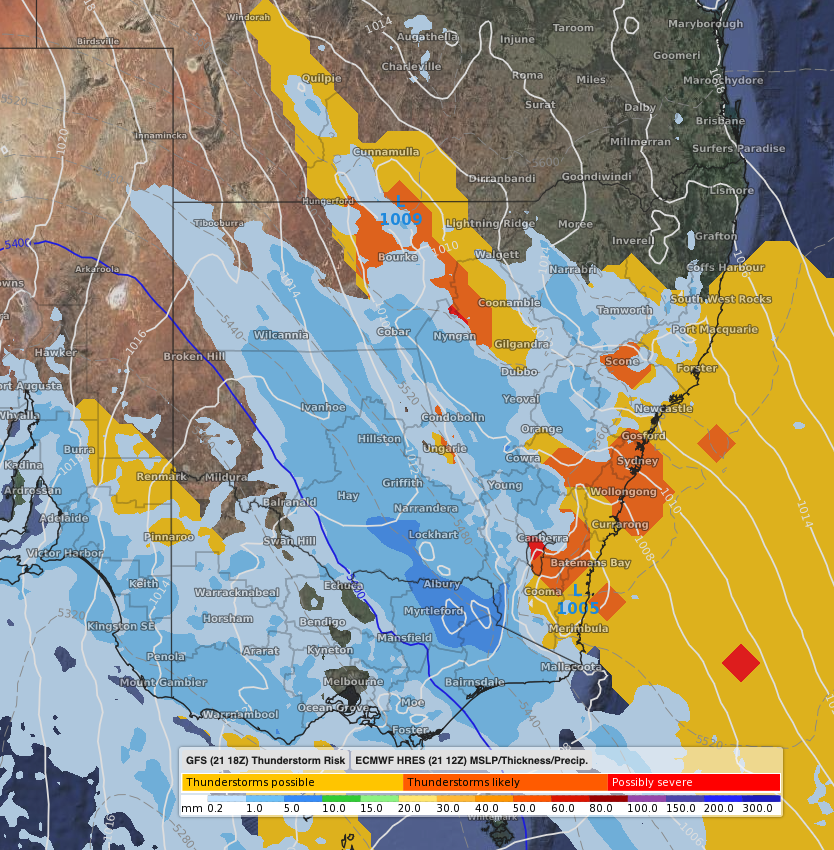 Image: Thunderstorm risk, mean sea level pressure, and 3-hour rain to Monday 1pm EST according to ECMWF.
The abrupt change will arrive in the Sydney region during the evening with cooling rain and possible squally thunderstorms on the leading edge of the front. However, isolated and brief storms could also pop up in the early afternoon.
If the above does not sound enough for you, dangerous weather is also possible on Tuesday. A low will rapidly develop off the NSW coast, bringing heavy rain to the Sydney and Illawarra regions, and damaging winds and surf near the coast.
As this is a dynamic system, be sure to check the latest warnings and news on Weatherzone's app and website.