
Strongest southerly of spring surging up east coast
A strong southerly change is surging up the east coast this Monday, pushing coastal showers and unseasonably cool temperatures all the way to the Queensland border and beyond by Tuesday.
The cold airmass is already entrenched in Australia’s two southernmost capital cities, with Hobart and Melbourne heading for Monday maximums of just 13°C and 14°C respectively, just five weeks before the start of summer, with light snowfalls in elevated parts of Tasmania.
Image: Temperatures at the 850 hPa level in the atmosphere (which equates to about 1500m above sea level) showing cold air pushing north along the coast and adjacent ranges on Monday, October 27, 2025.
Sydney will begin to feel the chill on Monday afternoon with a sharp temperature drop of 5-7 degrees expected after the mercury peaks in the mid-20s just after midday.
In Brisbane, the temperature change will be even more dramatic, although the coolest air won’t arrive until the late hours of Monday or the early hours of Tuesday morning.
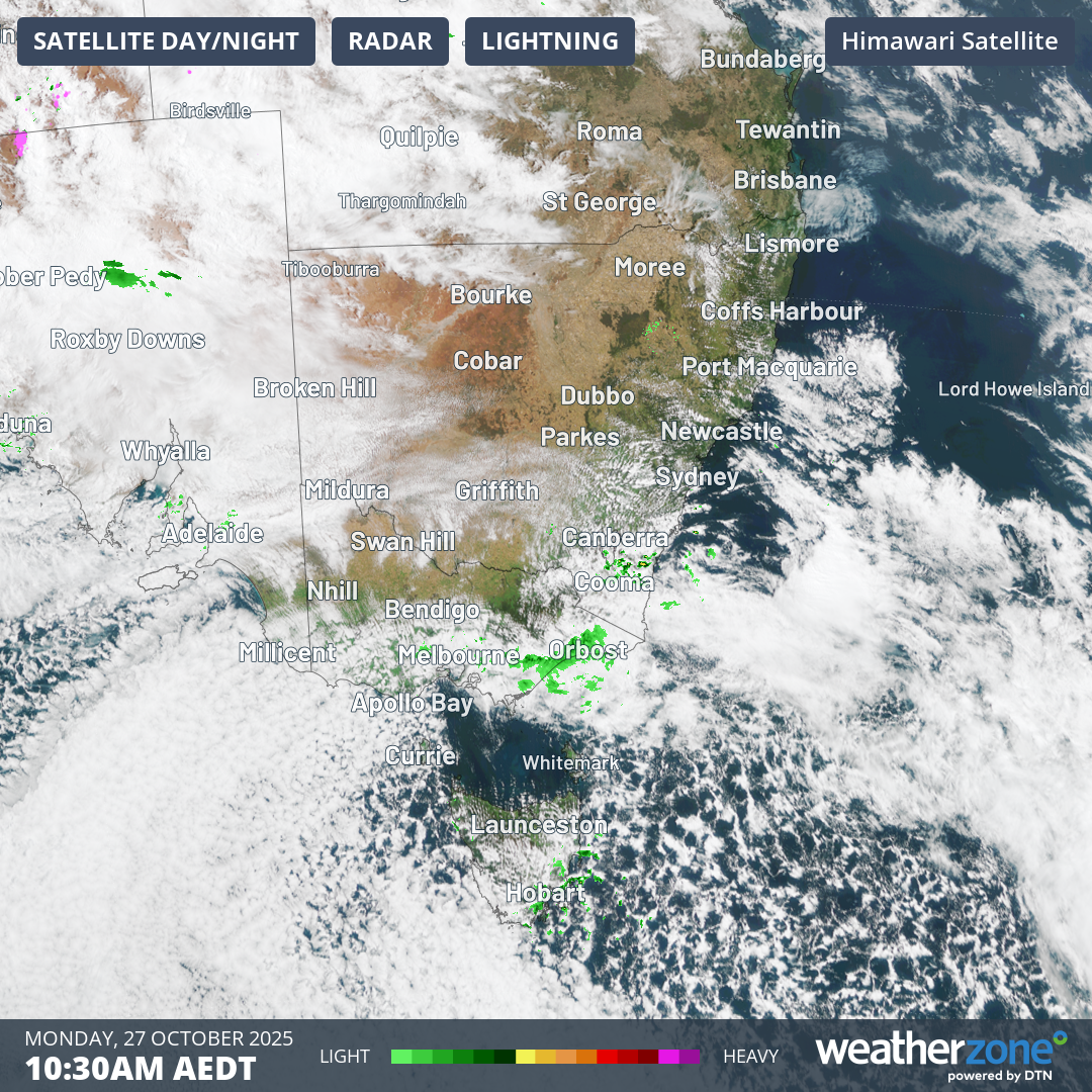
Image: A speckled cloud field (typically associated with a cold airmass with polar origins) can be seen off the SE corner of Australia on Monday, October 27, 2025, and is pushing north along the coast.
Brisbane has had a hot spell of late, with six of the last 10 days topping 30°C in a month when the average maximum over the last 30 years has been 27.1°C.
After a dynamic Sunday in Brisbane with severe storms and large hailstones in some suburbs, the heat has intensified this Monday, with the mercury already reaching 34.2°C at 9:30am (AEST) on the way to a predicted maximum of 37°C.
On Tuesday, Brisbane’s maximum could be as chilly as just 21°C under frequent showers and southeasterly winds, making a potential 16-degree maximum temperature difference in two days. That’s the sort of spring temperature see-saw which is much more common in cities like Melbourne.
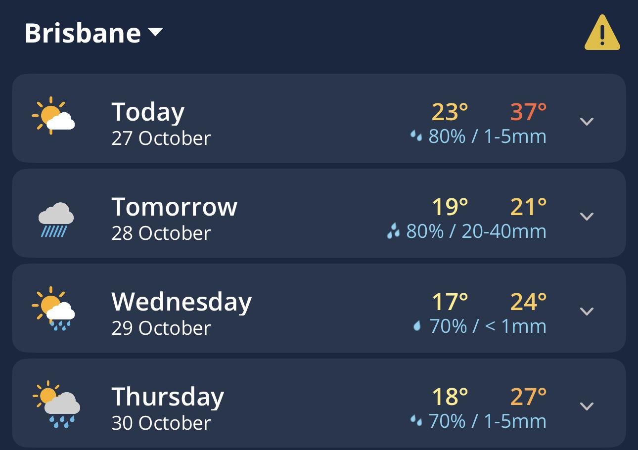
Image: Hot, cold, then close to average for Brisbane over the next four days, as seen in the Daily Forecast on the Weatherzone app.
Brisbane will gradually warm up as the week progresses, with maximums hovering around the monthly average for a good stretch from Thursday onwards.