
Severe thunderstorms lash three states and two capitals
Parts of Qld, NSW and Vic are being hammered by severe thunderstorms on Sunday afternoon. Over 200,000 lightning strikes have been recorded over Qld alone. A further 150,000 lightning strikes have been recorded over NSW and Vic.
Melbourne has already faced off with a severe cell at about 4:30pm EDT. Warnings were issued for the city as well as for the bay.
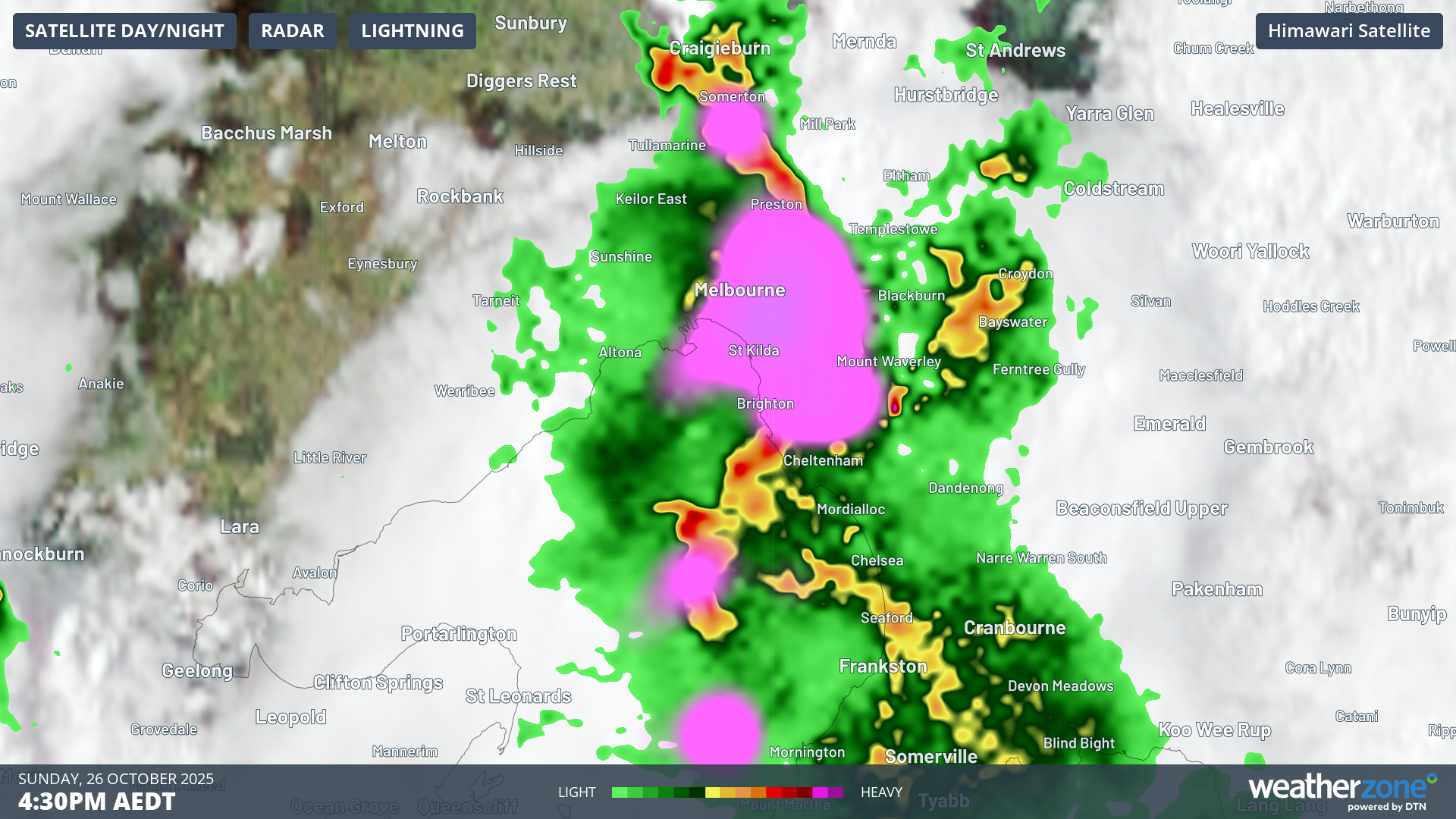
Image: Himawari-9 satellite imagery with Weatherzone lightning and BOM radar at 4:30pm EDT.
Brisbane is next up in the firing line with dangerous supercells forming along a trough line and heading in different directions with some heading for Brisbane, the Gold Coast and the Sunshine Coast.
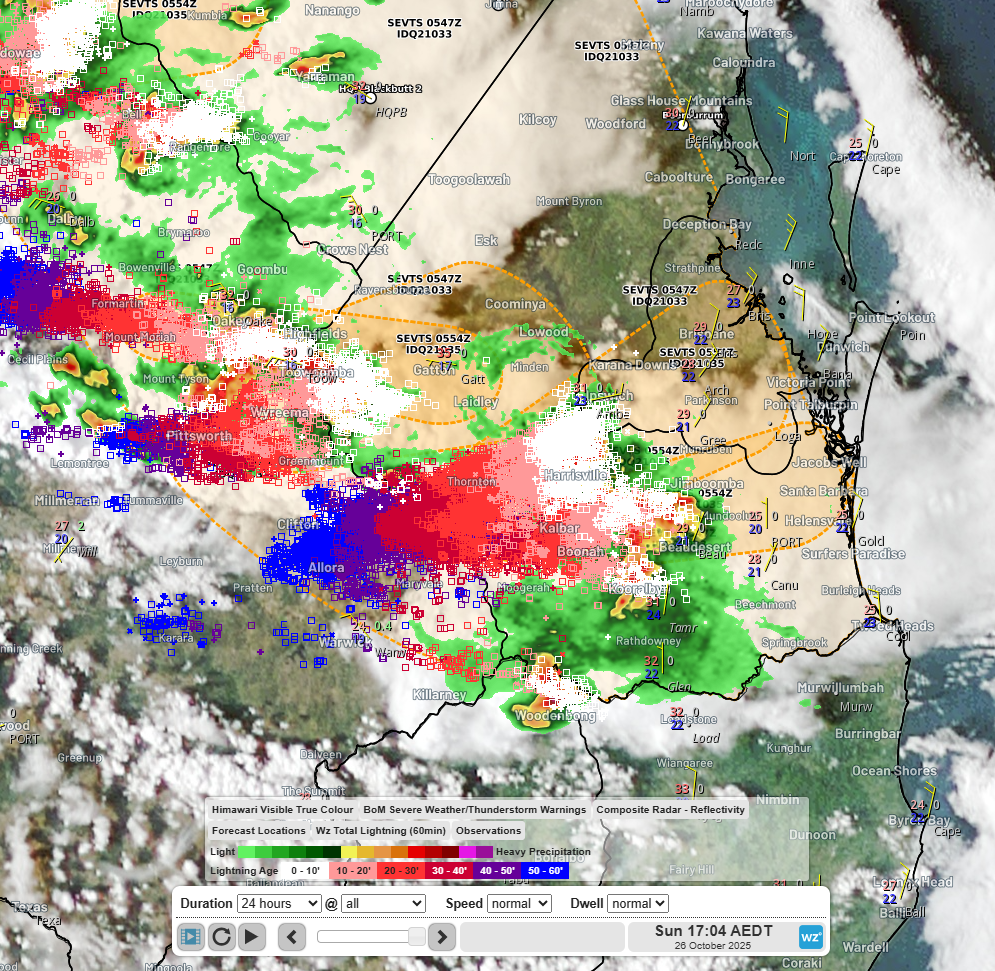
Image: Himawari-9 satellite imagery with Weatherzone lightning strikes and BOM radar at 5:04pm EDT. Supercell thunderstorms can be seen heading for Brisbane.
Please stay up to date with the latest warnings at: weather warnings