
Series of cold fronts to bring four days of severe weather
A cold, wet and windy week lies ahead for much of southern Australia, with two bursts of snow heading towards the mainland alpine region.
This promises to be a classic week of wild, wintry weather, with high pressure systems situated far enough north over the interior of the continent to allow powerful surges of polar air to penetrate northwards.
Monday: the first front lashes WA
The first front has already swept through southwest WA, with wind gusts approaching 120 km/h recorded at exposed coastal weather stations.
The Perth CBD received 13.8mm of rain in the 24 hours to 9am Monday (AWST), with 39.2mm at Bickley, an elevated suburb on the city’s eastern fringe. The highest total in the South West Land Division was 51mm at Mt William, about 90 minutes south of Perth.
Tuesday: the WA front marches east
As the cold front currently crossing Western Australia streams across the country, it will tend to slide towards the southeast.
However it will stay far enough north to deliver rainfall and very strong winds on Tuesday to southern parts of SA and NSW, as well as most of Victoria and Tasmania.
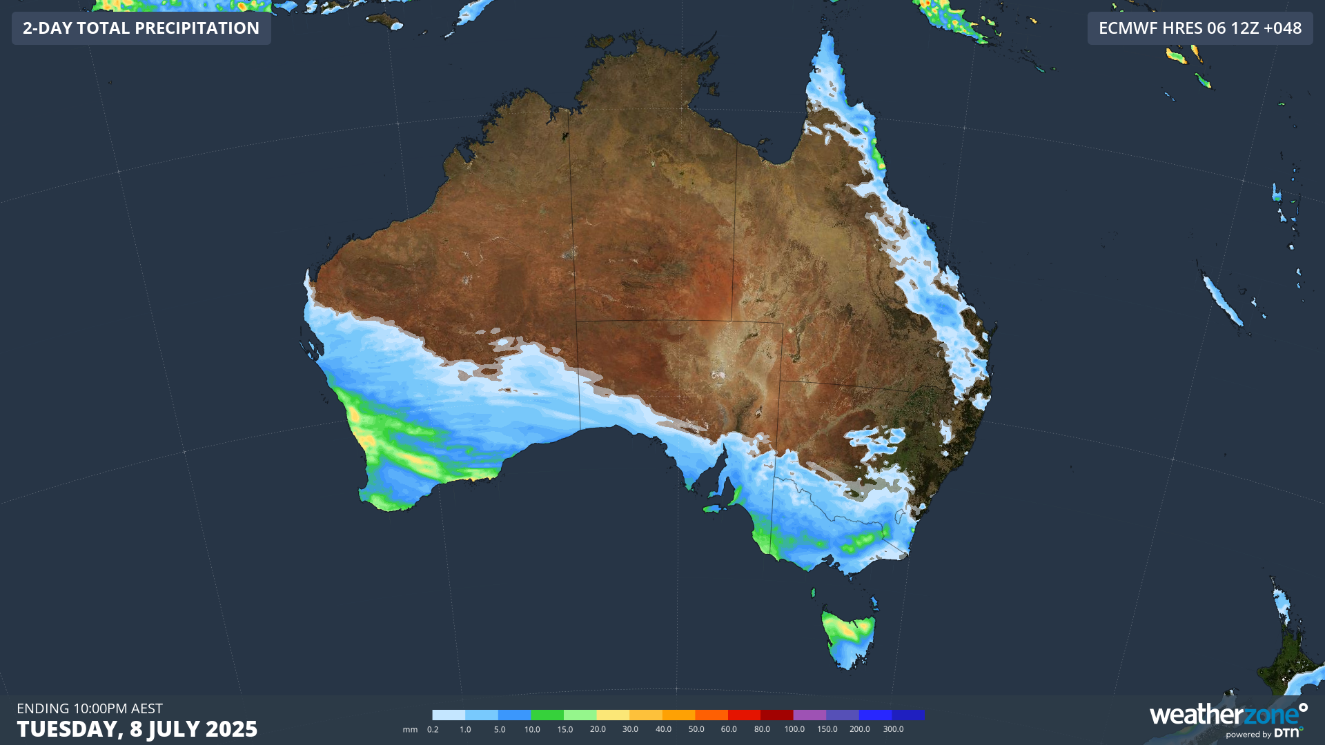
Image: Predicted rainfall across southern Australia from Monday morning through to 10pm Tuesday according to the ECMWF model.
Showers should fall as snow in the alpine area down to an elevation of about 1200m from late Tuesday into Wednesday morning, with possible snowfall totals in the range of 10cm to 30cm.
Wednesday: a stronger cold front approaches
On Wednesday, a stronger front approaches. This one will bypass southwestern WA, but the southeast of the country will cop a direct hit of very cold, windy weather.
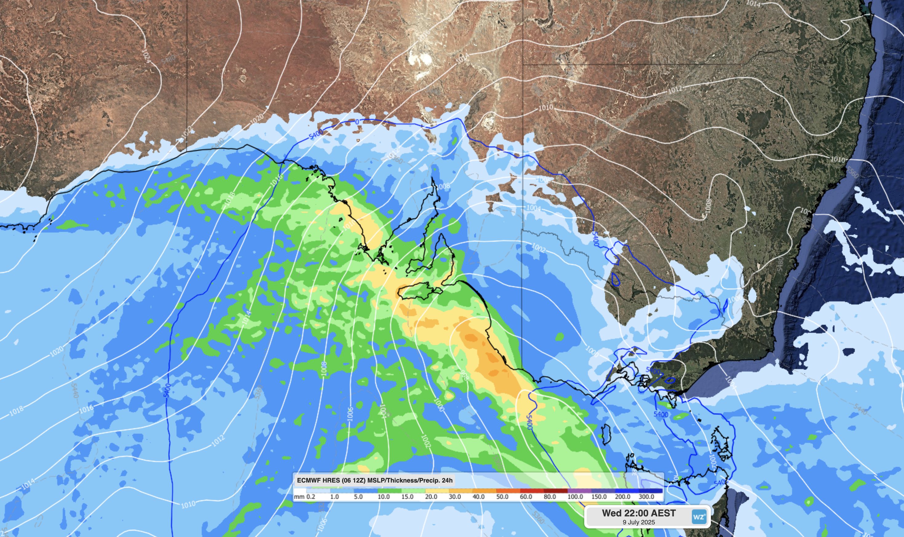
Image: Chart showing a surge of air from the south with moisture affecting the South Australian coastline and adjacent areas associated with a stronger cold front on Wednesday evening.
Adelaide will be the first city to feel the chill of this strong system, with maximums of just 13°C and 14°C respectively on Wednesday and Thursday.
The airmass will likely be cold enough for snow in SA’s Flinders Ranges later on Wednesday, should sufficient moisture make it that far north. A snowflake or two could even fall on the 710m summit of Mount Lofty, just 25 minutes’ drive from the Adelaide CBD.
Thursday: significant snowfalls in the alpine region
Thursday morning is when the week’s heaviest snowfalls are due in the alpine resorts of NSW and Victoria. Very welcome snowfall totals of 20cm to 40cm are likely up high, with snow falling to elevations as low as 800m. Snow showers can also be expected in elevated areas beyond the mountains like the NSW Central Tablelands.
As showers and frigid westerlies lash Melbourne on Thursday, the Victorian capital is set for one of its coldest days of 2025 to date, with a maximum of just 11°C on the cards. Canberrans will also shiver with a maximum of 9°C expected.
Looking further ahead, conditions will start to moderate on Friday and Saturday in most of the areas mentioned. However, there’s the potential for yet another outbreak of polar air with more wind, rain and snow at higher elevations across southeastern Australia to start off next week.
For now, expect two distinct bouts of cold and potentially severe weather across most parts of southern Australia this week. Only areas east of the Great Dividing Range will be spared from the bleakest weather. For example, Sydney should be cool but mostly dry all week.
Please check the Weatherzone warnings page for the latest warnings.