
Damaging winds battering WA
A cold front will continue to cause damaging winds over the southwest of WA today, following a separate system that brought wind gusts of close to 120 km/h on Sunday.
The satellite image below shows two bands of cloud over southwestern Australia. The northern-most band of cloud is the remnants of a cold front that crossed the region on Sunday. The other band of cloud is a second cold front, which will spread over WA’s southwestern districts on Monday.
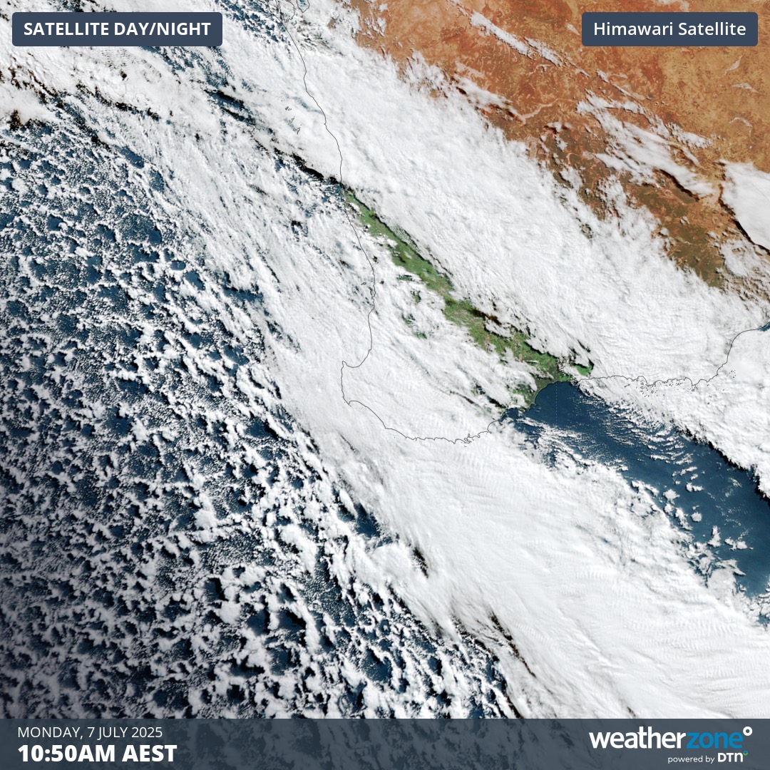
Image: Satellite image showing clouds over southwestern Australia shortly after sunrise on Monday, July 7, 2025.
The first in this pair of powerful cold fronts caused damaging winds on Sunday, including gusts of 119 km/h at Cape Leeuwin and 100 km/h at Cape Naturaliste.
While conditions eased on Sunday night in the wake of the first front, the arrival of the second front caused wind to pick up again on Monday morning. In the hours prior to 9am AWST on Monday, gusts had already reached 93 km/h at Rottnest Island, 91km/h at Busselton and 100 km/h at Cape Leeuwin.
The front crossing southwestern Australia on Monday will be stronger than the system that arrived on Sunday and likely the strongest front so far this year for the region. It should also bring some of the coldest weather so far this year.
The temperature in Albany was only 10.2°C at 9:40am and could struggle to reach its forecast top of 14°C on Monday, which would make this their coldest day of 2025 to date. Perth is forecast to reach a top of 16°C on Tuesday, which will be the city's coldest day so far this year if it stays below 16.1°C.
These systems will also bring showers to a broad area of southern and western WA on Monday, possibly reaching north to the Gascoyne and east to the SA border. This follows 30 to 50 mm of rain along the Darling Range during the 24 hours to 9am on Monday, including 51 mm at Mt William, 44 mm at Dwellingup (its heaviest rain in one year) and 39 mm at Bickley. The map below shows how much rain is expected to fall on Monday.
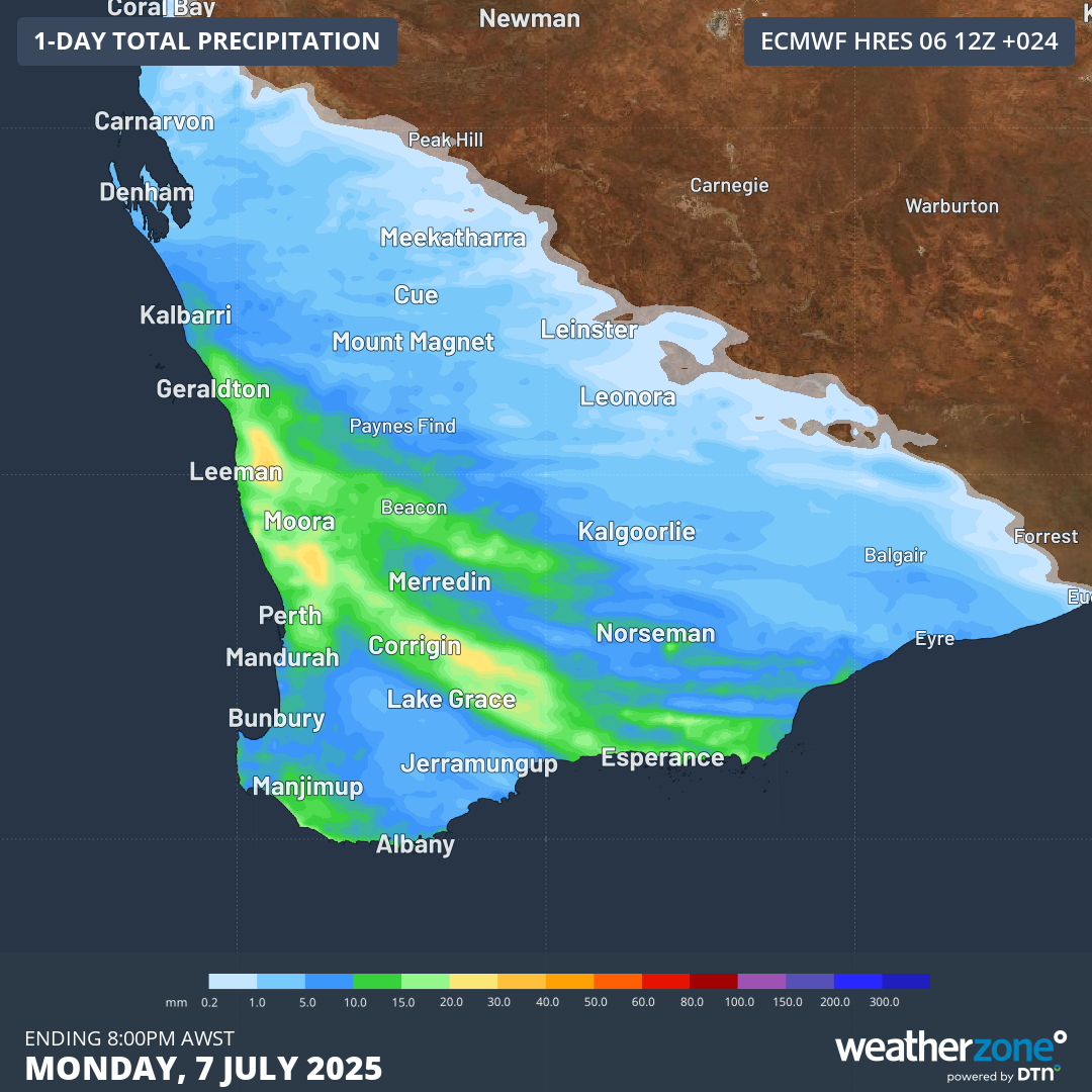
Image: Forecast accumulated rain on Monday, according to the ECMWF-HRES model.
Wind and rain will ease over WA later on Monday and into Tuesday morning as the cold front moves further east.
Anyone in southwestern Australia on Monday or Tuesday morning should keep a close eye on the latest severe weather warnings.