
Satellite images show Super Typhoon Ragasa’s ferocious eye hitting Philippines
Japan’s Himawari-9 satellite has captured striking images of Super Typhoon Ragasa – known locally as Nando in the Philippines – bearing down on the Babuyan Islands on Monday.
Typhoon Ragasa underwent rapid intensification late last week and became the first super typhoon so far this season in the Northwest Pacific region.
As Super Typhoon Ragasa approached Babuyan Island on Monday, it was a colossal system with an eye measuring 40 nautical miles (74 km) in diameter and peak wind gusts of around 175 knots (324 km/h) near its core. For comparison, Tropical Cyclone Yasi’s peak wind gusts were around 285 km/h.
The Himawari-9 satellite was in an ideal position to watch Super Typhoon Ragasa barrelling towards the Philippines on Monday. The images captured by the satellite revealed the immense power of this huge typhoon.
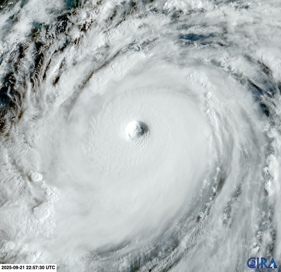
Image: Visible satellite image of Super Typhoon Ragasa on Monday, September 22, 2025. Source: RAMMB/CIRA
One of the standout features in the satellite images of Ragasa is the presence of mesovortices, which are small-scale circulations of air near the typhoon’s eyewall. Mesovortices can only be seen in satellite images when the eye is clear of high cloud, which is a sign of a mature and powerful typhoon.
Mesovortices in the eye of a typhoon can be extremely dangerous as they are capable of producing very destructive winds. The strongest wind gust ever reliably measured on Earth was 220 knots (407 km/h) in the eyewall of Tropical Cyclone Olivia in 1996 over Australia’s Barrow Island. This gust is believed to have been associated with a mesovortex.
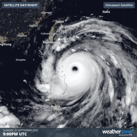
Image: Super Typhoon Ragasa approaching the Philippines on Monday.
Ragasa is expected to move towards the west over the next few days, taking a path that will impact parts of the Philippines, China and Vietnam.