
Satellite images capture East Coast Low spinning near NSW
Satellites have captured spectacular images of a powerful East Coast Low that has been causing severe weather in NSW this week.
East Coast Lows are one of the most dangerous types of weather systems in Australia. Their impacts can be similar to a tropical cyclone and they often affect highly populated areas of Australia's eastern seaboard.
This week’s system formed when an upper-level trough passing over NSW caused a surface-based low pressure system to deepen rapidly near the NSW coast.
The video below shows enhanced water vapour satellite imagery between Sunday afternoon and Wednesday morning. This satellite layer is useful for identifying moisture in the upper atmosphere. In this video, you can see moisture-laden air from the tropics being wrapped into the developing low near eastern NSW.
Video: Enhanced water vapour satellite images showing an East Coast Low forming near the NSW coast this week.
The intense low pressure system sat very close to the NSW coast throughout Tuesday and into Wednesday, causing a sustained period of heavy rain, flooding, damaging to destructive winds and damaging surf over a broad area of eastern NSW.
The severe weather from this system caused power outages and evacuations as wind gusts reached 130 km/h along the coast and rain rates exceeded 120 mm in 6 hours and 220 mm in 24 hours.
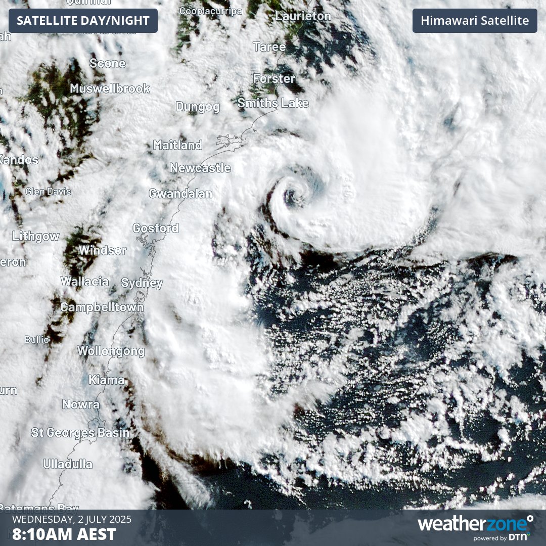
Image: Visible satellite image showing the low sitting off the Central Coast on Wednesday morning.
Fortunately, the low pressure system that caused the severe weather on Tuesday and Wednesday will move towards the east into Wednesday night, taking it away from the coast. However, a second low pressure system associated with the same broad low pressure complex will deliver another burst of wind and rain to eastern NSW on Wednesday night into Thursday morning.
The weather will improve by Friday as the lows move further away from the coast and a high pressure ridge builds over eastern NSW.
Be sure to monitor the latest severe weather warnings in your area and contact the SES on 132 500 if you need emergency assistance from this weather event.