
Rare prospect of snowfalls in seven Australian states this week
Bursts of wintry weather are chilling large parts of Australia this week, with snowfalls already recorded in four states and one territory, and two more states in line for a potential dusting.
With only the Northern Territory having no chance of snowfalls, here's the current situation for potential snowfalls – or snow that has already been recorded – in the other six states as well as the ACT:
WA snowfalls on Monday
Intrepid hikers captured snow falling on Bluff Knoll, the highest peak of Western Australia's Stirling Range, as a strong cold front swept across southwestern WA on Monday morning.
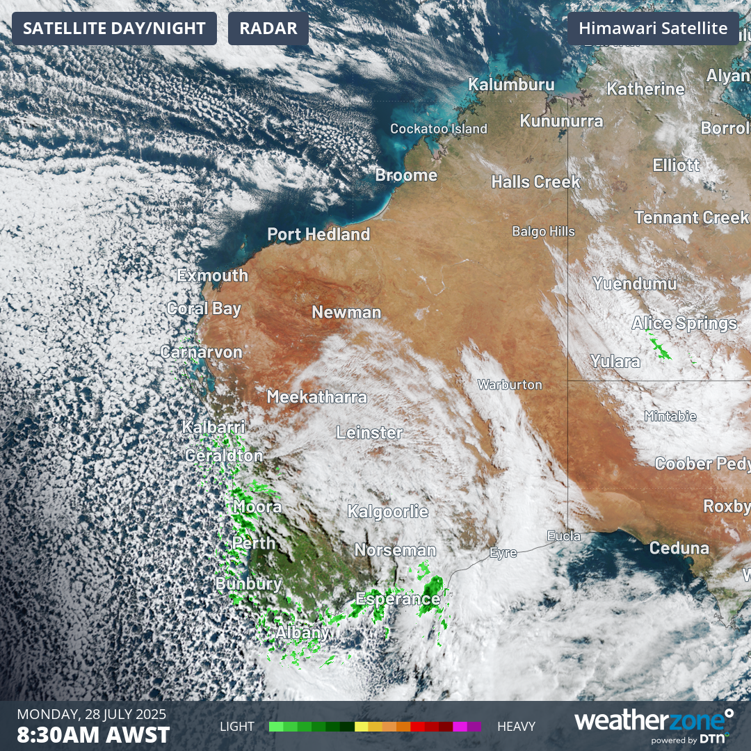
Image: The Stirling Range is situated about an hour north of Albany, shown at the bottom of this map from Monday morning, which also shows the speckled cloud pattern typically associated with polar airmasses.
It was reportedly the third snowfall in the area within a week, after light dustings last Monday and Thursday.
For perspective, Bluff Knoll's elevation (1099m) and latitude (34.37° S) are both about the same as the NSW town of Oberon, just west of the Blue Mountains, where snowfalls tend to occur each winter. Snow on Bluff Knoll can also be expected at least once each winter.
Bluff Knoll gets first snow fall of the season with ‘light dusting’ in the Great Southern https://t.co/912nhLhLle
— Great Southern Herald (@GS_Herald) July 21, 2025
Possible SA snow late in the working week
Light snow showers are possible on Thursday and Friday above 1100m in South Australia’s Flinders forecast district, as small amounts of moisture reach the SA coast and nearby inland areas in cold air circulating around a high pressure system.
This will not be one of those SA snow events where you can drive to the summit of an easily accessible location like Mt Lofty (elevation 710m) on Adelaide’s outskirts. Nor will snow fall on the valley floor of Wilpena Pound in the Flinders Ranges, as it did in August 2020.
But anyone brave enough to tackle the day-long return hike from Wilpena Pound to St Mary Peak (the highest point of the Flinders Ranges at 1171m) might just see a snowflake or two.
Alpine snow in NSW, Vic, Tas, ACT
After a weekend of heavy snowfalls at the higher elevations of the ski resorts with rain lower down, a colder airmass has settled over the southeast of the country this Wednesday. Most of the moisture is now further north, however light snow showers are still occurring above about 1000m.
It’s a #winter wonderland at #Hotham this week. All lifts spinning on a 1.2m snow base! ❄️???? pic.twitter.com/YXG53hvOir
— Hotham (@_hotham) July 30, 2025
Snow in central and northern NSW beyond the alpine region
There are already reports of light snow flurries on higher parts of the NSW Central Tablelands this Wednesday, due to a pool of upper-level cold air associated with a low pressure system centred over the state’s northern interior.
Further snow showers are possible above 1200m on the Central Tablelands today and Thursday, with the snow level dropping to 1100m on Friday. The NSW Northern Tablelands could also see snow above 1200m by Friday and into the weekend.
Possible Queensland snow
Yes, Queensland does occasionally see snow on the Granite Belt, an area of the Great Dividing Range near the NSW border on the southern Darling Downs that rises above 1200m on the highest peaks.
The town of Stanthorpe is located in the heart of that region, about half an hour north of the NSW border at an elevation of just over 800m. Stanthorpe records light snowfalls every few years, with the most recent significant snow event in 2015.
.@PureNewZealand Ideas on what we should do in the snow? ;) Stanthorpe @MissNicolaHolly #sqcountry #thisisqueensland pic.twitter.com/U8E5UKEucv
— Queensland Australia (@Queensland) July 16, 2015
The chances of snow in Stanthorpe or anywhere in Queensland this weekend depend on the availability of moisture pushing inland from an intense complex low pressure system which is forecast to develop off the northern NSW coast on Friday.
The two key ingredients for snowfalls appear to be aligning – a pool of cold upper-level air and moisture funnelled inland by the offshore low – but those elements still have to combine almost perfectly for significant snowfalls to occur.
Many snow-starved Queenslanders have already bet on the weather gods smiling upon them, with booking inquiries reportedly soaring for accommodation this weekend in the Stanthorpe area. We’ll keep you posted on this event as the week progresses.