
Rain in Perth on State of Origin Wednesday
There's a very high likelihood of rain, possibly heavy at times, with a 30% chance of a thunderstorm in Perth this Wednesday, where Game II of the State of Origin rugby league series between New South Wales and Queensland will kick off at Optus Stadium at 6:05pm (AWST).
The positive news for fans – and for players and TV viewers hoping for a dry pitch conducive to an open, free-flowing style of game – is that the rain could hold off during the game.
The rain in Perth will arrive later on Tuesday ahead of a cold front pushing into the southwest of WA, with a band of rain likely ahead of the front.
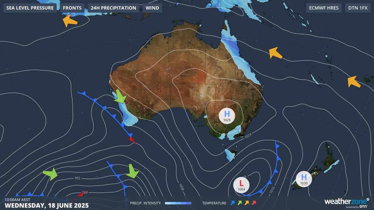
Image: Predicted synoptic chart for the Australian region on the morning of Wednesday, June 18.
After cold fronts have moved through, precipitation typically tends to be on-and-off rather than constant. So if there is rain during the game, it will likely be in showery bursts rather than a persistent downpour from the kick-off through to the end of the contest at around 8pm local time.
Meanwhile the NRL match between the high-flying Canterbury Bulldogs and South Sydney Rabbitohs on Sunday at Sydney’s Accor Stadium was suspended due to lightning towards the end of the first half – the first time an NRL match had been stopped mid-game due to extreme weather in a decade.
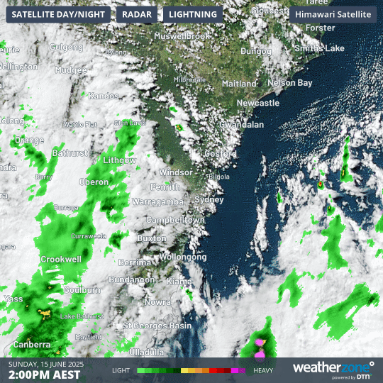
Image: Four-hour combined radar and satellite loop showing the line of storms that crossed the Sydney region on the afternoon of Sunday, June 15 2025.
On Sunday morning, storms in the Sydney area had been rated only a 20% chance. Some elements were in place for a stormy outbreak – including a pool of cold air in the upper atmosphere and an upper-level trough. Whether it would be humid enough was the main issue.
As things turned out, sufficient humidity occurred as some surface moisture was present. The combination of a warmer-than-expected day and a lack of strong winds helped fuel evaporation across a sodden landscape which had been soaked by consistent rains recently.
The storms passed quickly but spectacularly, with an unseasonable lightning show and rainfall totals up to 10mm across the Sydney basin in a short period of time.
As for Perth, the city’s wet spell should continue beyond Wednesday, with rain expected on each day from Tuesday through to Sunday as another cold front moves through southwest WA later this week.
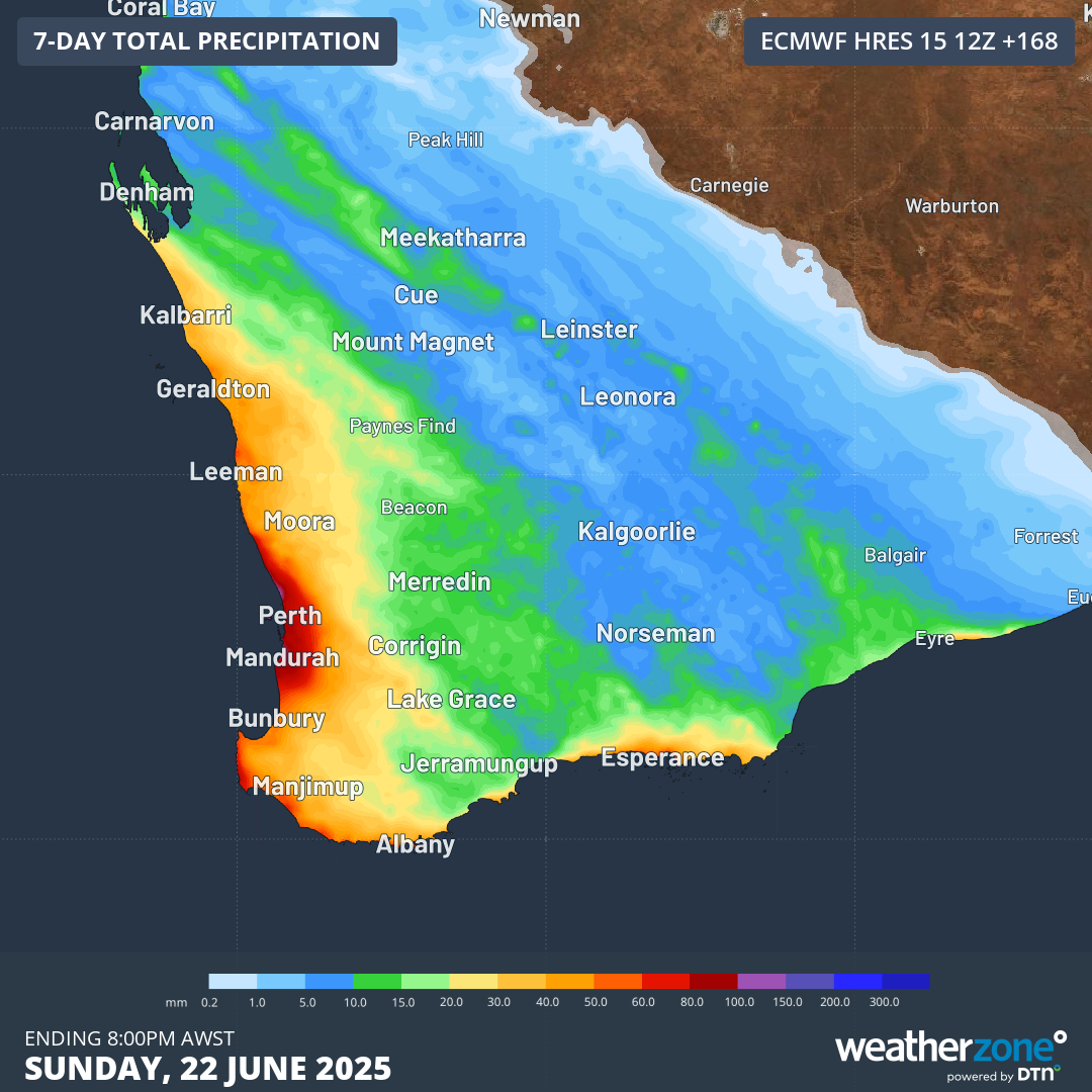
Image: Predicted rainfall accumulation in southwest WA to Sunday, June 22, according to the ECMWF model. Perth is in line for a solid soaking.
After a very wet start to June which included Perth's wettest day in 11 months, the last 10 days of June have seen only a drop or two. The return to wet conditions this week will be welcomed by most residents after a dry start to 2025 by local standards.