
Perth's wettest day in 11 months, more rain on the way
Perth just registered its wettest day since July last year and more rain is on the way for Australia's west coast in the coming days.
The first five months of 2025 were unusually dry in Perth. The city only received 96 mm of its 170 mm average for the period from the start of January to the end of May.
This lack of early-year rainfall was partially caused by a predominantly positive Southern Annular Mode (SAM) between March and May. When the SAM is in a positive phase at this time of year, it can prevent rain-bearing cold fronts from reaching southwestern Australia.
What is the Southern Annular Mode (SAM)?
The Southern Annular Mode (SAM) is an index used to monitor the position of the westerly winds that flow from west to east between Australia and Antarctica. When the SAM is in a negative phase, these westerly winds, and the cold fronts and low pressure systems they carry, are located further north than usual for that time of year. When the SAM is positive, the westerly winds, cold fronts and low pressure systems are located further south than usual.
The start of June has seen a transition towards a more negative SAM, which has ushered in a more winter-like processions of cold air and rain over the southwest of Australia.
Perth picked up 47.6 mm of rain during the 48 hours ending at 9am AWST on Wednesday, with 33.2 mm falling in the final 24 hours of this period. This was the city’s wettest day in 11 months. Bickley’s 41 mm in the 24 hours to 9am on Wednesday was also its heaviest daily rain in nine months.
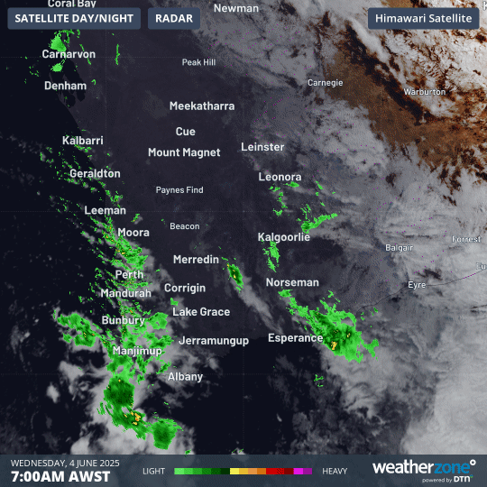
Image: Cloud and showers streaming over the southwest of WA on Wednesday morning.
Rain, thunderstorms and blustery winds will continue over a broad area of WA on Wednesday as a low pressure system and associated low pressure troughs affect the state. This wet and windy weather will ease on Thursday and Friday as a high pressure ridge builds over WA.
This week’s burst of rain and wind is a reminder that winter has arrived, and Perth can expect to see more systems like this in the coming weeks and months. Forecast models already suggest that another front could hit the southwest of WA early next week.