
Queensland weather becoming severe
Warm and unstable conditions are expected this weekend across Queensland, as troughs develop and linger over the state. Maximum temperatures should peak in the high 30's in the northwest parts of the state this Saturday 11th, with a Low Intensity to Severe Heatwave conditions over northern areas and the southeast. Heatwave conditions are expected to the west of the seabreeze-affected Brisbane; however, temperatures will still trend up by 3-5 degrees above average in the city.
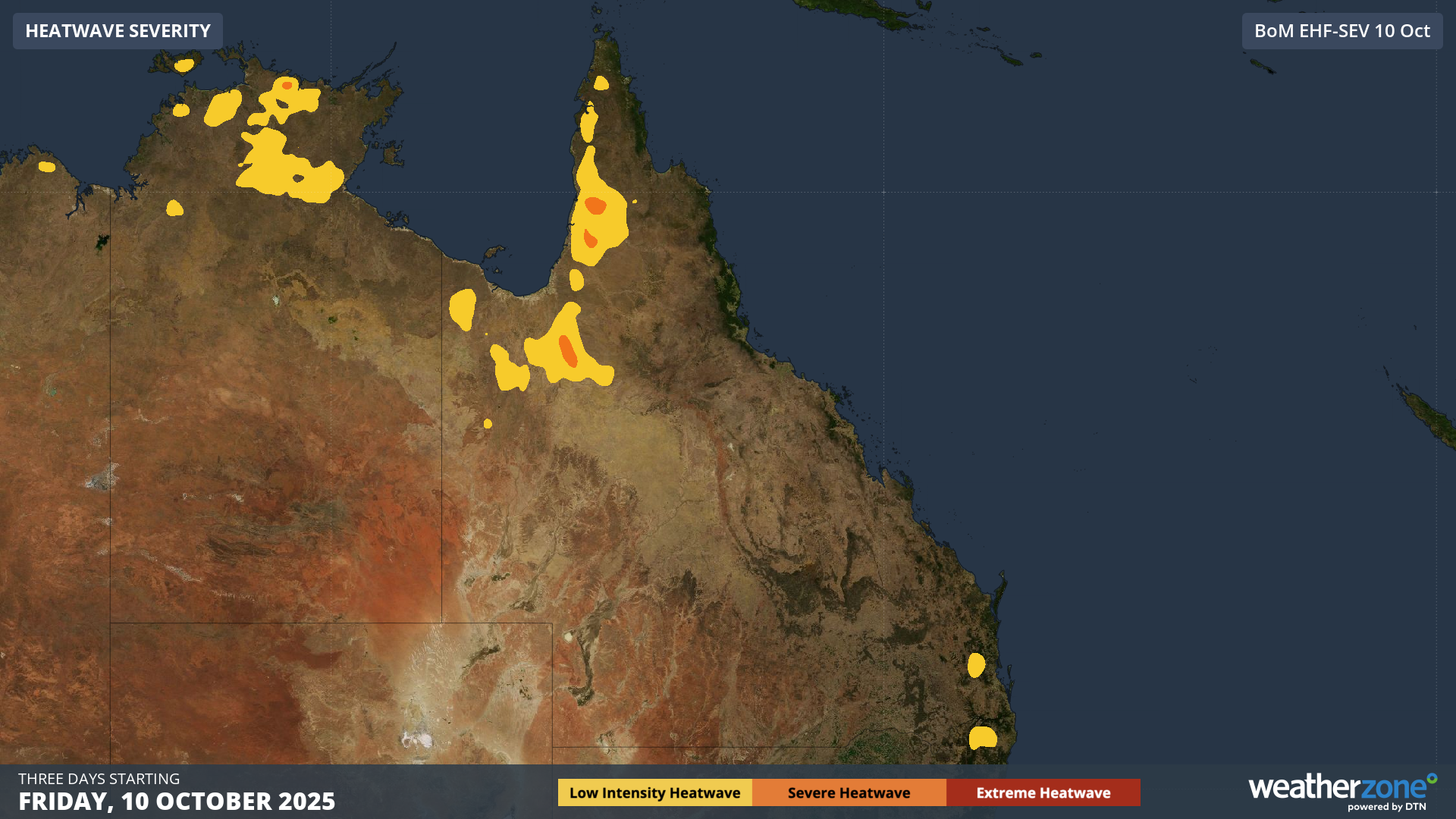 Image: Heatwave Severity for Friday 10 to Sunday 12 October 2025. Source BOM.
A ridge of high pressure along the east coast is also feeding moisture laden easterlies into these troughs. The combination of heat, moisture, and instability can cause isolated to scattered thunderstorms to develop over the northeast, central, and southeast parts of the state from this weekend onward. Some thunderstorms may be severe, with lightning, large hail, and wind gusts.
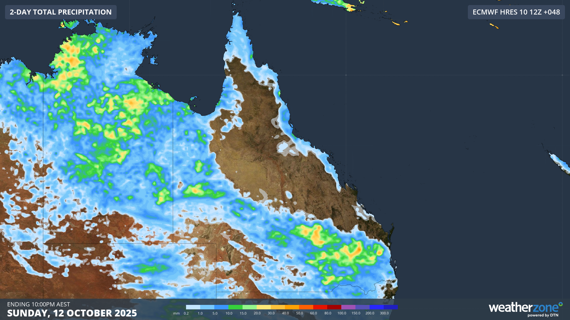 Image: 2-Day Total Precipitation forecast for Sunday, 12 October 2025. Source: Weatherzone.
This system indicates the change in seasons compared to the past month, with a broad corridor of lacklustre rainfall stretching from the southeast to the northwest, as Ben Domensino wrote here. Looking ahead, showers and thunderstorms should keep affecting the state over the next week.
To follow the warnings and forecasts of your region, check here.