
Prepare to rug up in the southwest corner
Residents of southwest WA will be ready with the blankets and heaters next week, as a series of cold fronts and a deep westerly airflow look to pepper the region during the week.
While today is a picture-perfect day in our southwest corner, with high pressure ushering in blue skies, the clouds are lurking just offshore, a reminder that the winter fronts are rarely far away in July.
Front number one will likely only clip the far south coast early Monday morning, delivering some showers between Bunbury and Albany. This front will then slide across into the Bight giving way to a more settled evening.
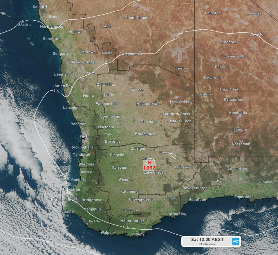
Figure: Himawari satellite image and MSLP of southwest WA at 11:00am AWST Sat 15th
Front number two should be a biggie. This one will slam into the WA coast on Tuesday afternoon, bringing gusty winds and heavy showers, with the effects likely to be felt all the way up the west coast by Wednesday afternoon.
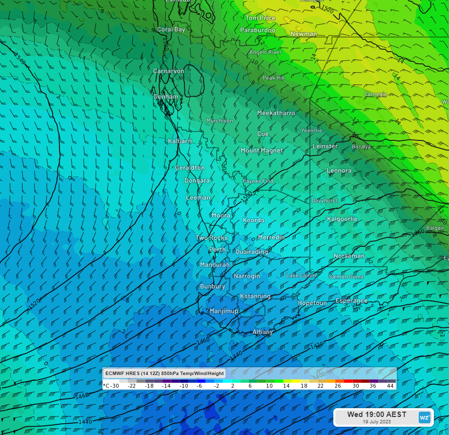
Figure: Forecast 850hPa temperatures at 5pm AWST Wed 19th from ECMWF
Behind will be a chilly airmass, illustrated quite nicely in the figure above. Daytime temperatures across the southwest on Wednesday are unlikely to escape the low teens, possibly even staying in single digits for some areas. This is the front that will then charge into the east coast late in the week and has already been hinted at here and here.
In its wake high pressure will settle over the central west coast. Anywhere south of this high pressure, possibly including Perth, will be exposed to gusty westerly winds and intermittent showers with another weak front (front number three) clipping the far south to round out the week.
Thankfully the temperatures should become a little more bearable as we move towards the back end of July.