
Good snow depth, not such great conditions
It has been a mostly dry and mild week in the mountains, with warmish days by July standards and frosty nights. That means only one thing: icy slopes.
Snow starts its life in various states of fluffiness (skiers talk about wet, almost cement-like snow, or dry, powdery snow depending on a combination of temps and humidity.
After the weather clears, the surface of the snowpack then changes quite drastically from day to day and even hour to hour. And when the classic freeze/thaw cycle sets in as it has this week, the surface turns decidedly hard – especially on high traffic ski slopes.
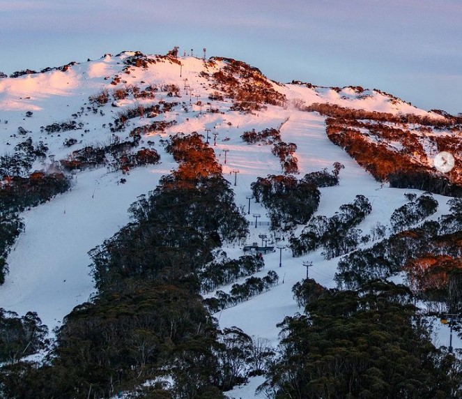
Image: Fantastic coverage for July at Thredbo with plenty of soft spots to be found, even if parts of the mountain are a little crunchy. Source: Thredbo Instagram.
Indeed, one Snowy Mountains local described the surface this week as "polished concrete".
The good news is that there is still soft snow here and there, and the really good news is that the snow depth on higher slopes is very respectable for mid-July.
- Snowy Hydro took its latest readings this Thursday, July 13, and the depth was 131 cm at Spencers Creek (situated roughly halfway between the NSW resorts of Perisher and Thredbo at an elevation of approx. 1800 metres).
- That made it the deepest snowpack for this point in the season since 2014, when a depth of 154.9 cm was measured on July 15.
The healthy base at higher elevations of both NSW and Vic means that most or even all lifts are running at the larger or higher resorts – Perisher, Thredbo and Charlotte Pass in NSW, as well as Mt Buller, Hotham and Falls Creek in Victoria.
But the lower resorts – Mt Baw Baw in Victoria and Selwyn Snow Resort in NSW – are struggling a little with a few lifts open but plenty closed too.
Click on the links for Thredbo, Perisher, Charlotte Pass, Selwyn (NSW) and Mt Buller, Hotham, Falls Creek and Mt Baw Baw (Vic) for the latest.
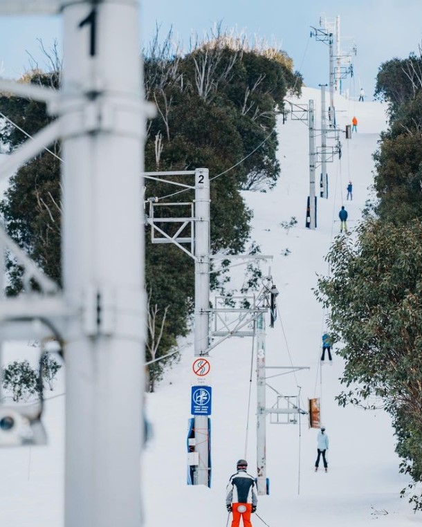
The International Poma at Falls Creek is an old school lift, but a definite fan favourite. When it opens, as it did this week, you know the overall snow cover is in good shape. Source: Falls Creek Instagram.
How's the outlook for fresh snow?
Not great in the short term, although something decent appears to be brewing towards the end of next week.
- For most of this week, we've been stuck in a pattern with high pressure dominating and the cold fronts passing by in the Southern Ocean without bringing cold or moisture to the southern mainland.
- That band of Southern Ocean storms has, however, been close enough to Australia's southern coastline to keep the westerly winds blowing strongly in the mountains. Those winds are particularly strong this Friday, with gusts topping 80 km/h in the mountains of NSW and Victoria, and some chairlifts on wind-hold.
- Expect more of the same for the next five or six days with just the hint of a snow shower or two on Saturday night as a front clips the mainland alpine region.
- Then as mentioned, later next week a stronger cold front looms with the potential for much-needed slope-softening snowfalls.
We'll keep you updated as that system draws nearer, and as ever, please check our snow page for the latest conditions, cams, forecasts and more.