
Parts of cloud-blanketed Queensland register coldest day in years
A beautiful display of altocumulus undulatus clouds were seen above the Brisbane area on Thursday, July 31st, marking the far southeastern edge of a jetstream cloud that produced the coldest day for a number of locations across eastern Queensland on Friday, August 1st.
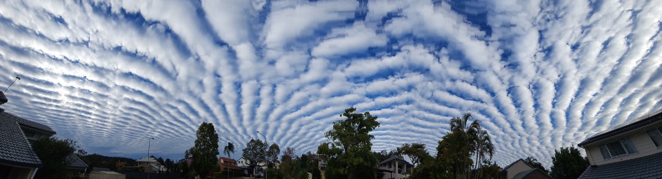 Panorama: Altocumulus undulatus clouds as seen from northern Brisbane just after 4pm on Thursday, July 31st. The ‘ripple’ shows the motion of atmospheric waves ahead of the jetstream (Photo taken by Craig Mitchell, Weatherzone Senior Meteorologist).
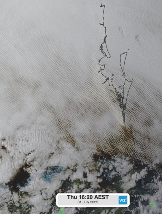
Image: Himawari satellite imagery of the Brisbane area at 4:20pm on Thursday, July 31st, 2025 showing the extent of the altocumulus undulatus clouds.
'Altocumulus undulatus clouds form when stable mid-level layers of the atmosphere are disturbed by wind shear or terrain, generating atmospheric gravity waves. These waves cause alternating areas of rising and sinking air—clouds form in the rising sections where air cools and condenses, while gaps appear in the sinking zones. The result is a rippled, banded cloud pattern that often aligns with the prevailing wind flow', Weatherzone Meteorologist Yoska Hernandez explains.
The persistent mid-level cloud building into Friday saw temperatures struggling to rise above 20ºC as far north as the state’s North Tropical Coast. Throughout much of the day, many coastal centres appeared gloomy, with the sun barely visible even in the western parts of the sky during the afternoon.
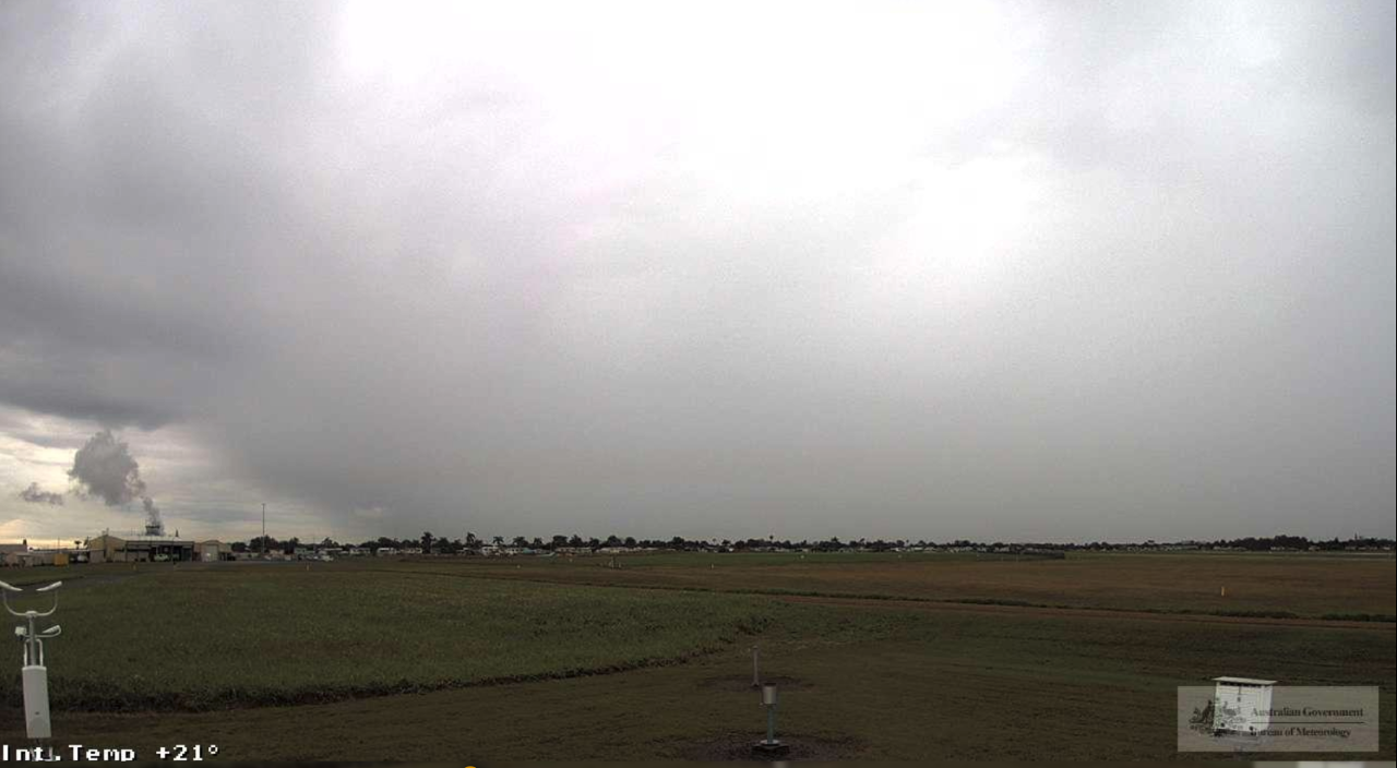 Image: Mackay Airport (northwest facing), just after 2pm AEST Friday 1st August (Bureau of Meteorology).
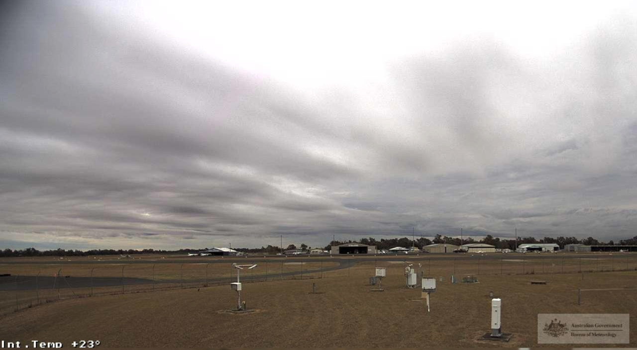 Image: Rockhampton Airport (northwest facing), just after 2pm AEST Friday 1st August (Bureau of Meteorology).
Some notable maximum temperatures on Friday, August 1st were some of the lowest for any month in years, and for August in decades.
- Mount Isa (19.9ºC), Gayndah (16.9ºC) and Charleville (15.4ºC) saw their lowest August maximums since 2016, with Gayndah’s recording also the lowest for any month since last July.
- Rockhampton (15.4ºC) and Maryborough (16.1ºC) saw their lowest August maximums since 2010, with both temperatures also the lowest for any month since July 2022.
- Hervey Bay (16.2ºC) saw its lowest August maximum since 2008, and the lowest for any month since July 2022.
- Bundaberg (14.4ºC) had its lowest August maximum since 2005, and Thargomindah (14.0ºC) the lowest since 2004, both the coldest for any month in around 3 years.
- Gladstone recorded 14.7ºC, the lowest August maximum since 1996 and lowest for any month since July 2022
- Proserpine (17.3ºC) and Mackay (16.2ºC) recorded their lowest August maximums since 1995, and lowest for any month since July 2022.
Being mid-level cloud, rainfall was not particularly significant across the Queensland coast, however neighbouring New South Wales has been drenched and will continue to receive rainfall into the new week, as we wrote on Thursday.
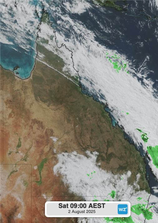
Image: Himawari satellite imagery showing the jetstream cloud clearing the Queensland coast on Saturday morning.
With the jetstream cloud largely clearing from the Queensland coast on Saturday morning, a cold, dry air mass in the system’s wake will bring chilly overnight minimums into Sunday over the southeast.