
Cold, wet weekend ahead for parts of eastern Australia
A wintry mix of rain, wind and large waves will affect parts of eastern Australia this weekend, with a chance of snow in elevated areas of northern NSW.
Satellite images captured over eastern Australia on Friday show a band of thick cloud passing over eastern Qld. This cloudband is associated with a channel of tropical moisture being carried southward by a fast-moving jet stream.
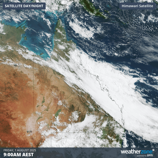
Image: Visible satellite images captured on Friday, August 1, 2025.
As we head into the weekend, this stream of tropical moisture will interact with a cut-off low passing over eastern Australia. The combination of the tropical moisture and cold upper-level air associated with the cut-off low will cause a dynamic low pressure system to form just off Australia's east coast on the weekend.
This system will cause a persistent stream of rain and blustery onshore winds over a broad area of eastern, central and northern NSW from Friday into this weekend. Some showers will also extend into southern Qld in the coming days.
The heaviest rain between Friday and Sunday is expected to occur over central and northern NSW, where accumulated totals of 30 to 60 mm are likely and more than 100 mm is possible in some areas.
Brisk east to southeasterly winds will also batter central and eastern NSW on Saturday before spreading up to northern NSW and southeast Qld on Sunday. Damaging wind gusts are likely to develop over parts of NSW this weekend and may extend into southeast Qld.
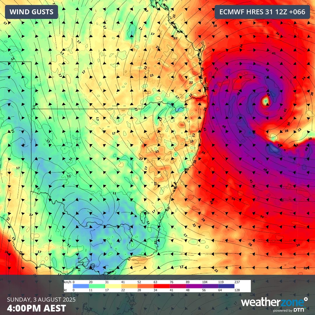
Image: Forecast wind gusts on Sunday afternoon.
In addition to the rain and wind, moisture being wrapped into the pool of cold upper-level air over eastern Australia this weekend could result in snow falling on elevated areas in northern NSW, most likely on Saturday. There is also an outside chance of a few snow flurries in southern Qld on Saturday, although the cold air might pass too far west of the state’s Darling Downs to facilitate snow north of the NSW border.
Coastal areas of NSW and southern Qld can also expect large waves to accompany the strengthening onshore winds over the weekend.
Be sure to check the latest forecasts and warnings in your area for the most up to date information on this developing system.