
New Zealand hammered by Extratropical Cyclone Vaianu
Cyclone Vaianu developed near Fiji last weekend and intensified into a category 3 tropical cyclone before transitioning into an extratropical cyclone on Thursday as it moved south of the Tropic of Capricorn.
Despite its transition to cooler waters, Vaianu's gradual weakening meant that New Zealand was going to be hit directly by a system equivalent to a category 1 cyclone. On Saturday 11th, impacts of Vaianu started to be observed over New Zealand's North Island, with up to 100mm of rainfall observed locally in elevated areas of Northland, Coromandel and Eastland (see Image below).
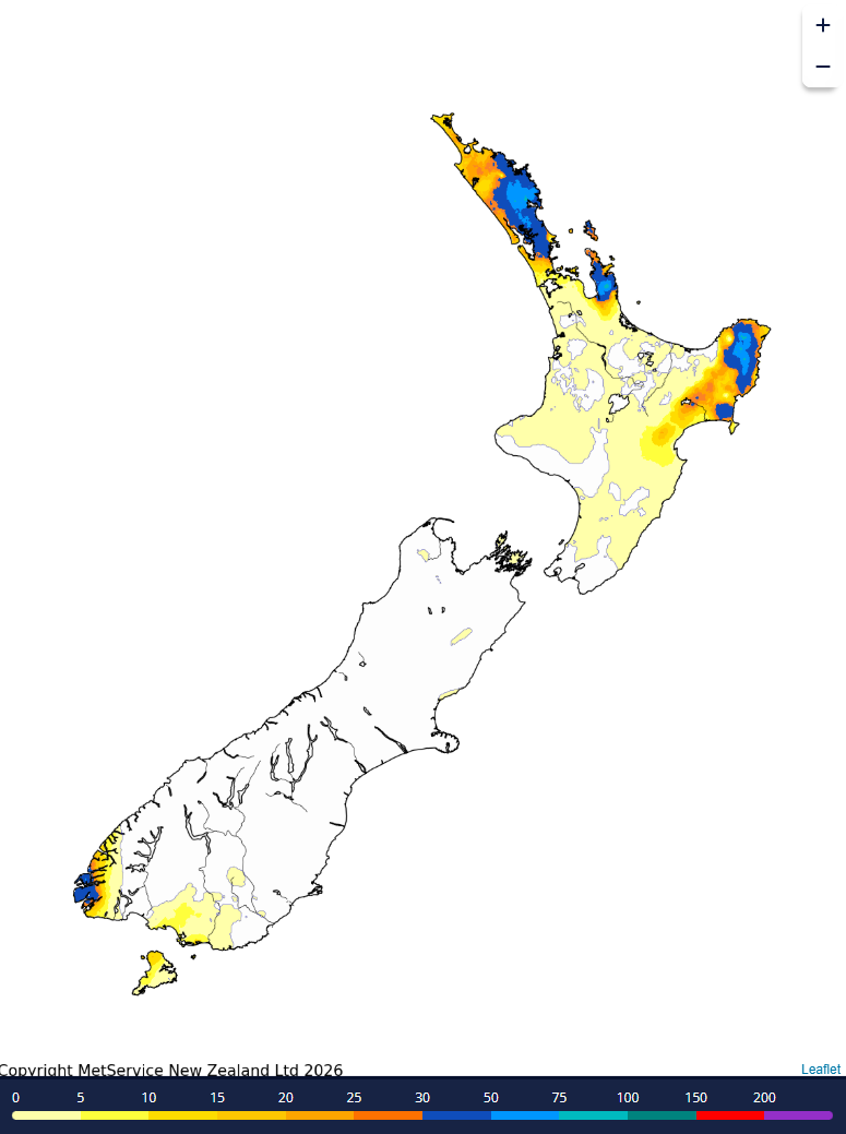
Image: Cumulative rainfall over New Zealand on April 11th 2026 (MetService)
Around 2pm Sunday local time (midday AEST), Vaianu made landfall over the Bay of Plenty bringing wind gusts above 80km/h for much of the north and east coasts of the North Island from early morning. Gusts up to 130km/h are expected in the late afternoon and evening as Vaianu continues to move over land.
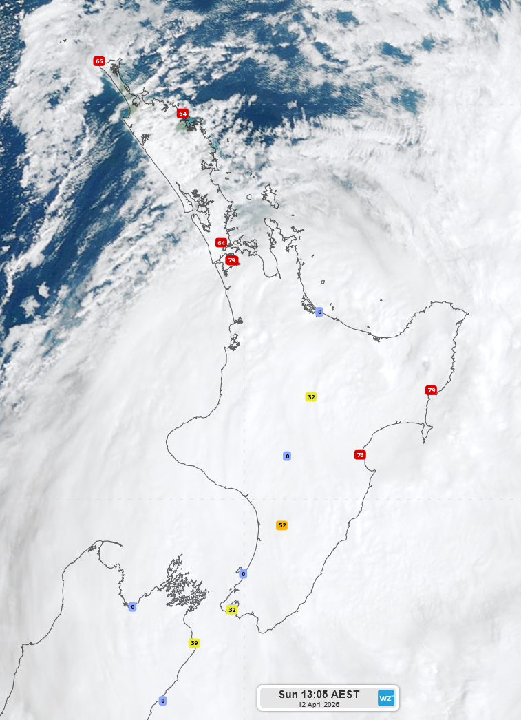
Image: Observed wind gusts over the North Island at 1:05pm AEST (locally 3:05pm)
Rainfall has intensified over the North Island and the northern South Island today (Sunday 12th), with rainfall forecasts indication more than 100mm of rain expected over most of the North Island in the next 24 hours, locally up to 250-300mm over Eastland. The New Zealand MetService warns of rainfall rates between 25-40mm/h for eastern areas of the North Island.
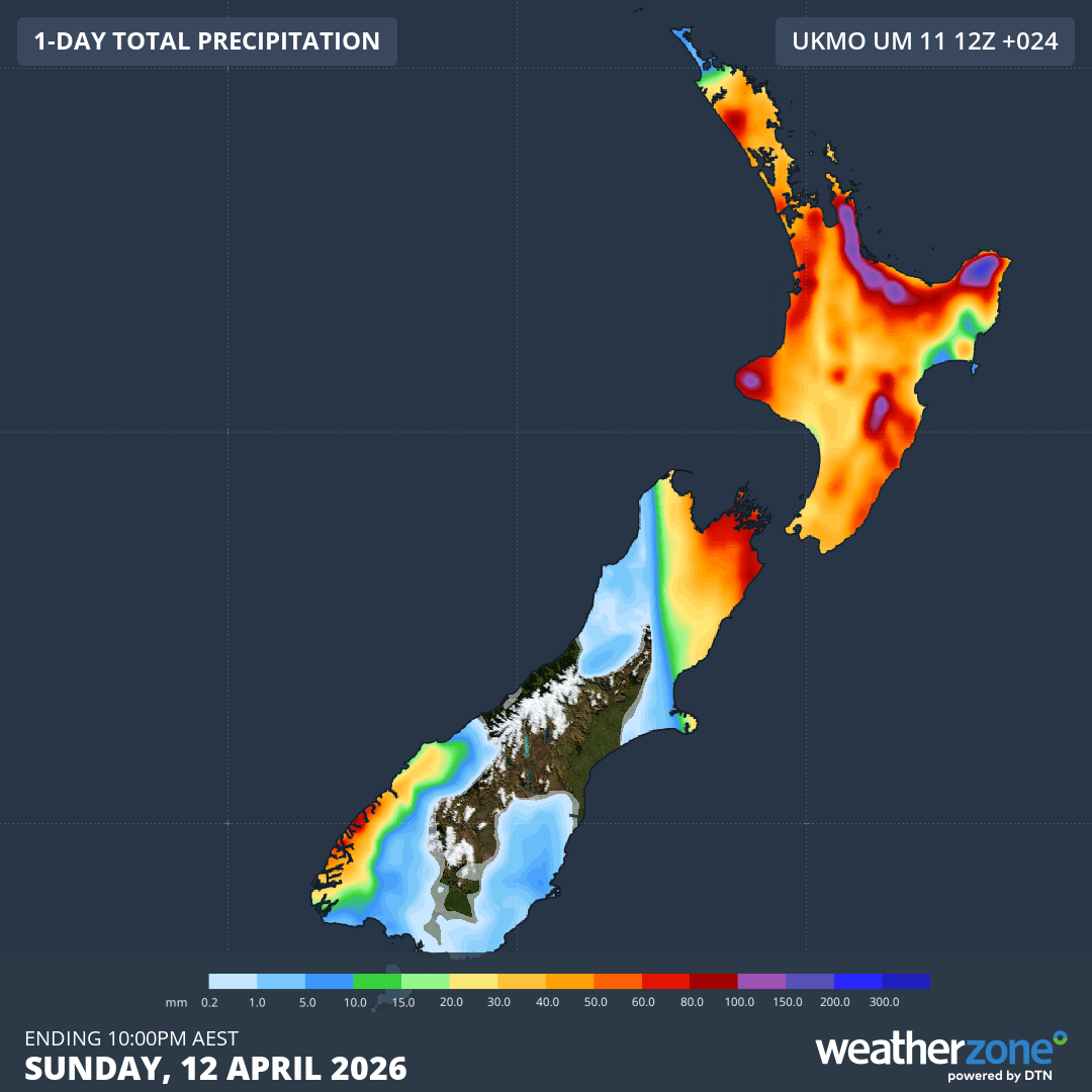
Image: Forecast accumulated rainfall over the next 24 hours over New Zealand as shown by the UKMO 12Z model
Warnings for strong winds, heavy rain and heavy swell are also declared all over the northern half of the country as can be observed at: https://www.metservice.com/warnings/home.
Vaianu is expected to continue south, crossing the North Island and returning into the southwest Pacific Ocean then further south into the Southern Ocean in the next 24 hours, reducing impacts over the country.