
New Zealand enduring a miserable snow season
While the Australian snow season is humming along nicely at our higher ski resorts, things are considerably worse across the Tasman Sea in New Zealand.
As we enter the second week of August, some of New Zealand’s most popular ski fields are struggling with a wafer-thin snowpack or even bare ground on many slopes – with only snowmaking keeping the season alive.
This was the scene earlier this week at Coronet Peak, the closest ski field to the hugely popular resort town of Queenstown. Coronet Peak’s slopes are tussocky, rather than rocky, which means most natural obstacles can be buried with a moderate snow cover. But the natural snow depth is close to zero.
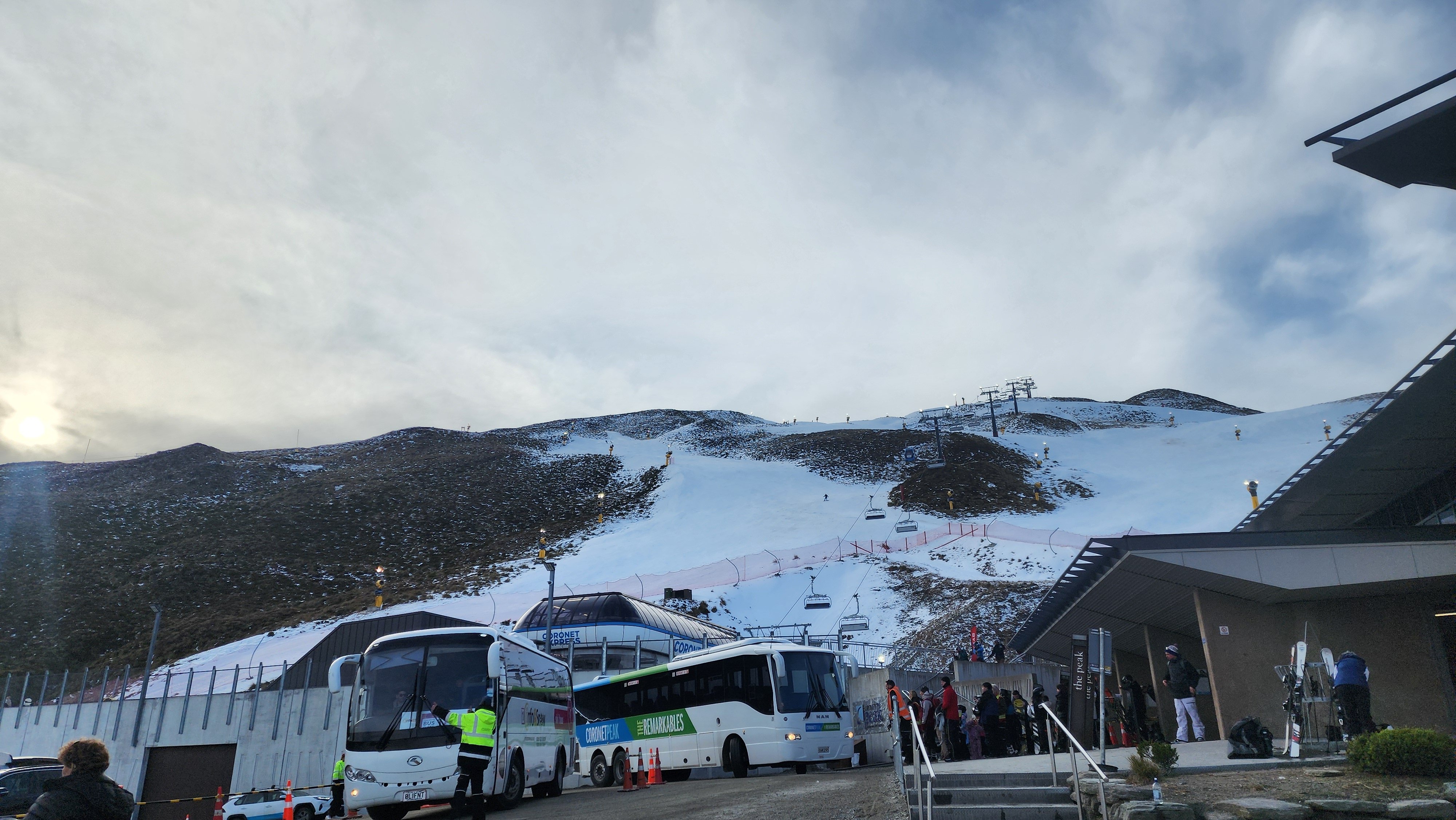
Image: Coronet Peak from the car park earlier this week. Source: Jason Ng Photography.
Here’s a snow cam image from Mt Cheeseman, two hours out of Christchurch. This is one of New Zealand’s lesser-known resorts with very limited snowmaking, and while many Aussies skip Cheeseman, it’s a highly under-rated hill which is popular with locals. Sadly, it’s completely closed right now.
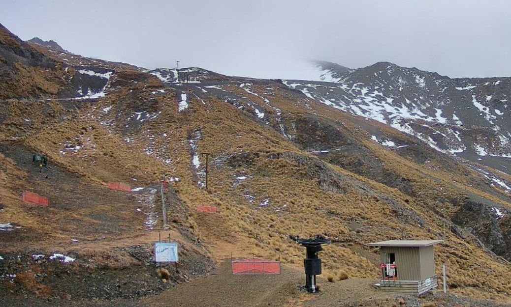
Image: You'd be pretty cheesed off if you wanted to go skiing there right now. Source: Mt Cheeseman.
"We’re not trying to hide anything as I’m sure everyone’s been watching the webcams," a resort manager announced recently in an admirably forthright social media post. "Thank you for your support and understanding, it’s been a tough old wait over the last month and particularly for our staff team."
It has indeed been tough at the snow-starved NZ ski fields for people whose winter livelihood depends on a decent snow season. Showing true Kiwi resilience, staff have been doing they can to create a positive visitor experience. One staff member was spotted walking the slopes placing loose rocks in a bucket at Porters, another ski field near Christchurch.
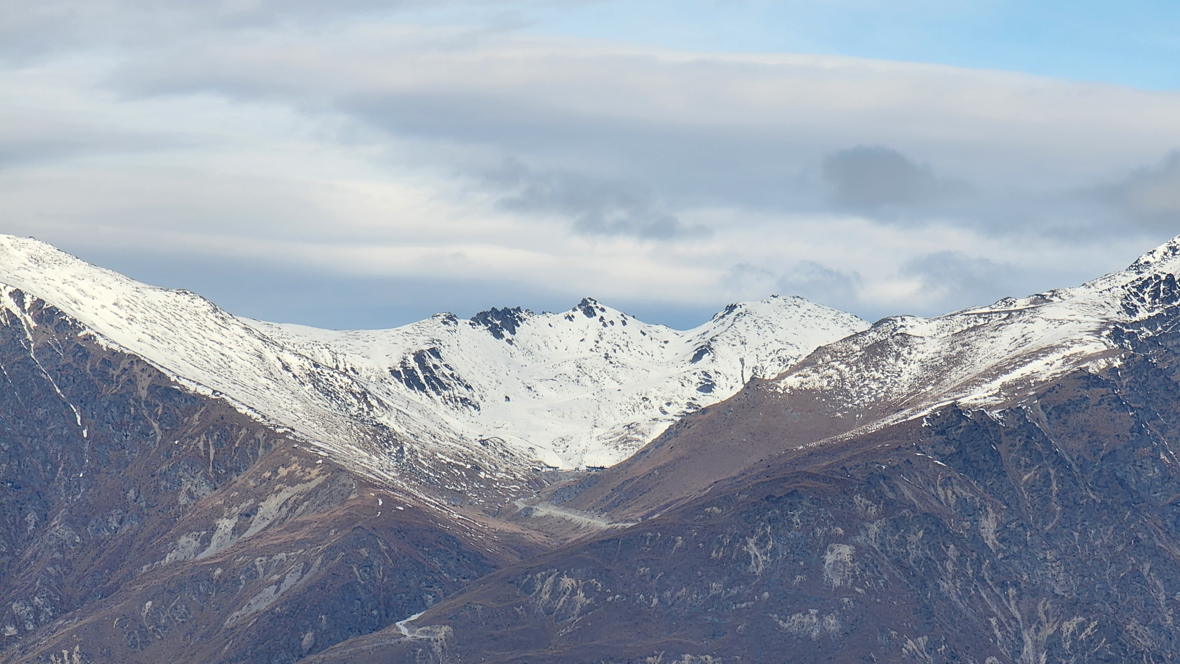
Image: The Remarkables is the second of the Queenstown ski fields and is considerably higher than nearby Coronet Peak, but its snow is still very thin at present. Source: Chunky via ski.com.au.
Not every New Zealand ski field is bare and bony at present. Mt Hutt – which many consider to be the country’s best ski area – is hardly having a vintage season, but at least most of its slopes have a consistent natural snow cover.
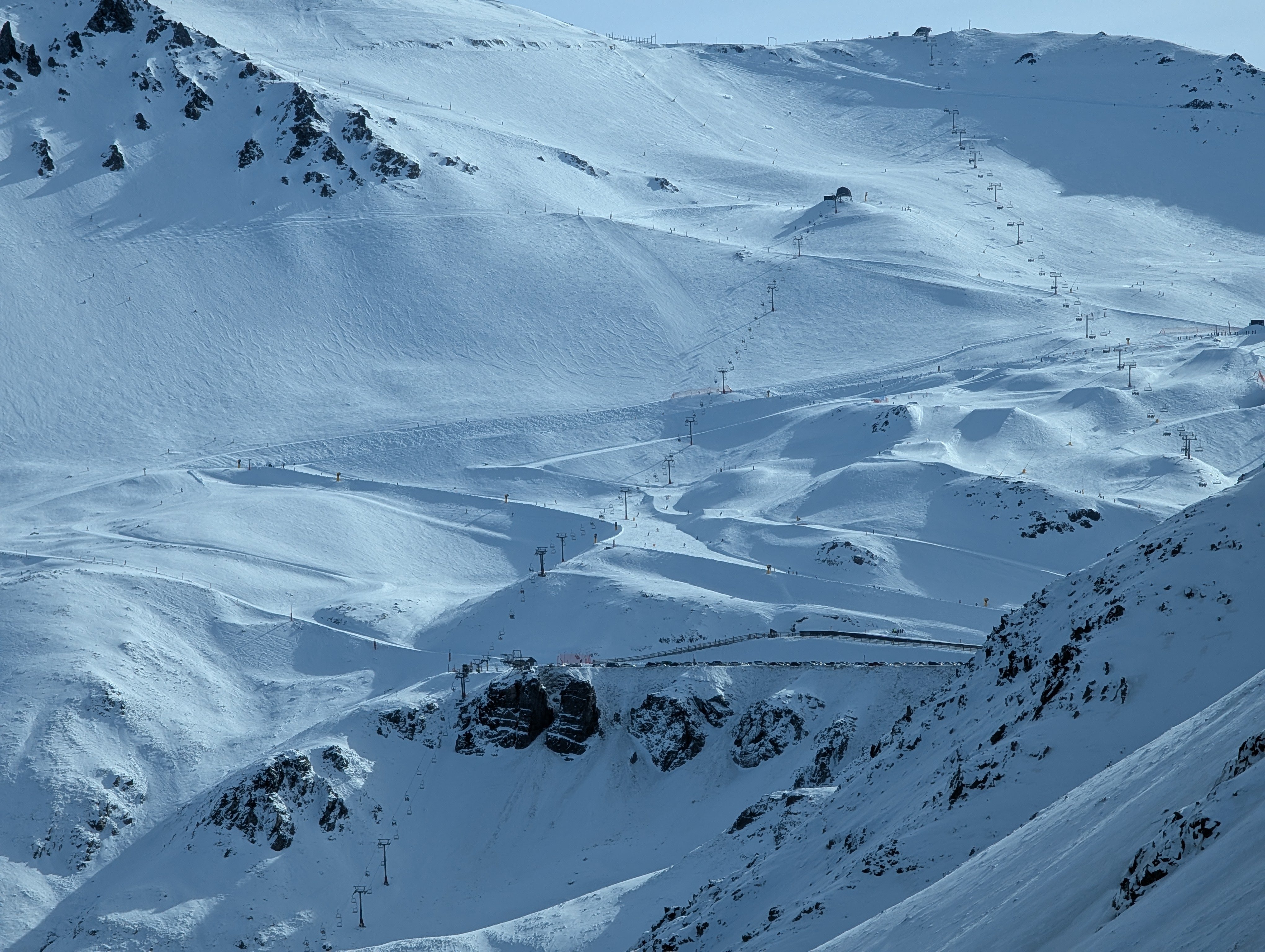
Image: Mt Hutt has received a lot more snow this winter than ski fields slightly further north like Mt Cheeseman and Porters and ski fields a few hours south like the ones near Queenstown. Source: Glen H.
The good news for Kiwis is that there’s the likelihood of long overdue snowfalls right across parts of the South Island above 1000m from Friday into the weekend.
The imminent cold front won’t turn a terrible season into a good one overnight, but it’s a start – and the season still has around two months to run before the scheduled close at most New Zealand ski fields. So the season could yet be saved, despite a forgettable first half.
Why has Australia’s snow season been good (at our higher resorts) while New Zealand’s has been poor?
Australia and New Zealand can both have either good or bad snow seasons in the same year, but it’s slightly more common for the two countries to have contrasting seasons.
In simple terms, that’s because the snow-bearing cold fronts originating in the Southern Ocean tend to hit one country and miss the other.
This effect is illustrated well in the chart below showing mean sea level pressure (MSLP) in the Southern Hemisphere from the polar region to the mid latitudes during one of the snowy outbreaks in early July that coated the Australian high country in heavy snow.
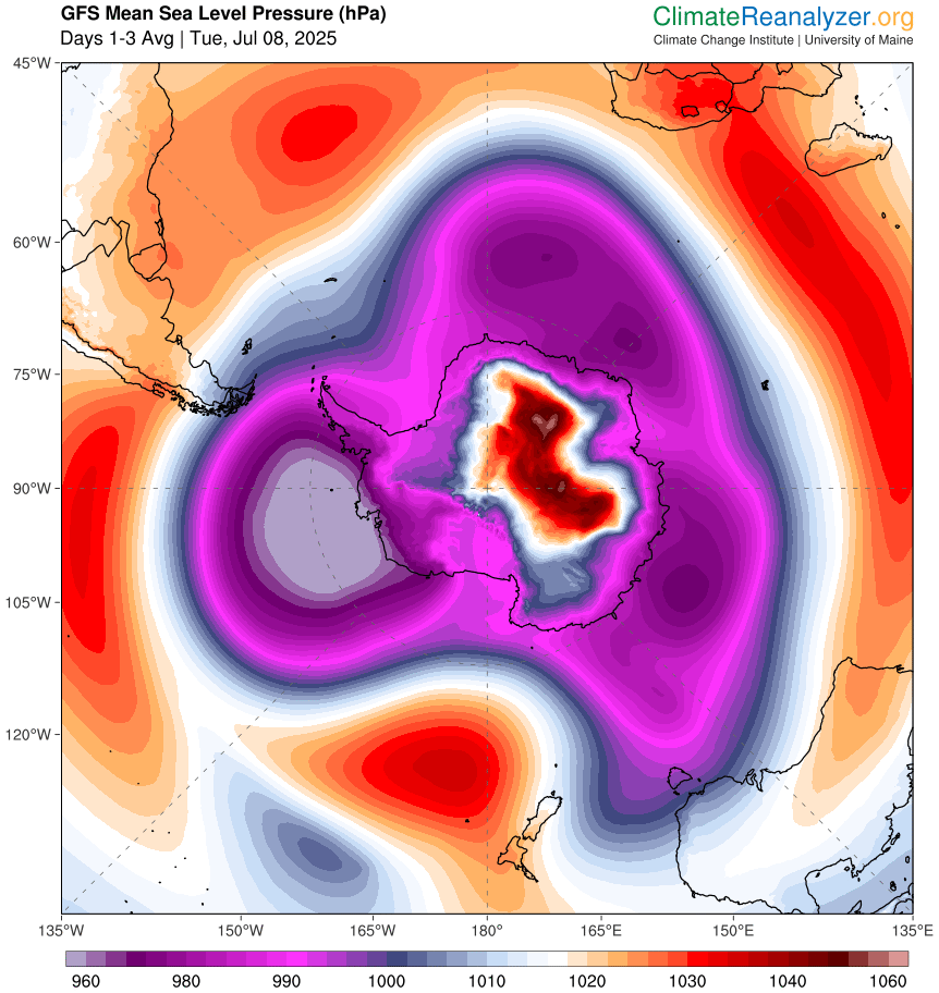
Image: Mean sea level pressure in the Southern Hemisphere from the polar region to the mid latitudes on July 8, 2025. Source: ClimateReanalyzer.
The chart shows low pressure pushing into SE Australia. In winter, low pressure in this region is generally associated with a cold, snowy system with polar origins. When these systems peak over Australia, they tend to be steered southeast, bypassing New Zealand as they take their cold air back south.
Meanwhile New Zealand is basking under high pressure – as it has been for much of this winter so far – which generally means clear skies and mild temperatures.
The chart below shows the abnormally warm 850 hPa temperatures over New Zealand from June 1 to August 4.
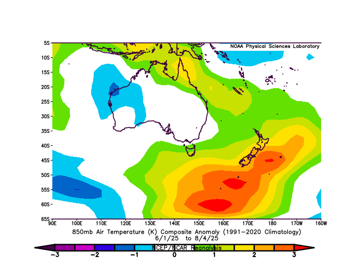
Image: Note that temperatures have been near average over Australia’s ski resorts on the SE mainland. Source: NOAA.
850 hPa temperatures are an indication of temperatures at about 1500m above sea level, which is the mid-elevation at most NZ ski fields. All that orange on the chart means a temperature anomaly above 2°C, which means it has been much warmer than usual. That's been bad news for the meagre snowpack.
Here’s hoping the situation changes soon for the sake of New Zealand business operators and staff, and for the approximately 50,000 Australians who make a winter pilgrimage to the Kiwi snow each year.
As for the Aussie snow, it could also use a top-up after some rain earlier this week. But the depth remains over a metre at the higher NSW and Victorian resorts, and while no significant snowfalls are expected in the next week or so, there are signs of snowy system on the weekend of August 16 and 17.
As ever, check the Weatherzone snow page for the latest info, forecasts, cams and more.