
Melbourne expecting coldest morning of the year
Melbourne is forecast to kick off August with a Saturday morning minimum around 2°C, which would make it the city’s coldest morning of the year to date.
Melbourne’s coldest night so far this year was July 10, when the mercury fell to 3.1°C. The long-term average August minimum is 6.8°C. The city’s record low was -2.8°C way back on July 21, 1869.
Geelong can also expect a chilly start to the month with a minimum of 1°C on Saturday morning, while numerous outer suburbs of both Melbourne and Geelong can expect a frosty first day of August, with early morning temperatures dipping to 0°C or lower.
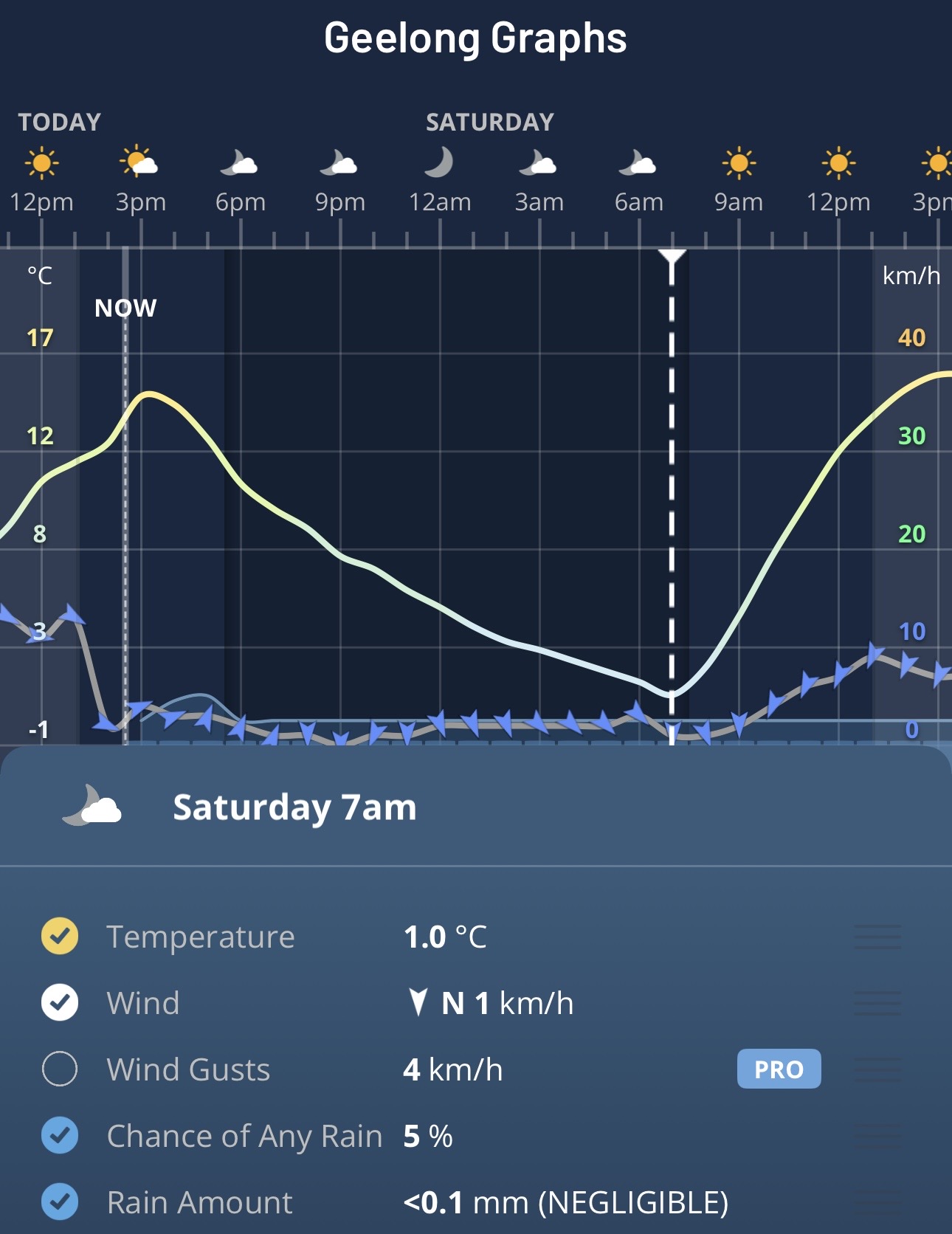
Image: Graphs for Geelong, Vic, on the Weatherzone app.
Why will the Melbourne area be so cold on Saturday morning?
Cold, dry air in the wake of a midweek cold front brought some of the year’s coldest temperatures to the southeast mainland on Thursday and Friday mornings.
The reason Melbourne is likely to have its coldest morning of this chilly spell on Saturday – lagging a day or two behind other SE Australian locations – is because light showers and humidity persisted for a day or two along the Victorian coastline after the passage of the front.
But the moisture has now pushed well out into the Tasman Sea, meaning virtually all of Victoria will see a dry weekend with chilly mornings. The only exception is the state’s far southwest where showers could arrive in places like Warrnambool later on Sunday.
The good news for those hoping to enjoy the weekend outdoors is that cold nights with frosty mornings often precede clear, sunny days – and that’s what’s in store for Melbourne this weekend, with sunny skies and maximums of 16°C and 17°C expected for Saturday and Sunday respectively.
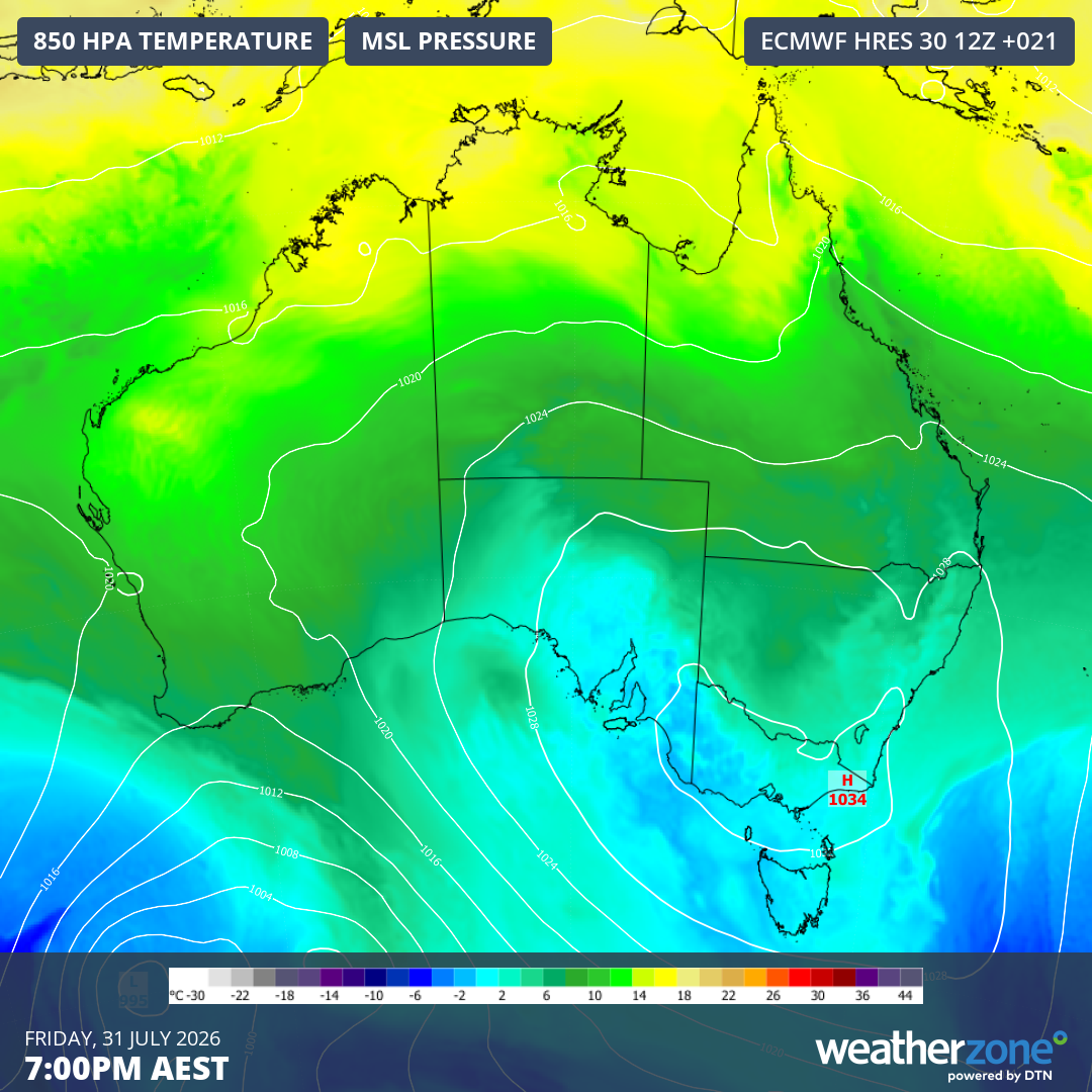
Image: 850 hPa temperatures and mean sea level pressure predicted for 7 pm this Friday, July 31, 2026, showing the high centred over SE Australia enabling stable conditions across much of the region.
Mainland Australia’s coldest fortnight of the year continues
The past two weeks have brought the coldest temperatures of the year to mainland Australia, due to injections of cold air from two distinct Southern Ocean cold fronts, both of which have been followed by high pressure systems ushering in periods of calm, clear, dry conditions ideal for frosty nights.
On July 20, Cooma Visitors Centre recorded mainland Australia’s coldest reading to date in 2026 of -9.5°C. That equalled the year’s coldest night Australia wide, after the same temperature was recorded at Liawenee in Tasmania on June 26.
Over the past few mornings, numerous frigid temperatures have been recorded after the midweek cold front. This Friday morning, Cooma Airport and Thredbo Top Station both recorded -8.3°C, while Goulburn Airport – between Canberra and Sydney – fell to -8.2°C.
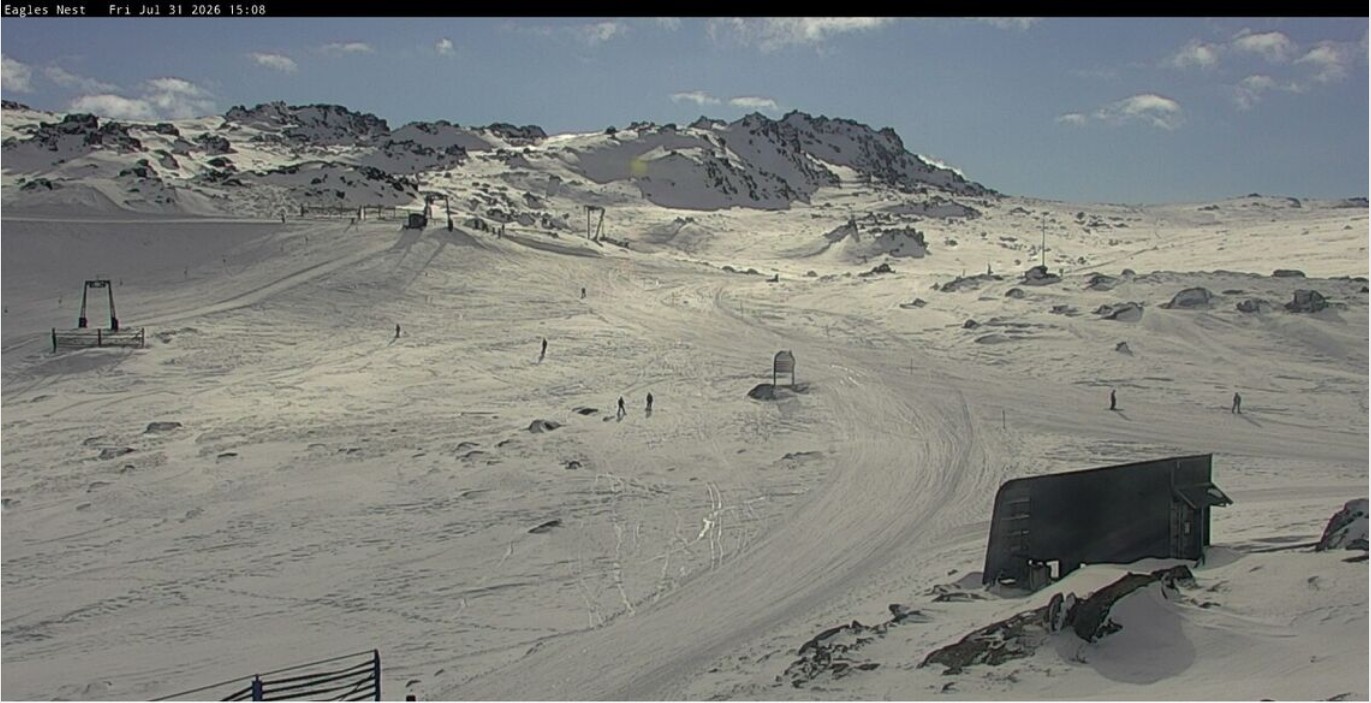
Image: The pole protruding behind a rock near the top right of the image shows the location of Australia’s highest weather station, Thredbo Top Station at 1957 metres. Source: thredbo.com.au.
And the recent morning chill hasn’t been confined to southern regions. On Thursday morning, Glen Innes on the NSW Northern Tablelands registered a low of -8.2°C, the day’s coldest temperature anywhere in Australia.
The mercury even plunged to -5.4°C in the Queensland town of Oakey this week.
Saturday promises to be another chilly morning across most of the locations mentioned, although some spots could be a degree or two warmer than Friday morning.
Weekend of the year in the snowfields
After as much as 20 centimetres of snow fell midweek across higher parts of the mainland alpine region, the combination of an improved snow cover and clear skies should see a great weekend on the slopes, especially on Saturday.
Winds look set to pick up on Sunday ahead of the next frontal system due early in the working week, so conditions may not be so pleasant towards the back end of the weekend, but the positive news is that a light top-up of fresh snow is likely.
Next week’s system doesn’t look like the big dump that snow lovers and mountain business operators are still craving, but most resorts currently have more than half of their lifts and terrain open, so the 2026 Australian snow season is in reasonable shape for now.
Please check the Weatherzone snow page for the latest forecasts, live snow cams and more.