
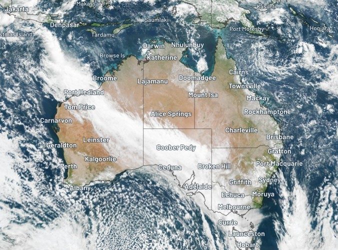
Massive northwest cloudband from Indonesia to Tasmania
Just look at that beast. It must stretch more than 5000 km from Jakarta in Indonesia all the way down to Hobart, Tasmania.
It's a classic northwest cloudband, and while there's not a huge amount of moisture associated with it along its full extent, it's definitely the dominant feature on Friday's weather charts.
While the entire cloudband is not delivering rain, showers and storms are affecting some parts of Australia, which you can see in green in the enhanced satellite image below which includes water vapour and the rain radar.
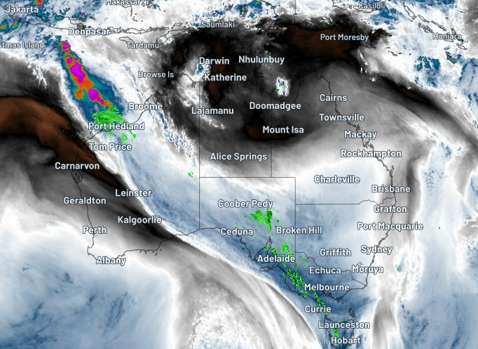
In terms of recorded rainfall from this cloudband, as we write this story around lunchtime on Friday, there are light showers around WA’s Pilbara coast, as well as showers and storms over parts of SA, Victoria and Tasmania.
Rainfall totals remain at just a few mm in most spots, but there is the potential for heavier falls as storms continue to develop into the afternoon, with the potential for rain continuing into Saturday across much of southeast Australia.
The extent of the moisture flow in a southeasterly direction across the country is captured beautifully in this animation created by Weatherzone developer Andrew Miskelly.
Atmospheric moisture associated with an Indian Ocean tropical low streams ahead of a cold front over the Great Australian Bight, producing a band of light to moderate rain. pic.twitter.com/ToMFmezUw1
— Andrew Miskelly (@andrewmiskelly) April 28, 2022
Reminder: What exactly is a northwest cloudband?
So glad you asked. We actually wrote about this last year. As WZ meteorologist Ben Domensino explained, it's "a vast layer of cloud that flows over Australia from the northwest. Once fully developed, the cloudband stretches across the country like a sash from the northwest to southeast".
The "sash" effect, as Ben described it, is visible in its full magnificence today.
As for what causes northwest cloudbands, Ben explained that they form when "humid and warm tropical air over the Indian ocean moves towards the southeast and passes over Australia. As this warm and humid air moves further south, it rises over cooler air in the mid-latitudes and produces clouds".
That's pretty much the case today, and there's also the influence of a tropical low in the northwest, which is providing extra moisture in this rainband than normal. The cloudband also follows a particularly strong jet with a cold front that is crossing the southeast.
Warmer-than-usual waters off northern WA are also enhancing the amount of moisture available in the atmosphere and providing ideal fuel for a northwest cloudband. You can see the water temperature anomalies for yourself in this BoM chart.
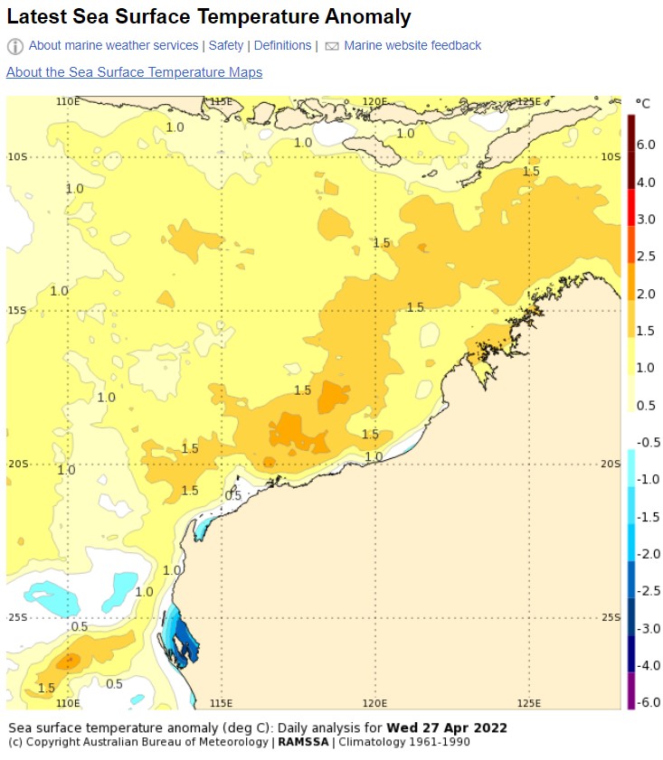
Image: It's a degree or more warmer than usual for this time of year in most parts of the Indian Ocean off WA's NW coast. Source: BoM.
It's also worth mentioning that Australia appears likely to experience a negative Indian Ocean Dipole (which you can read about here).
Without getting bogged down in the detail of what that means (it's all in the story with a link in the previous paragraph), a negative IOD typically causes an increase in northwest cloudbands. So we might see a whole lot more of these babies in coming months.
Meanwhile as air flows across the country from the northwest, warm temperatures are being experienced on Australia’s east coast, with temps reaching 27°C and slightly higher in the Sydney and the NSW Central Coast before 2 pm – unusually warm coastal temperatures for late April.