
Light snowfalls to start winter, more to come ahead of ski season opening
A light dusting of fresh snow has coated the alpine areas of New South Wales, Victoria and Tasmania to start winter, with heavier snowfalls likely later this week just in time for Saturday’s official opening of the 2026 Australian ski season.
The heaviest snowfalls are due later on Wednesday into Thursday, with accumulations of 20 to 40 cm possible at higher elevations. But before that happens, expect a burst of what snow-lovers call the dreaded "r" word – as in rain.
Cold, then warm, then cold again
Over the weekend, a cold front crossed Tasmania and the southeastern mainland, ushering in a burst of showery weather with snow that fell down to around 1500 metres above sea level at times.
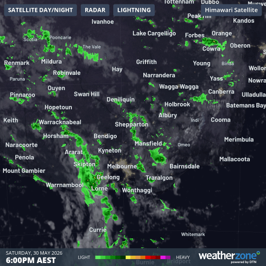
Image: 12-hour combined satellite and radar loop to 6 am on Sunday, May 31, 2026, showing showery weather crossing the SE corner of mainland Australia in a cool southwesterly stream that brought snow to elevations above about 1500 m.
In the wake of the front, cool, windy, but mostly dry conditions are prevailing this Monday. Overnight, Thredbo fell to -4.1°C, the coldest temperature recorded anywhere in Australia.
But Monday’s relatively stable weather will be short-lived, with another major system moving in. A low pressure system and associated cold front is currently crossing the Great Australian Bight. This is the same system that brought extremely strong winds to SW Western Australia over the weekend.
Numerous strong wind warnings are in effect this Monday as the system tracks east, including a severe weather warning for damaging winds for large parts of South Australia, including all coastal areas from the WA border right across to the Victorian border.
As this system approaches the mainland high country, a surge of relatively warm northwesterlies will precede the cold front, and this could push the snow level up to around 2000 m.
For context, Australia’s highest peak Mt Kosciuszko is 2228 m, while the very highest parts of Thredbo and Perisher are around 2040 m. So we’re facing the prospect of rain at most of Australia’s ski resorts.
But as mentioned, colder air and moisture will cross the southeast on Wednesday and Thursday. Thursday and Friday look especially chilly, and depending how much moisture lingers, brief snow showers could occur beyond the mountains in places like the NSW Central Tablelands.
Will resorts be open for skiing and snowboarding this weekend?
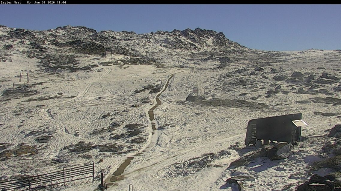
Image: A lovely clear Monday morning at the top of Thredbo (site of Australia’s highest official BoM weather station) at the start of the track to Mt Kosciuszko. Source: Thredbo.com.au.
We can’t yet confirm whether ski resorts will be open, but if you’re heading up to the mainland high country for the King’s Birthday long weekend (which is not a long weekend in Qld or WA), you should definitely find enough snow to throw a snowball or two.
As for skiing and snowboarding, at this stage it appears highly likely that beginner terrain will be open at major Australian ski resorts like Thredbo, Perisher, Mt Buller, Mt Hotham and Falls Creek.
That’s not just because of the snow that will fall on Wednesday and Thursday, but because of the ideal snowmaking conditions which should set in afterwards, with cold, crisp nights ideal for pumping out snow on the most popular runs.
READ MORE: Snowmaking begins in Australia: but how does it work?
After snowmaking in Australia briefly kicked off last week, warm, mild, humid nights have prevented the guns from firing. Some rain in the meteorological mix didn’t help either. But the end of this week and the weekend look like providing an ideal window for snowmaking.