
Here comes yet another massive November cold burst
Thought we were done with these wintry bursts in southeastern Australia just a few weeks out from summer
Forget it.
Yet another extremely strong cold front is ploughing its way across the Southern Ocean, heading for the southeast of the country on Sunday and Monday.
This one, to use an everyday, non-meteorological term, is a doozy. It would be classed as a strong cold storm in June, July or August, but as November systems go, it is seriously cold.
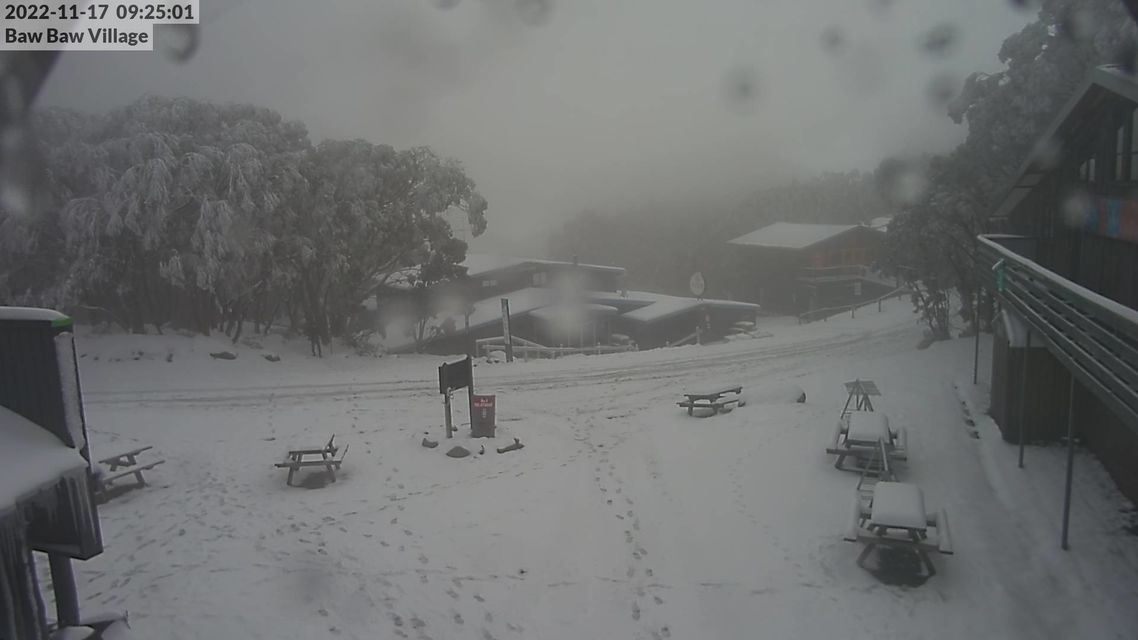
Image: Mt Baw Baw ski resort, near Melbourne, is still covered in snow from this week's front. Some of that will melt between now and Sunday, before similar amounts fall again. Source: ski.com.au.
What's going on with the late spring weather?
As Weatherzone meteorologist Ben Domensino wrote yesterday, the weather is always dynamic in Australia at this time of year, thanks to stifling hot air masses building up over the tropics and regular pulses of much colder air sweeping over southern Australia.
That's what caused a 50-degree temperature differential between Australia’s hottest and coldest place within an 11-hour period on Tuesday afternoon into Wednesday morning.
But this year, the spring cold fronts have been much more active than normal. This was the case in October too, but to use just the example of fronts in November, we've seen:
- The Melbourne Cup day front, when so much snow fell in the mountains that there were actually small avalanches.
- This week's front, when snow again fell – heaviest in southern Vic and Tas – and Mt Hotham recorded the nation's coldest temp for November 22 to date with -7.0°C.
- The front arriving later this coming weekend.
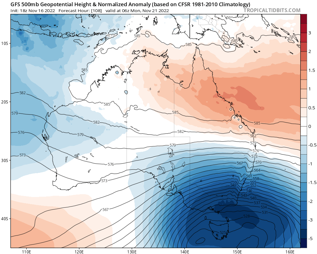
Image: This image shows temperature anomalies caused by the abnormally cold upper-level airmass. Similar temperature anomalies can be expected at surface levels. Source: Tropical Tidbits.
To understand why there's so much wintry weather in late spring this year, your best bet is to read this story by Weatherzone meteorologist Joel Pippard, which describes how the stratospheric polar vortex has been unusually strong and cold of late.
Joel's story fleshes out what that means, but in very simple terms, it means that cold fronts may not necessarily be more frequent, but when they come (which they have been doing a lot) they are more likely to pack a strong punch – creating out-of-season snow events and severe thunderstorm outbreaks of the sort we saw last weekend in Adelaide and elsewhere.
So what can we expect from the coming cold front?
In a nutshell: cold temperatures, showers and strong winds.
- Several days of top temps in the teens in Melbourne, Adelaide, Hobart and Canberra (and pretty much anywhere in between) can be expected from Sunday onwards.
- Canberra could reach a top of just 13°C on Monday as the coldest air tracks north. That would make it even colder than Wednesday, when snow was reported near the capital, and a snow-like covering of graupel (a type of small, soft hail) coated the city.
- Meanwhile mountain areas will see snow, and it could be quite heavy with falls of 20 cm or more realistically on the cards.
- As for Sydney, it will be insulated against the coldest air, and should continue its run of every day in November 2022 peaking in the 20s for the foreseeable future, although Sunday's max could come very close to 30°C in a brief surge of warm air ahead of this latest cold front.