
Miserably cold Melbourne day
They say that if you don't like the Melbourne weather, just wait a few minutes. In November 2022 to date, the waiting period has been more like a week.
- On the first Tuesday of November this year (Nov 1, Melbourne Cup Day), Melbourne reached a frigid top of just 13.3°C as an extremely strong spring cold front swept across southeastern Australia.
- A week later, Tuesday November 8 peaked at 27.6°C, which for the record, was warmer than the average January max temp of 26.0°C (January is Melbourne’s hottest month).
- Another week on, and we’re looking at potentially the coldest November day since 2006.
We're writing this story at 4 pm on Tuesday November 15, and the warmest temp so far today was 13.1°C at 2:28 pm.
Omg I'm so done with Melbourne weather, WHY IS IT SO COLD IN NOVEMBER. I should just move to Queensland for that glorious eternal heat~
— Fiddles (@Fiddles_) November 15, 2022
There's a slight possibility that Melbourne's temp will nudge upwards above 13.1°C in the late afternoon period, but as things stand right now:
- The temp has bounced around since today’s interim high of 13.1°C was recorded, affected by passing showers and brief periods of sunshine.
- At 3 pm, it was just 10.8°C.
- At 4 pm, it had rebounded slightly to 12.5°C.
- If the reading of 13.1°C remains today's maximum, then today will be the coldest November day since November 15, 2006, when the max temp also reached just 13.1°C.
- The last time a lower November max was recorded was November 7, 1994, with a top of just 12.7°C.
So what's going on?
Another burst of unseasonably cold weather is under way over south east Australia. pic.twitter.com/5RQ8s7JKAq
— Andrew Miskelly (@andrewmiskelly) November 14, 2022
Every Melburnian knows that cold fronts can sweep northwards from the Southern Ocean at any time of year. Some are stronger than others and today’s is packing a real punch of polar air.
We wrote earlier today that heavy snow had fallen in Tasmania, and to quite low levels below the mountain districts too.
That snow has now extended into the mountains of southern Victoria, with steady snow falling on the live cams at Victoria's southernmost ski resorts, Mt Baw Baw and Mt Buller.
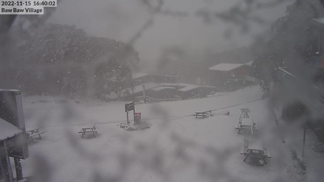
Image: Get out the skis! Source: ski.com.au.
Interestingly, the snow has only just started falling at Victoria's highest resort Mt Hotham, only 80 km or so northeast of Buller, while only a flake or two has thus far been spotted in the NSW skifields just a little further to the northeast.
The cold air should push a little further northwards overnight and into Wednesday, but for now, southern Victoria, Tasmania, and southeastern South Australia are copping the brunt of this chilly burst, as well as most of the moisture.
Indeed, Adelaide is also having a very cold day by November standards, with an interim Tuesday top of just 15.9°C recorded at 1:33 pm local time, and a temp of 14.5°C at 3:30 pm as we write this story.
Both Adelaide and Melbourne will slowly warm up this week, with temps reaching the mid-twenties by the weekend, before another strong spring cold front dramatically drops temperatures again late in the weekend and into the new week.