
'Get out now': Western Sydney residents urged to flee as deluge hits day four
As Monday delivers a fourth consecutive day of heavy rainfall in Sydney, residents of many low-lying areas of the Hawkesbury-Nepean basin in the city's west have been urged to leave - with the worst flooding since 1990 expected to inundate the region.
Evacuation orders are in place for parts of Penrith Jamisontown, Mulgoa, Agnes Banks, Freemans Reach, Cornwallis, North Richmond, Pitt Town North, Pitt Town Bottoms, and Gronos Point at Willberforce.
I have never seen flood waters so high, mass evacuations of fam, friends & the community I represented & loved.
— Emma Husar (@emma_husar) March 21, 2021
Vindicated for standing up against @stuartayresmp @GladysB proposals to raise dam & develop flood plain #nswpol #nswflood #penrith #auspol
The New South Wales State Emergency Service has so far helped around 2,000 people to evacuate, with many more expected to require assistance on Monday.
Numerous road and school closures are in force aross western Sydney, as well as in other parts of NSW including the disaster-declared Mid North Coast, where over 800 mm of rain has fallen in some areas.
MAJOR FLOODING HIGHER THAN THE 1961 EVENT EXPECTED ALONG THE HAWKESBURY RIVER
— NSW SES (@NSWSES) March 21, 2021
Major flooding is occurring along the Hawkesbury River at North Richmond where the river level is rising. Flooding is likely to be higher than any floods since Nov 1961. https://t.co/k27HxGqmMG
Between 200 mm and 300 mm of rain has now fallen in most areas of Sydney since Thursday. The week leading up the deluge was persistently wet in most suburbs too. For example, the gauge at Sydney airport has now recorded 11 straight days of rain.
But western Sydney has borne the brunt of the deluge in the last 24 hours, with some of the heaviest rain in the entire Sydney region.
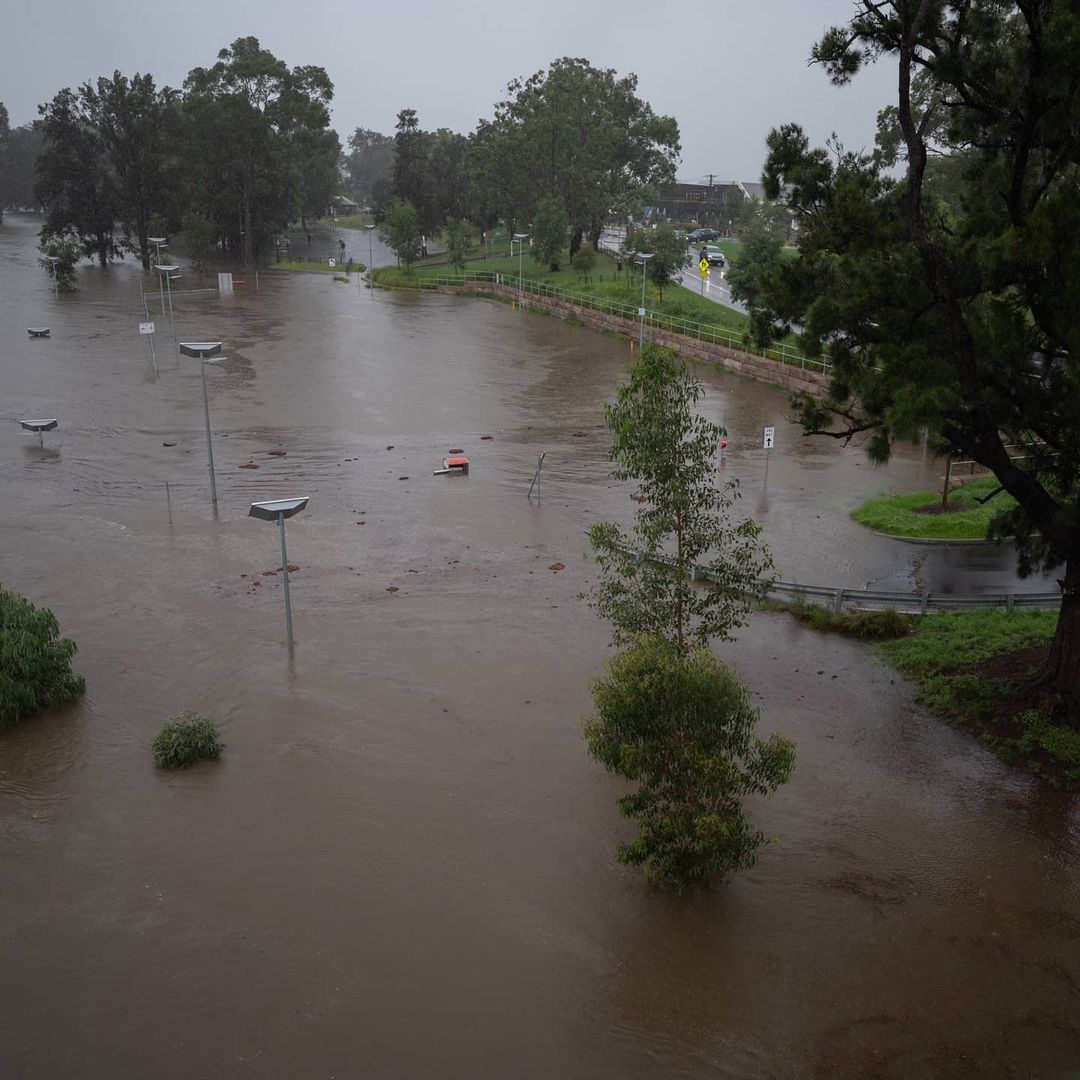
Image: The Nepean River near Penrith on Sunday afternoon. Source @jbmoorephotography.
Penrith recorded 88 mm of rain between 9 am Sunday and 9 am Monday, compared to 28.4 mm at Observatory Hill in the CBD. That brought Penrith's total rainfall since Thursday to almost 300 mm.
The situation in the Nepean River in western Sydney is compounded by releases from Warragama Dam, which as we told you yesterday, has reached capacity and is now releasing around 90% of the volume of Sydney Harbour per day.
Huge rain event driving major Warragamba Dam spill.
— WaterNSW (@WaterNSW) March 21, 2021
Heavy rain is generating a major spill event at Warragamba Dam, with inflows from the catchment likely to sustain large-volume spill activity for days.
Read more: https://t.co/Uxd0vgVxz0 pic.twitter.com/naBTXxzgzz
"What we’re going through now is different to what you've been through for the last 50 years, so please take it seriously," NSW Premier Gladys Berejiklian said on Sunday afternoon.
"It's the sustained rainfall, the fact that weather event has settled in, it's not moving on, and also, of course, the capacity of the spillover and what that might mean."
We'll keep you updated throughout the day. Be sure to check the official Bureau of Meteorology Warnings page here.