
Fourth typhoon in a month for Southeast Asia
Tropical Storm Matmo, the system that impacted the northern Philippines as Typhoon Paolo (Paolo being the Philippines' local name for the system) on Friday, October 3, is now heading for China's Leizhou Peninsula as it begins to reintensify into a typhoon.
Matmo (Paolo) is the fourth typhoon and fifth tropical system to affect countries surrounding the northern South China Sea after Typhoon Tapah (Lannie) formed off the northern Philippines coast on September 5, followed by Tropical Storm Mitag (Mirasol), Super Typhoon Ragasa (Nando) and Typhoon Bualoi (Opong).
Now edging towards southern China, Tropical Storm Matmo is set to intensify into a category 1 typhoon shortly before making landfall over the Leizhou Peninsula in the afternoon of Sunday, 5 October, generating maximum sustained winds of about 160km/h, gusting to 200km/h.
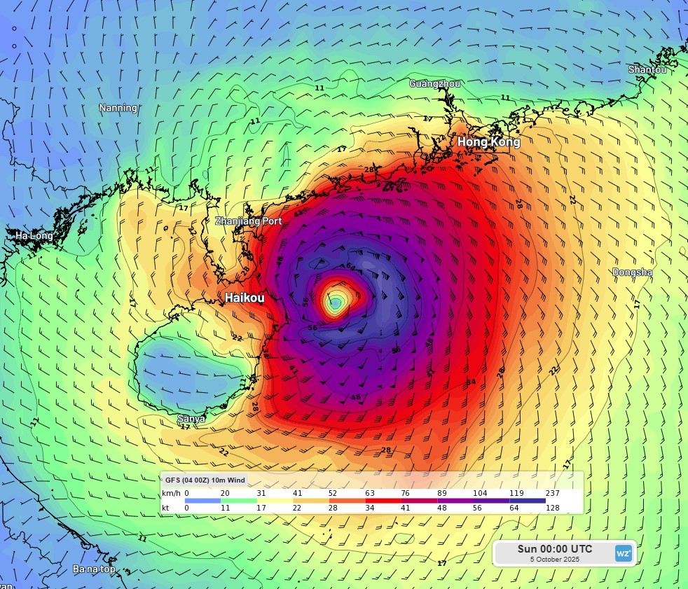 Image: Sustained winds off the coasts of Hainan Island and the Leizhou Peninsula at 00 UTC (8 am China Standard Time) according to the GFS model.
While the system will weaken significantly after it makes landfall, it will still pack a punch in terms of rainfall is it travels west-northwest into southern China and northern Vietnam, with some areas accumulating rainfall amounts well in excess of 250mm between the evenings of Sunday, 5 October, and Tuesday, 7 October.
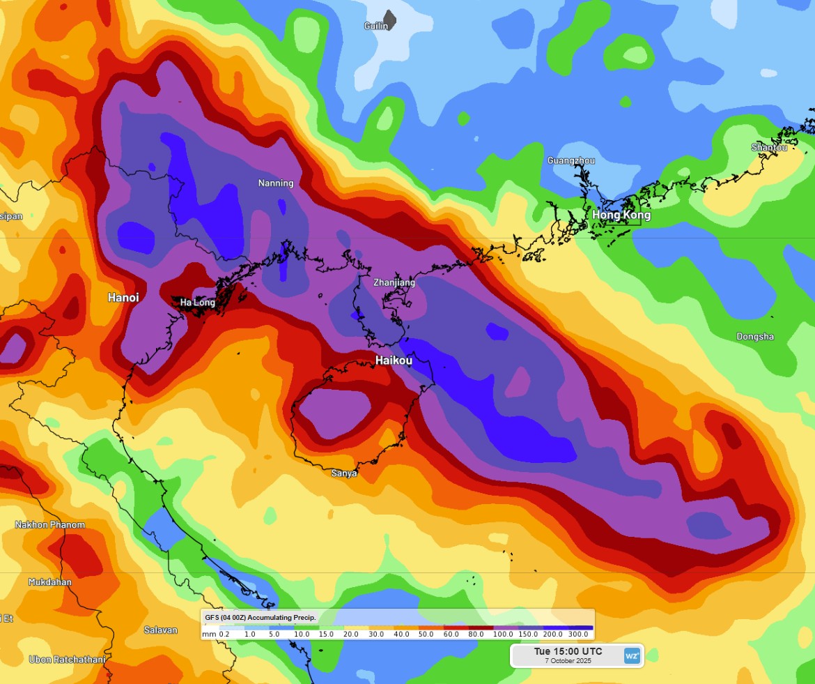 Image: Accumulated rainfall over southern China and northeast Vietnam to 15 UTC (11 pm China Standard Time), Tuesday, October 7, according to the GFS model.