
Coldest morning since last winter over inland NSW, SA and Vic
The coldest morning since last winter has eventuated over inland NSW, SA, Vic, and also parts of the ACT.
The coldest temperature was recorded at Perisher, with –5.5°C, though Goulburn's -4.1°C wasn’t far behind, the non-alpine centre once more holding its own in the cold morning stakes.
Other cold minima around the region included:
- -2.3°C at Orange, the coldest since last winter and coldest for April since 2008
- -1.6°C at Coonawarra, the coldest since early spring, 2025 and the coldest for April since 1999
- 0.9°C at Renmark, the coldest since last winter and the coldest for April since 2024
- 1.4°C at Hay, the coldest since early last spring and the coldest for April since 2024
- -1.8°C at Canberra, the coldest since last spring and the coldest for April since 2021,
with Perisher and Goulburn's corresponding stats being:
- Perisher: -5.5C, coldest since just December and coldest for April since 2019
- Goulburn: -4.1, coldest since last winter and coldest for April since 2008
These values are representative of many other locations throughout the surrounding regions.
The cause of the cold was a very dry and cool airmass behind a cold front that skimmed southeast Australia on Friday. The front wasn’t strong enough to bring much wind beyond coastal areas, yet the injection of cool and dry air led to ground surfaces very efficiently radiating heat back to space overnight. It's a stark change from the recent summer when blankets of humidity layered through the atmosphere prevented such radiation and led to consistently very mild nights.
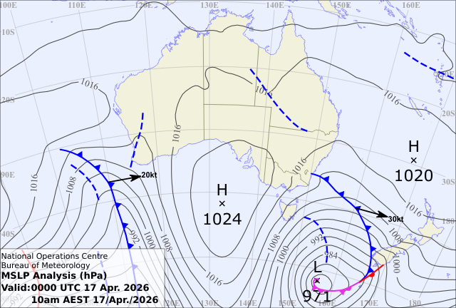
Image: Cold front skirting southeast Australia on Friday, 17th April, introducing cool SW'ly winds that quickly dropped as a high pressure system ridged in, bringing very dry air. The combination of cool, dry air and light winds is a classic set up for cold mornings. Source: Bureau of Meteorology
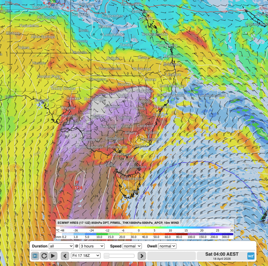
Image: Forecast dewpoints (a measure of humidity) at around 1500m about the ground, surface winds and MSLP over southeast Australia at dawn on Saturday, 18th, April, showing large very dry (purple) areas that allow that Earth’s surface to effectively lose heat overnight. Source: Weatherzone
Moving into Sunday, the cold temperatures will contract east and spread north with the driest, coolest air, as predicted yesterday. The latest satellite and synoptic imagery show the northern tail of the cold front is now near the NSW, Qld border, allowing the cold dry air to follow suit. It will then start to dissipate early in the new week.