
Frosty weekend for the southeast with widespread freezing temperatures
The coldest nights of 2026 to date await southeastern Australia this weekend, with temperatures falling to near or even below freezing across a wide area in the cool, dry airmass in the wake of a cold front.
Saturday morning
- Thredbo Top Station in New South Wales will likely register the coldest temperature in Australia this weekend, with a low of -5°C expected on Saturday morning.
- The Victorian alpine resorts are all expecting minimums around -2°C or -3°C on Saturday morning.
- But it’s not just the usual suspects in the High Country that will shiver, with numerous locations right across Victoria likely to see lows of around 1°C or 2°C.
- Melbourne should go as low as 5°C on Saturday morning, which would be the coldest reading of the year by several degrees, with a chilly welcome of 3°C for those arriving early at the airport.
- Even South Australia should see frost in the southeast of the state with a minimum of 0°C forecast for Coonawarra.
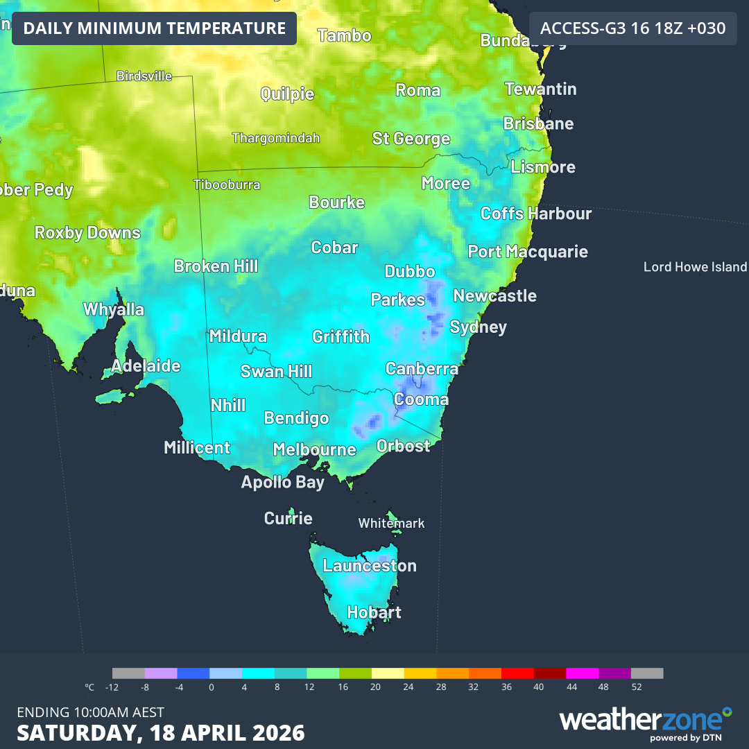
Image: Predicted minimums for SE Australia according to the ACCESS-G model for the morning of Saturday, April 18, 2026. Source: Weatherzone.
Sunday morning
- The tiny town of Liawenee on Tasmania’s Central Plateau could be the coldest spot in the country on Sunday morning with a low of -4°C predicted.
- Omeo just east of the Victorian Alps can expect -2°C on Sunday morning.
- Canberra is set for its first sub-zero night of the year with -1°C forecast for Sunday morning, after the mercury got close on April 14 when the minimum was 0.1°C.
- The cold nights will reach all the way up to the Northern Tablelands of NSW by Sunday and Monday, with lows around 1°C or 2°C expected in places like Guyra and Glen Innes.
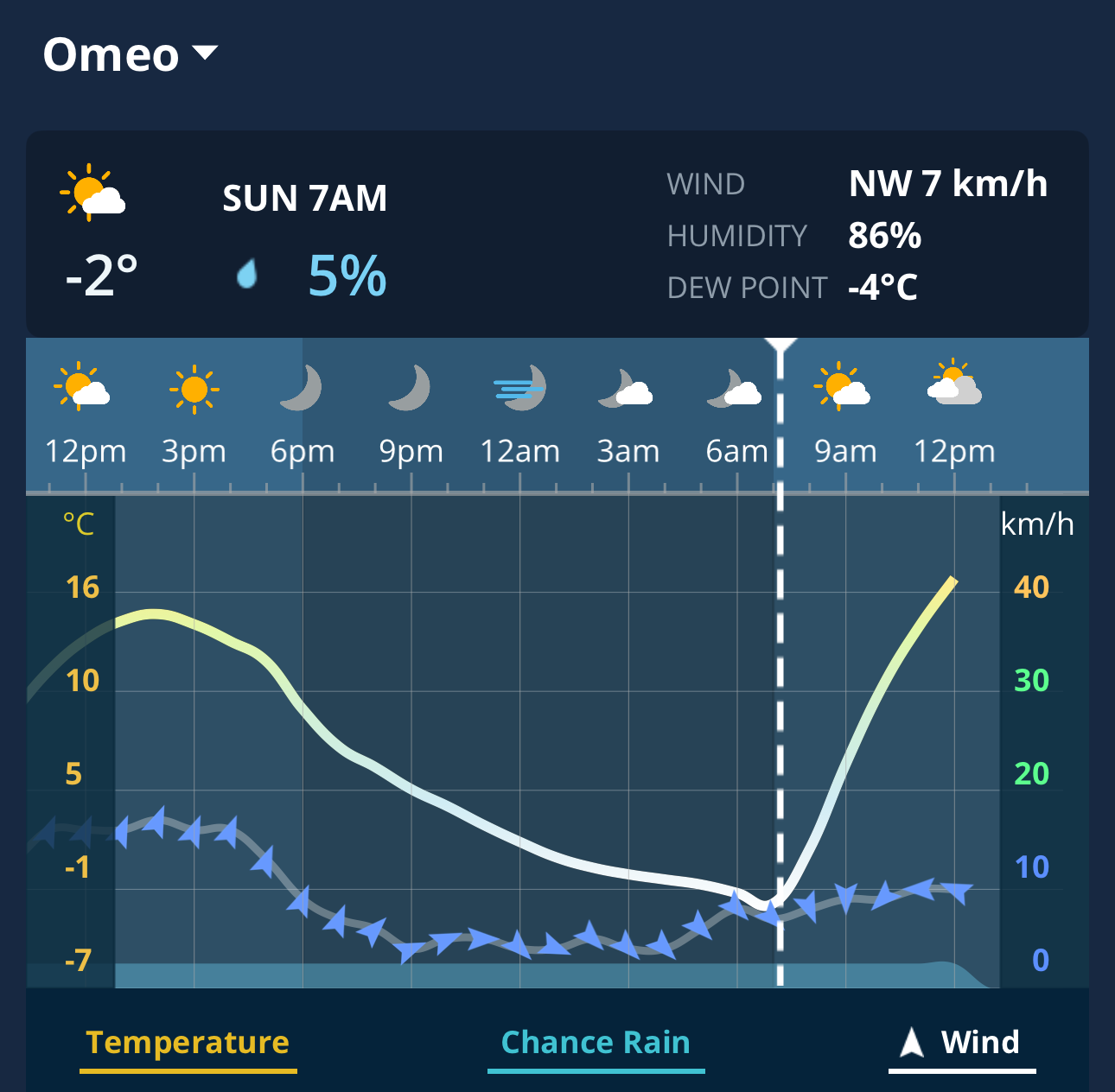
Image: 48-Hour Graph for Omeo, Vic, on the Weatherzone app.
What’s causing the frosty outbreak?
As mentioned, a cool, dry stable airmass will settle in over the southeast after a cold front that roared through Tasmania and clipped the southern mainland on Thursday night into Friday morning. The combination of still night-time conditions and dry, cold air is always a healthy recipe for frosty mornings.
The image below shows the forecast mean sea level pressure and precipitable water over Australia at 10pm (AEST) this Saturday night.
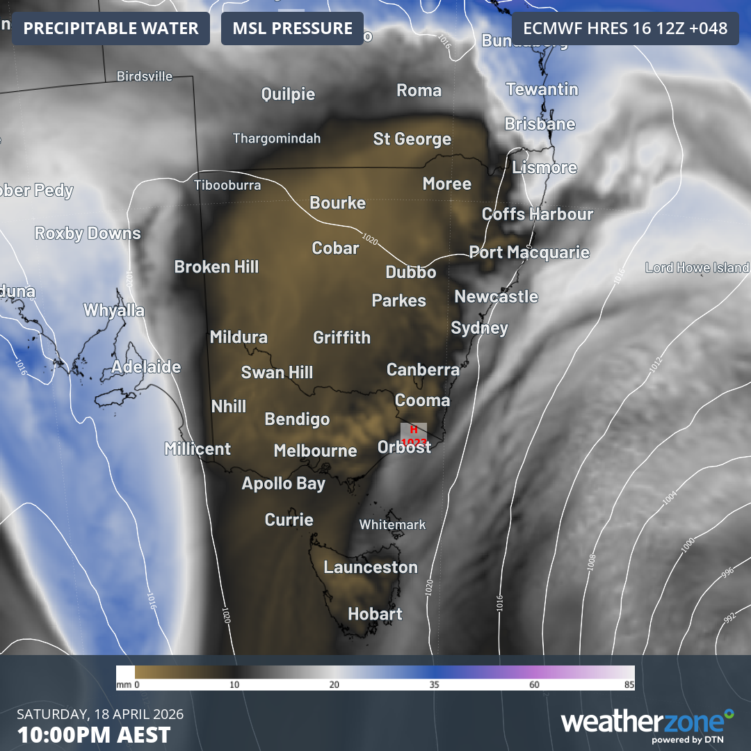
Image: Mean sea level pressure and precipitable water according to the ECMWF model for 10pm AEST) on Saturday, April 18, 2026. Source: Weatherzone.
As you can see, an area of high pressure and an associated dry airmass is centred over the southeastern corner of the mainland.
To the east of the high, there’s still moisture associated with the low pressure system which will be centred over the Tasman Sea near New Zealand. A very light shower or two from this system could flick northern parts of the NSW coast.
To the west of the high, the next cold front crosses South Australia, and while the blue-coloured band of atmospheric moisture looks impressive, only a few showers can be expected on Sunday in southeastern SA and southwest Vic before the weak front slides away to the southeast.