
Bucketing down in Birdsville and Betoota
The outback deluge continues, with the heaviest overnight falls occurring in the area around the town of Birdsville in far southwest Queensland
It’s a very rare day indeed when one of the wettest locations anywhere in Queensland is Birdsville, which sits at the eastern edge of the Simpson Desert.
But in the 24 hours to 9am Thursday, Birdsville received 93.2mm. That was:
- 58% of the town’s annual average rainfall of 161.4mm in one day
- Nearly five times the average monthly rainfall for February in one day
- Birdsville’s heaviest day of February rainfall this century
- Birdsville's heaviest day of rainfall in any month since 2011
- Queensland’s second-highest 24-hour rainfall total behind only Fall Creek on Cape York Peninsula.
Locations near Birdsville also received heavy falls overnight.
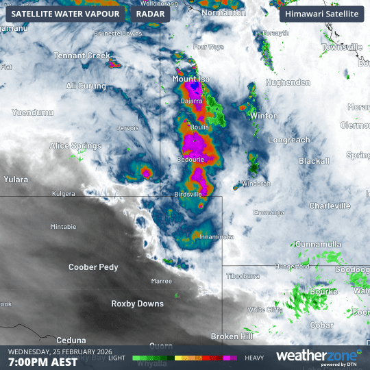
Image: 12-hour combined radar and water vapour loop showing heavy rainfall on Wednesday night which eased off in the early hours before re-intensifying on Thursday morning. Source: Weatherzone.
Durrie Station, about 105km northeast of Birdsville, collected 92mm in the rain gauge, so it’s reasonable to assume that heavy rain fell another 50km east at Betoota, the map speck which is perhaps best known for the satirical news website named in its honour.
As the loop above shows, rainfall has re-intensified in southwest Queensland on Thursday morning.
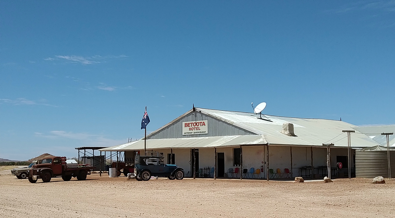
Image: The Betoota Hotel in late January 2026, in much drier times. Source: Josh Feek/iStock.
Severe weather warnings in place
Just after 4am (AEST), the BoM issued its latest severe weather warning for heavy, locally intense rainfall for the Channel Country (where Birdsville is located) and parts of the North West, Central West and Maranoa and Warrego forecast districts.
READ MORE: Mount Isa and Alice Springs break longstanding rainfall records
The BoM warned that six-hour rainfall totals between 50 and 80 mm were likely, with expected 24-hour rainfall totals between 60 and 100 mm. Isolated totals of up to 130 mm are possible.
Dangerous and life-threatening flash flooding is possible in all the areas mentioned with slow-moving lines of thunderstorms on Thursday morning, the BoM added.
Please check the Weatherzone warnings page for the latest flooding and severe weather information.
Why is outback Australia so wet this week?
A slow-moving tropical low has been sitting over central Australia for much of this week and is currently located over the southeast corner of the Northern Territory.
Tropical moisture has been feeding this system, and thunderstorm activity is occurring along a trough in the southwest of Queensland, as air moving towards the trough is forced to rise into an unstable atmosphere.
This wet and stormy outback weather is not done yet, with tropical moisture set to extend towards southern and southeastern Australia at times in coming days.
READ MORE: Simpson Desert tropical low causing flooding in four states