
Simpson Desert tropical low causing flooding in four states
A rare weather pattern involving a near-stationary tropical low over the Simpson Desert is causing widespread rain and thunderstorms in central Australia this week, resulting in flooding across four states.
The animation below shows a low pressure system sitting above the Simpson Desert region in central Australia. This animation reveals that the low barely moves over a 72-hour period from Sunday morning until Wednesday morning (today).
Video: Composite day/night satellite imagery and modelled mean sea level pressure between Sunday, February 22 and Wednesday, February 25, 2026. Source: Weatherzone.
Rain and thunderstorms associated with this low pressure system have inundated parts of the Northern Territory, South Australia, Queensland and New South Wales over the last few days. Moisture from this low has also extended south and fuelled showers and thunderstorms in Vic, where flooding also occurred on Tuesday.
Some of the standout rainfall observations from the last few days have included:
- 169 mm at Nappa Merrie, Qld in the 24 hours to 9am local time on Wednesday
- 121 mm at Winnathee, NSW in the 24 hours to 9am local time on Tuesday
- 118 mm at Rabbit Flat, NT in the 72 hours ending at 9am local time on Wednesday
- 99 mm at White Cliffs, NSW in the 72 hours ending at 9am local time on Wednesday
This is exceptionally heavy rain for these parts of Australia. For example, Nappa Merrie is in a part of Qld that usually receives about 100 to 200 mm of rain in an average year. On Tuesday night this week, they picked up 97 mm in just six hours.
While it has already been odd to see the low pressure system lingering over central Australia during the last three to four days, it could stay in a similar position until at least Saturday. This would make a whole week where the same tropical low has hovered above the Simpson Desert region, which is a remarkable and highly unusual meteorological event.
Unfortunately for cities, towns and communities in central Australia, this is likely to mean more rain, thunderstorms and flooding in the coming days. From Friday into the weekend, rain and storms are also likely to extend further south in SA, NSW and Vic, and possibly towards Tasmania early next week.
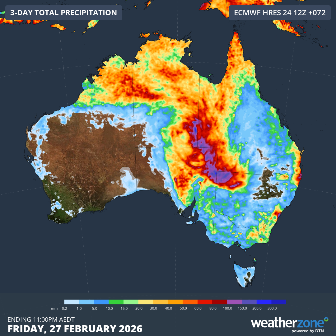
Image: Forecast accumulated rain during the 72 hours ending at 11pm AEDT on Friday, February 28, 2026. Source: Weatherzone.
Flood watches, flood warnings and severe weather warnings are currently in place in parts of the NT, Qld, NSW and SA.
Flooding is already occurring across parts of central Australia and will continue during the rest of this week and into next week. The State Emergency Service advises people to:
- Avoid flooded roads and never drive, ride or walk through flood water
- Keep clear of creeks and storm drains.
- Contact the SES on 132 500 for emergency help in floods and storms. Dial 000 if you need rescue.