
Biggest, coldest blizzard of the season about to hit the alps
In what has been a reasonably good snow season in higher parts of the Australian Alps, a huge multi-day blizzard is about to strike, delivering potentially the heaviest snowfalls of the 2025 winter along with wild winds and snow flurries at very low elevations.
Many chairlifts at the mainland ski resorts were already on wind-hold on Tuesday afternoon as strong northwesterly wind gusts reached 80 km/h at Thredbo Top Station (NSW) and 91 km/h at Mt Hotham (Vic).
But that’s just a taste of things to come, with damaging winds likely to exceed 100 km/h at times in coming days as the first strong cold front approaches the mountains on Wednesday, and again on Friday as a second vigorous front crosses.
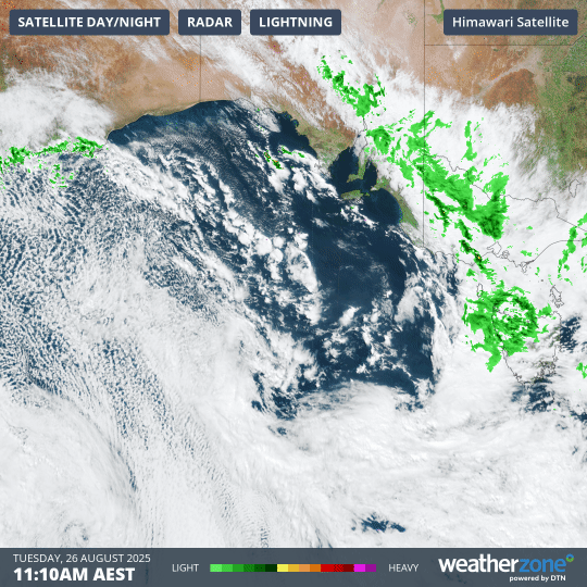
Image: Four-hour combined satellite and radar loop showing the tell-tale speckled cloud pattern associated with polar airmasses in the Great Australian Bight. Ahead of it, warm winds and areas of rain are being pushed across SE Australia.
The combined satellite and radar loop above shows the big engine of the low pressure system, currently based over waters south of the Great Australian Bight. Unfortunately for the snow cover, it’s pushing northwesterlies across the mountains, creating what snow industry people call "hair-dryer" conditions. Rain is also arriving on Tuesday evening.
Some snow loss is certain by Wednesday morning, however the damage will be more than compensated for by the coming snowfalls, which should comfortably exceed 50cm in total by Sunday.
How low will it snow?
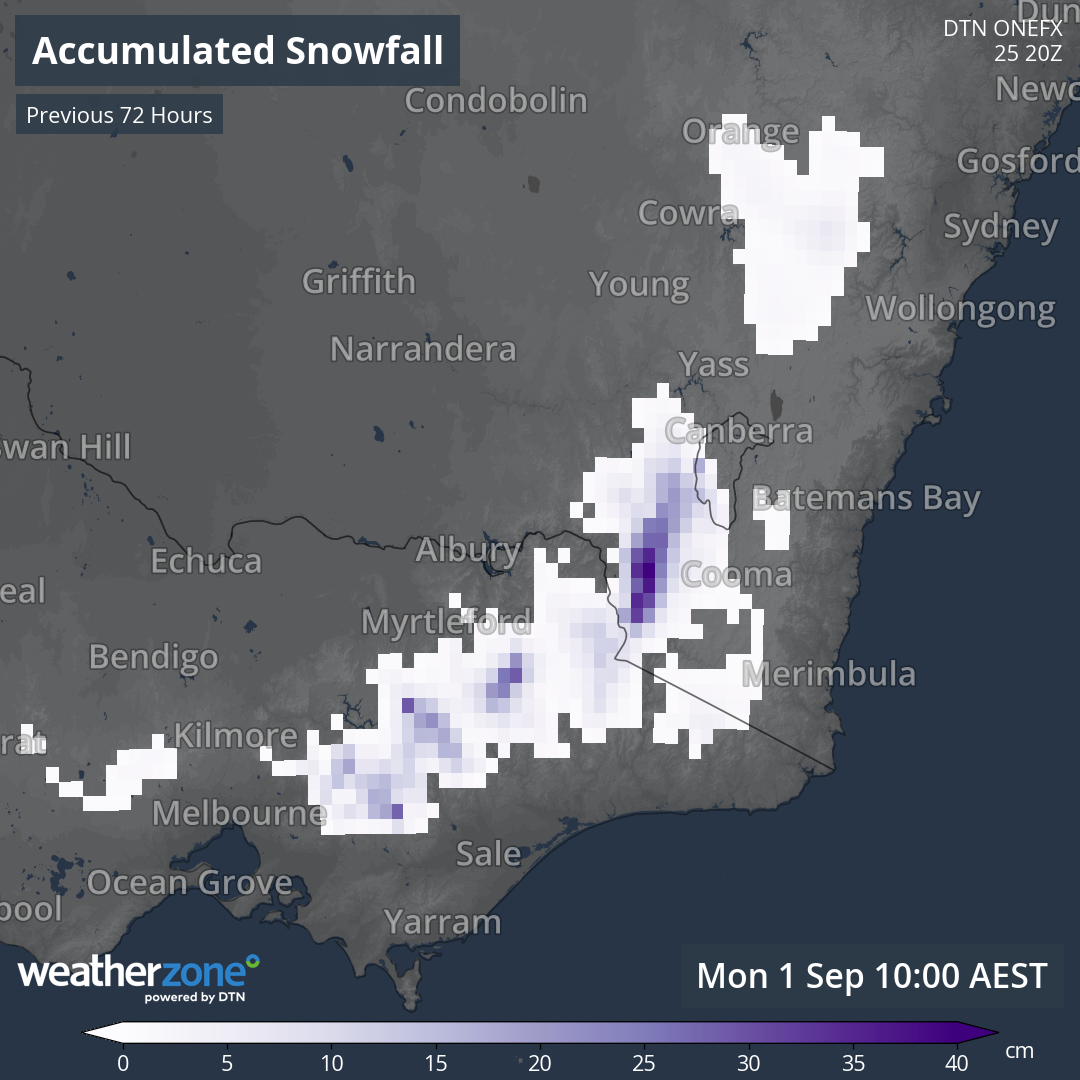
Image: Areas where snow is likely to fall from Friday, August 29 to Monday, September 1, 2025.
The map above shows mainland areas that are expected to see snow in the period from Friday to Monday.
As you can see, the snowy areas include large parts of the Central Tablelands (west of Sydney) as well as patches of Victoria well beyond the mountains (the small white blobs NW of Melbourne),
The snow line will hover at around 1000 metres or slightly lower from late Thursday into Friday, before dropping as low as 500-600 metres on Saturday morning as the most frigid polar air crosses the mountains.
In Tasmania, the snowline should be even lower by Saturday morning.
One spot to watch this weekend is Canberra, which hasn’t seen settled snow across the city for some years. The most famous Canberra snowfall of the century came in May 2000, when the Canberra Raiders hosted the Wests Tigers in blizzard conditions in an NRL match at Canberra stadium.
READ MORE: The day the NRL turned white
Wouldn’t you know it, the Raiders again host the Tigers this Saturday at 3pm, and while current models suggest that most of the available moisture for snowfalls will have cleared the ACT by the afternoon, it will definitely be very chilly and a snow shower or two remains a slim possibility.
For Australia’s lower resorts, this system will be a season saver. This was the scene at the lowest NSW ski area, Selwyn Snow Resort, on Tuesday afternoon.
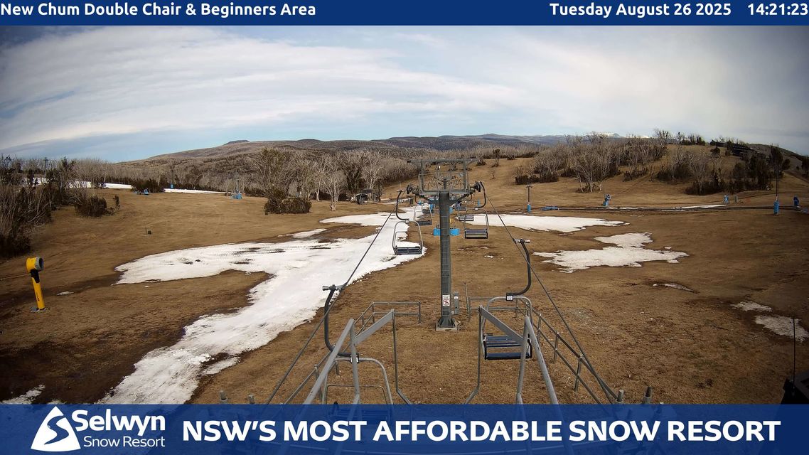
Image: The main beginner run was still open (just) and the resort should be back in business will several lifts open by the weekend for some fantastic spring sliding. Source: Selwyn Snow Resort.
And this was the Tuesday afternoon scene at Charlotte Pass, the NSW resort with the highest base altitude.
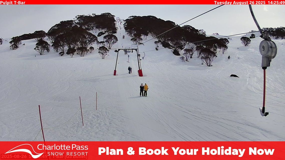
Image: It’s amazing how much difference a few hundred metres of elevation makes. Source: Charlotte Pass.
The difference between those two images illustrates why we stated at the top of this story that this has been “a reasonably good season in the higher parts of the Australian Alps”. At lower elevations, not so much.
But the coming system will deliver heavy snow to all elevations of the mountains, and as mentioned, snow showers will also develop into the weekend far below the usual snowline.
Friday and Saturday will be potentially hazardous days on the roads with icy conditions likely both in the alpine region and areas much further afield. Please be careful out there if you’re driving and monitor local road conditions as some road closures are likely.
And don’t forget to check the Weatherzone snow page for the latest forecasts, cams and much more until the end of the ski season – which should now be late in September or even early October.