A hard rain is gonna fall in the snowfields
Chalk down this Thursday, August 4, as a day to avoid the snowfields because a four letter word starting with r that snow-lovers dare not mention is in the forecast – and plenty of it.
We've written a lot this week about the massive weather system currently centred to the south of Perth which is working its way east.
- On Monday we described it as "one of the year’s strongest systems".
- On Tuesday morning we wrote of the dangerous winds spreading across southern Australia.
The system has already brought winds as strong as 137 km/h at Cape Leeuwin in SW Western Australia (the strongest reading in eight years) as well as strong winds and frequent showers to Perth and surrounds.
But if you glance at the 4 pm Tuesday chart below, you'll notice a tongue of warmer air (denoted by the orange colour) originating in the tropics which extends down to about halfway across the Great Australian Bight.
That's the stuff which is being pushed east by the huge engine of the low pressure system, and which will bring warm northwesterly winds, and rain rather than snow, to the mountains.
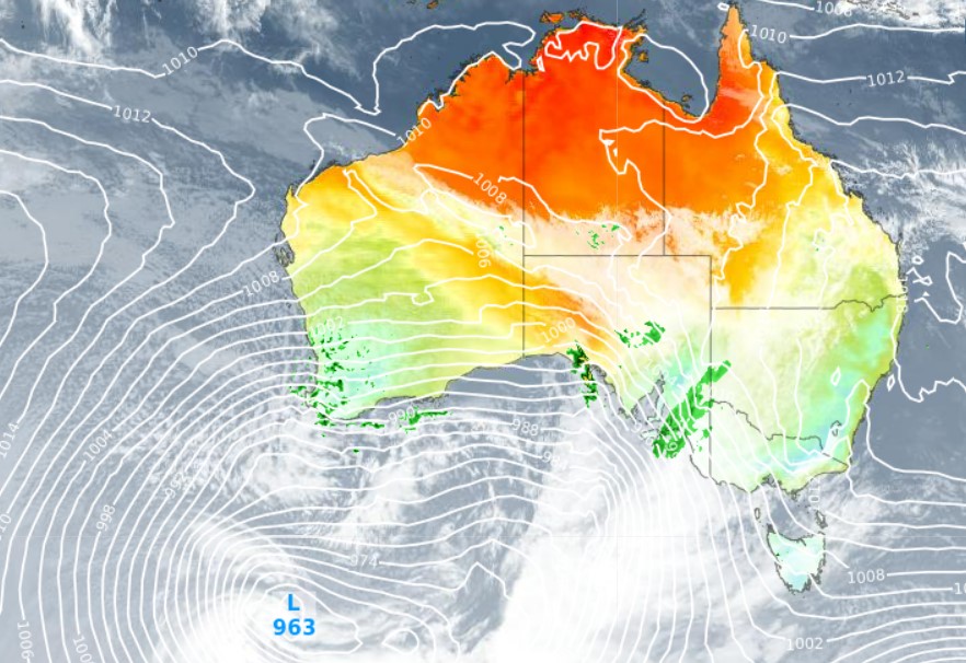
That warm air will impact both Adelaide and Melbourne on Wednesday, and while it won't feel especially warm due to strong winds, the top temp will reach around 19°C in both cities – which is very mild for August when you consider that both cities will likely see showers.
The warm air will also extend to Canberra by Wednesday, with a top of 18°C expected. That'll be well above the national capital's warmest winter 2022 day to date of 15.8°C (on July 28).
READ MORE: FASCINATING PATTERNS CAUSED BY RAIN RUNNING DOWN SNOW
As for the snowfields, it's not really a technical term, but "ugh".
Rain is of course part of life in the Australian Alps in winter, especially at lower altitudes where a mix of rain and snow is common throughout the winter. Higher up, you hope you might just make it through winter without a significant deluge.
But there's usually at least one big rain event at all elevations, and unfortunately, that looks like what's coming this week. The latest forecasts suggest that well over 100 mm of rain could fall in a period of about 36 hours from Wednesday afternoon into early Friday morning, a series of troughs cross the Alps.
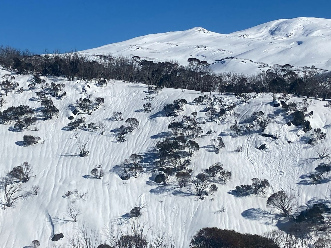
Image: These tiny gullies, or "rain rills" are caused by rain running down an exisiting snowpack. Source: Author's pic.
There remains a sneaky chance that snow could fall throughout this period at the very highest elevations of our ski resorts – above 1700m in Victoria and above 1900m in NSW – but you'd better cross your fingers extra tight for that to happen.
The good news is that snow will return later on Friday and into the weekend as cooler air arrives, with the snow level dropping to 1200 or 1300 metres, which is low enough for all mainland ski resorts. Around 25 cm could fall, and perhaps even a little more.
The bad news is that so much rain is expected, it seems unlikely at this stage that the fresh snow will be sufficient to repair the rain-damage to the snowpack.
We'll keep you posted. And please keep checking our snow page for the latest forecasts, conditions and cam images.